This is the
smartphone version of this web page. For the desktop version
click here.
Kynouría:
traces of the past
Jaap-Jan
Flinterman
Some incomplete
impressions of my favourite
Greek destination, based on quite a few holidays spent there since 2008
and on
archaeological and historical publications about the region: the east
coast of
the Peloponnese south of the Argolída. Kynouría is sandwiched between
the
Argolic Gulf and Mount Párnonas: the mountains and the sea are never
far away.
What
can you expect from this web page? It is the work of a retired lecturer
in Ancient History, but Greece does not cease to fascinate him when
Antiquity ends. It reflects the limitations of his own sightseeing and
reading, and is emphatically not a complete guide to the region. The
content consists of some geography and history of Kynouría, as well as
descriptions of a number of sights. In principle, we
follow the
coastline from north (Ástros) to south (Leonídio). Occasionally we
leave the
coastal strip for visits to the hinterland. The remains of the villa of
the
second-century plutocrat Herodes Atticus near Ástros are covered quite
extensively, as is the Archaeological Museum in that town. Furthermore,
the webpage offers shorter descriptions with some photos of a small
selection from the region's numerous monasteries; of the castle of
Parálio
Ástros; and of remains of ancient settlements and sanctuaries. A
relatively large amount of space is devoted to the archaeological site
of Ellinikó Astrous - Teichió (Eua), which I have visited on several
occasions. In
South
Kynouría, Leonídio and its hinterland, we tour monuments recalling the
Greek civil war: a historical episode to which much attention is paid
on
Greek-language web pages on the region's history. The itinerary
concludes with
a visit to the mountain villages of Prastós, Plátanos and
Kastánitsa and
to the plateau north of Mount Párnonas. A more detailed table of
contents, with
links to the various pieces of information and sights, can be found
below. To
weblogs and sites of people from the region (often with brilliant
photos, much
better than those of my own making) I have diligently linked.
The information on this web page is
accounted for in the form of a list
of literature and web pages
consulted, in many cases with a brief indication of what
was taken from a publication. Where
the text
of the
web page attributes a fact or opinion to an author and/or mentions a
title, the
details can be found in this bibliography. If you
have problems finding a title, please consult the desktop version (link at the top of this page). There, the bibliography is
regularly linked from the text. In this smartphone version, an excess
of links would not be very user-friendly. Therefore, there are no such
links here.
I
will not give a complete key to the bibliography, but
an exception should be made to highlight the standard Greek-language
monograph on Kynouría in Antiquity by Panayiotis
V. Faklaris (1990). It is true that
the book was published 35 years ago. Archaeology is hardly a stagnant
discipline, and new finds or new insights inevitably lead to
established beliefs being challenged. But Faklaris's work is of
enduring importance because of his meticulous reporting of the
archaeological data available when the book was written, in the
1980s, and because of his unrivalled knowledge of the region. I have
not always referred to Αρχαία
Κυνουρία
(this is not a scholarly publication, after all), but the reader of
what follows should assume that I have benefited from Faklaris's work
even
where
it is not mentioned.
This
web page reflects a personal predilection, but I would not have been
able to pursue it without the help of others. I first visited Kynouría
in 1973, when I was eighteen, during a walking tour of Arkadía and
Lakonía led by Herman Hissink (1915-2011: Ας είναι ελαφρύ το χώμα που
τον σκεπάζει), then a teacher of Dutch at the Christelijk Gymnasium
Sorghvliet in The Hague and an incomparable explorer of Greece. One of
my vivid memories of this trip is how often we got lost. That never
happened when Wendy Copage was my guide during two walking holidays in
2022 and 2023. Thanks to her, I walked trails and visited places that
would have remained inaccessible without her expert help. Last but not
least, my wife Susanne and son Simon have put up with my sometimes
hard-to-follow enthusiasm during ten family holidays since 2008.
The transliteration of Modern Greek follows, by and large, the rules of
the journal Pharos
of the Netherlands Institute at Athens ('Instructions to authors
2019'). These are in most cases in accordance with the rules of the Journal of Modern Greek Studies,
with a few exceptions, e.g. γ > y before ε, ει, η,
ι, υ. In a deviation from the rules of Pharos, I
transliterated υ (ypsilon)
as y: 'Tyrós', not 'Tirós'. For details click here. As for Ancient
Greek, personal names have been latinized (Thucydides, Polybius) or
Anglicized (Lucian). In the case of ancient toponyms, I have
generally stuck closer to the original word image (Anthene, Argos,
Polichne, Prasiai, Tyros), unless there is a common modern version of
the name in
English (Athens, Corinth).
Unless
indicated otherwise, the
photos on this web page were made by Jaap-Jan Flinterman. You are
allowed to download, copy,
re-format and redistribute my photos. For conditions, see the desktop
version of this web page (link at the top of this page). There, in most
cases, the
original large-size file is linked to the downsized version on display.
Comments and corrections are welcome. Please send me a message.
Published online on
5 January 2025. Last update or correction: 12 November 2025.
Table
of contents
Kynouría:
some
geography
The region of Kynouría (open
link in
Google Earth),
part of the regional unit of Arkadía, stretches along the Aegean
Sea or, to be more precise, the Argolic Gulf. The coast consists of a
series of
bays, separated by capes. The beaches are generally of small pebbles;
only at
Ástros is there a sandy beach. As the crow flies, the northernmost and
southernmost points are some 55 km apart, but the distance along the
winding
coastal road is considerably longer, some 100 km. To the north, the
region
borders the regional unit of Argolída; the natural border here is
formed
by the
spurs of the Parthénio massif, especially the Závitsa; to the south,
where
Kynouría borders the regional unit of Lakonía, the border is marked by
the
Madára
massif. The narrow coastal strip widens into modest plains in two
places: in
the north at Ástros and Áyios Andréas, where the Tános and Vrasiátis
rivers, and in the south at Leonídio, where the Dafnónas flows into the
Argolic
Gulf.
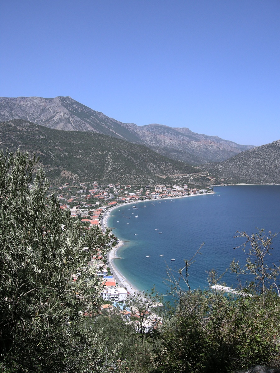 The coast at Paralía
Tyroú - Photo: Jaap-Jan Flinterman, summer 2008
The coastal strip and plains are
suitable for olive and fruit trees, and near the larger settlements
there is
also horticulture. In the nineteenth century (and probably also
before), market
garden products from Leonídio were exported by caique to Constantinople
and
Smyrna and even to Alexandria. The hinterland of the coastal strip is
formed by
a plateau of between 650 and 800 metres altitude, where winter cereals
used to
be grown and where small livestock is kept; maize,
pulses and potatoes are also grown there, and there is some viticulture
and
some tree cultivation (apples, pears, chestnuts, nuts). Behind it rise
the
forested slopes of Mount Párnonas; the highest peak is Megáli Toúrla
(1934
metres). Mount Párnonas forms the western border of Kynouría; as the
crow
flies, the distance between the coast and the central massif is about
20 km.
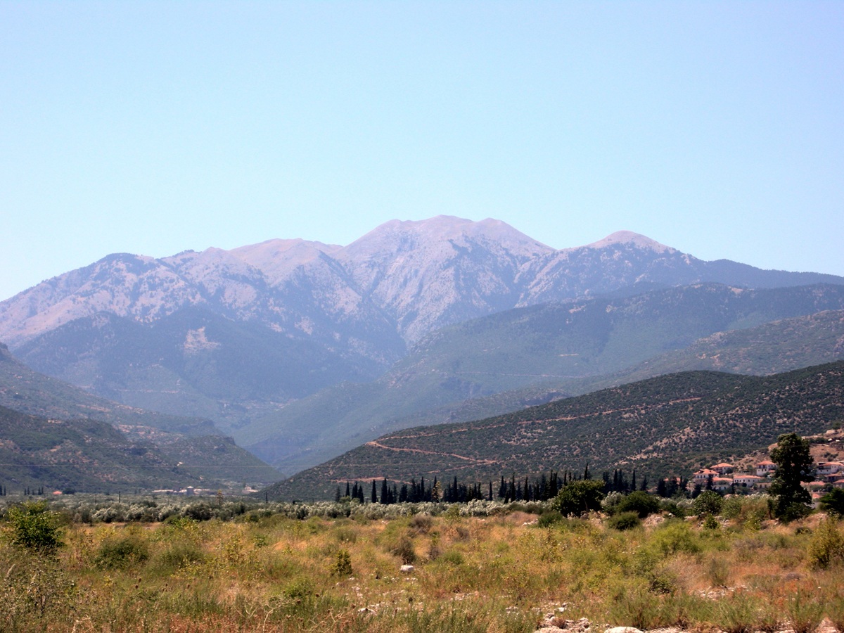 Mount Párnonas seen
from the Vrasiátis riverbed - Photo: Jaap-Jan Flinterman, summer 2011
The traditional dialect of the region
around Tyrós and Leonídio, Tsakonian, differs so much from standard
modern
Greek that it seems to be practically unintelligible to Greeks from
outside the
Eastern Peloponnese. According to those who cherish Tsakonian, it goes
back to
the Doric dialect of the Greek language spoken by the ancient Spartans.
Modern linguists take this claim seriously, see Liosis 2013.
On this
map, the area where Tsakonian was still spoken in the late
19th century is
coloured blue.
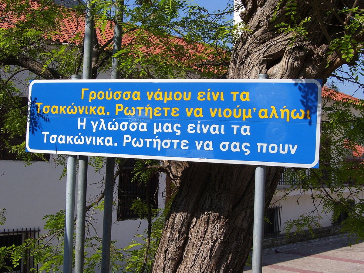 "Our
language is
Tsakonian. Ask us to speak it with you."
Bilingual sign in
Leonídio - Photo: Wikimedia Commons (Miko), GNU
Kynouría is sparsely populated: from
the middle of the 19th century until the eve of the second world war,
the population
grew from about 25,000 to almost 32,000 souls, before shrinking to
about 20,000
souls at present (in the early 2020s). At the time of the 2021 census,
20,654 people lived in
Kynouría, 11,836 in Vóreia Kynouría (North Kynouría) and 8818 in Nótia
Kynouría
(South Kynouría). North and South Kynouría are the two municipalities
into
which the region has been divided since the 2011 municipal
reorganisation;
Ástros is the main settlement in the north and Leonídio in the south.
During
the summer months, many Greeks who have moved to the city or emigrated
return
to their village of origin. Because of this, and because of domestic
tourism,
the population of Kynouría increases considerably during the summer.
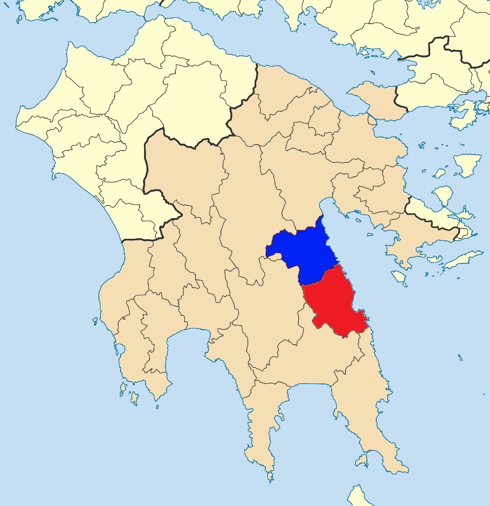 North Kynouría (blue) and South Kynouría (red) - Map: Wikimedia Commons, Pitichinacchio (GNU), adapted
In 1958, Henrik Scholte wrote in his
Dutch-language Gids
voor Griekenland about the east coast of the
Peloponnese south of the Argolída: 'For the length of several hundred
kilometres and very deep into the land, the Peloponnesian coast is
virtually
uninhabited and uninhabitable. (...) Only the tourist, who sails around
the
Peloponnese by liner, occasionally catches a glimpse of this coast,
where the
1,200-metre-high mountains come anxiously close to the sea.' That was
not
devoid of exaggeration even in the 1950s, and since then the area has
been
reasonably opened up by motorways. But it is true that to this day
Kynouría is
devoid of most of the blessings of mass tourism.
Kynouría
in and after
Antiquity
A history of Kynouría worthy of the
name can hardly be written; our information is too fragmentary for
that. As a
rule, Kynouría appears in our sources only when the 'greater'
Greek history
happens to visit the area. Long periods for which information is
totally
lacking alternate with short episodes with a high information density.
In Antiquity, Kynouría was home to two 'city-states' (poleis)
of some significance,
Thyréa (whose core area was the region around Ástros and Áyios Andréas)
and
Prasiaí (the region around Leonídio and Tyrós). There were several
settlements in each of the two territories, the location of which poses
no
small problem for archaeologists and historians: the ancient topography
of Kynouría is, according
to Graham Shipley (1993),
'fraught with debates and difficulties', so that 'attempts
to identify named sites have led to an almost infinite variety of
reconstructions.' The difficulties mainly concern the northern part of
the
region, the Thyreátis. Several settlements are mentioned in literary
sources
from Antiquity, for example in the works of historians and geographers.
But the
place indications in these literary sources are not always accurate,
and
inscriptions that could give a definitive answer have hardly been
found. In
short, the identification of quite a few archaeological sites is
disputed, and
the scholarly debate on the historical geography of the Thyreátis has
been described
as 'a game of musical chairs'.
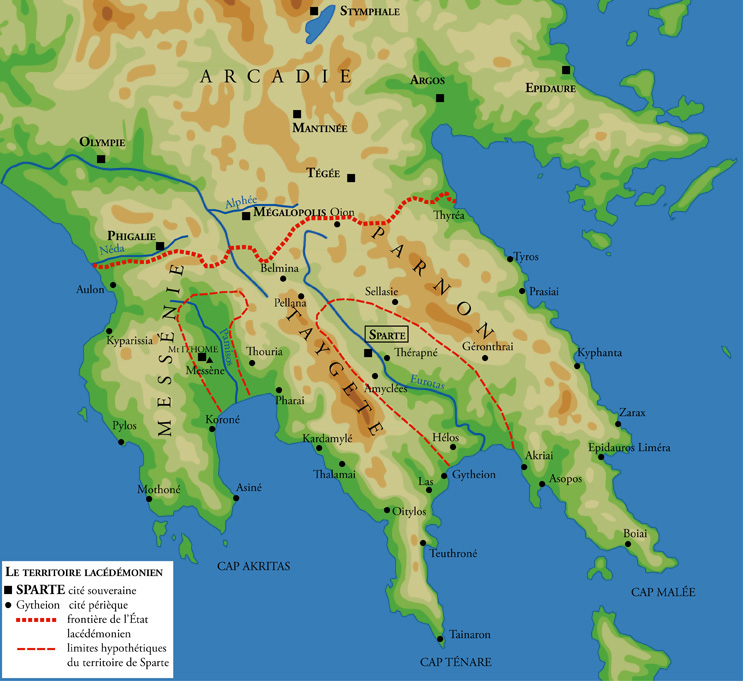 Territory of Sparta in the classical period - Map:
Wikimedia Commons (Marsyas), CC BY-SA 3.0
Only from the Archaic period onwards
do we gain some insight into the position of Kynouría in the context of
relations between the larger poleis
on the Peloponnese. (Nigel Copage's website Archaeological
Sites of the Peloponnese
has concise descriptions and excellent photos of what remains of the
major historical centres of power in the Peloponnese.) The southern
part of Kynouria, the region around
Leonídio and Tyrós, was probably taken over by the Spartans in the
decades around 600 BC. [Lanérès
& Grigorakakis 2015 with my bibliographical note] Now
they turned their
eager eyes
to the Thyreátis, which until then had been part of the territory of
Argos. Here is
what happened, if we are to believe the historian Herodotus (Herodotus
1.82;
cf. Pausanias 2.38.5):
It chanced, however, that
the Spartans were
themselves just at this time [547 BC] engaged in a quarrel with the
Argives about a
place called Thyrea, which was within the limits of Argolis, but had
been
seized on by the Lacedaemonians [= Spartans]. (...) The Argives
collected
troops to resist the seizure of Thyrea, but before any battle was
fought, the
two parties came to terms, and it was agreed that three hundred
Spartans and
three hundred Argives should meet and fight for the place, which should
belong to
the nation with whom the victory rested. It was stipulated also that
the other
troops on each side should return home to their respective countries,
and not
remain to witness the combat, as there was danger, if the armies
stayed, that
either the one or the other, on seeing their countrymen undergoing
defeat,
might hasten to their assistance. These terms being agreed on, the two
armies
marched off, leaving three hundred picked men on each side to fight for
the
territory.
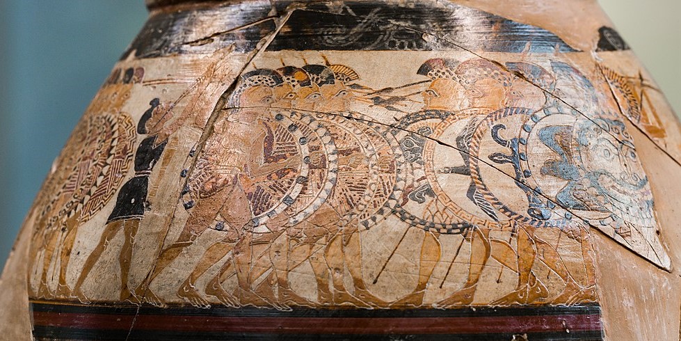 Battle
between heavy infantrymen, so-called hoplites - Proto-Corinthian Olpe,
c. 640 BC - Photo: Wikimedia Commons (ArchaiOptix), CC-BY-SA 4.0
(clipped)
The battle began, and so equal
were the combatants, that at the
close of the day, when night put a stop to the fight, of the whole six
hundred
only three men remained alive, two Argives, Alcanor and Chromius, and a
single
Spartan, Othryadas. The two Argives, regarding themselves as the
victors,
hurried to Argos, Othryadas, the Spartan, remained upon the field, and,
stripping the bodies of the Argives who had fallen, carried their
armour to the
Spartan camp. Next day the two armies returned to learn the result. At
first they
disputed, both parties claiming the victory, the one, because they had
the
greater number of survivors; the other because their man remained on
the field,
and stripped the bodies of the slain, whereas the two men of the other
side ran
away; but at last they fell from words to blows, and a battle was
fought, in which
both parties suffered great loss, but at the end the Lacedaemonians
gained the
victory. Upon this the Argives, who up to that time had worn their hair
long, cut
it off close, and made a law, to which they attached a curse, binding
themselves
never more to let their hair grow, and never to allow their women to
wear gold until
they should recover Thyrea. At the same time the Lacedaemonians made a
law the
very reverse of this, namely, to wear their hair long, though they had
always
before cut it close. Othryadas himself, it is said, the sole survivor
of the
three hundred, prevented by a sense of shame from returning to Sparta
after all
his comrades had fallen, laid violent hands upon himself in Thyrea.
[Translation: George Rawlinson, London 1858]
Kynouría as a whole was thus part of
Spartan territory since the 6th century BC. Later generations preserved
the
memory of the heroism of the Argives and Spartans of the sixth century.
Lucian,
a satirist of the 2nd century AD, returns to it repeatedly; in his
view, the
sacrifice of so many human lives for a border dispute is the height of
folly.
In one of Lucian's writings, the protagonist reports on a trip to
heaven he
recently made. During that trip, he had ample opportunity to marvel at
the
futility of all human ambitions (Lucian, Icaromenippus
18; cf. Charon
24; Rhetorum praeceptor 18):
And when I looked at the
Peloponnese and caught sight of Kynouria, I
noted what a tiny region, no bigger in any way than a lentil,
had caused so many Argives and Spartans to fall in a single day.
[Translation: A.M. Harmon, London/Cambridge Mass. 1915, slightly
adapted.]
More
than a century after the
Thyreátis had passed into Spartan hands, in 431 BC, the inhabitants of
the
island of Aegina were driven from their homes by the Athenians; the
Spartans
allowed them to settle in Thyréa (Thucydides 2.27 and 4.56; Pausanias
2.29.5). During the Peloponnesian War between Athens and
Sparta
(431-404 BC), the
Athenians and their allies raided the Kynourian coast with some
regularity; the
Athenian historian Thucydides, who chronicled this war, mentions such
attacks
consistently. In 430 BC, an expedition of 4300 men on 100 ships under
the
command of the Athenian political and military leader Pericles attacked
Prasiaí; the city was taken and destroyed (Thucydides 2.56.5-6).
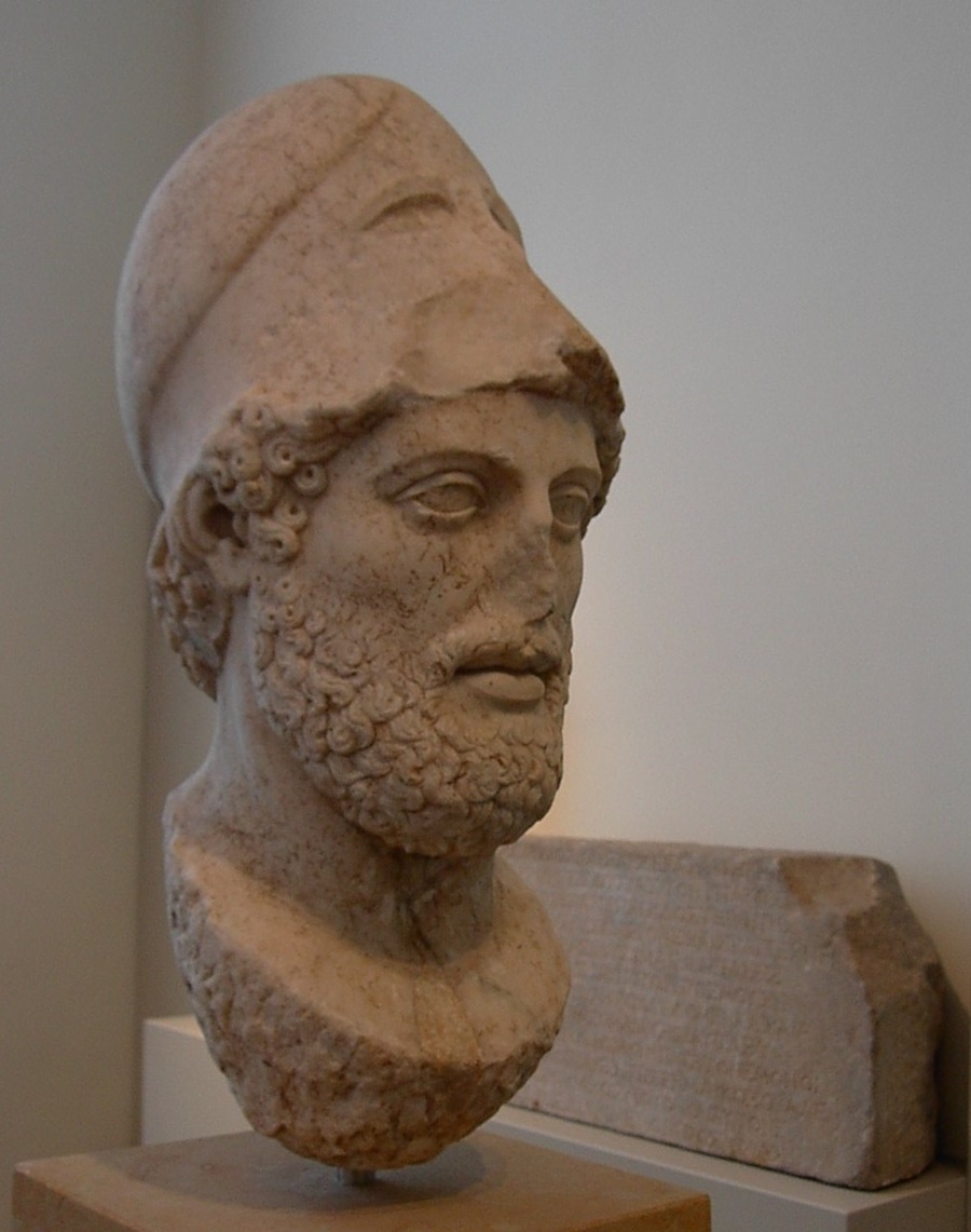 Pericles - Staatliche Museen zu Berlin - Photo: Adam Carr,
Wikimedia Commons
In
424 BC,
Thyréa suffered the same fate at the hands of the Athenian general
Nicias
(Thucydides 4.56-57). In 414 BC it was Prasiaí's turn again: the city's
territory was ravaged (Thucydides 6.105.2 and 7.18.3), after the
Argives had
already plundered the Thyreátis earlier that year (Thucydides 6.95.1).
In
the 4th century, Argos
regained the Thyreátis, after the defeat of the Spartan army by the
Thebans at
Leuctra in 371 BC and the subsequent Theban invasion of the
Peloponnese, which marked the end of Spartan hegemony over the
peninsula. Thanks to the intervention of the Macedonian king Philip II
(Pausanias 2.20.1, 2.38.5 and 7.11.2; Polybius 9.28.6-7 and 9.33.8-12),
Argos'
possession of northern Kynouria was confirmed in 338 BC.
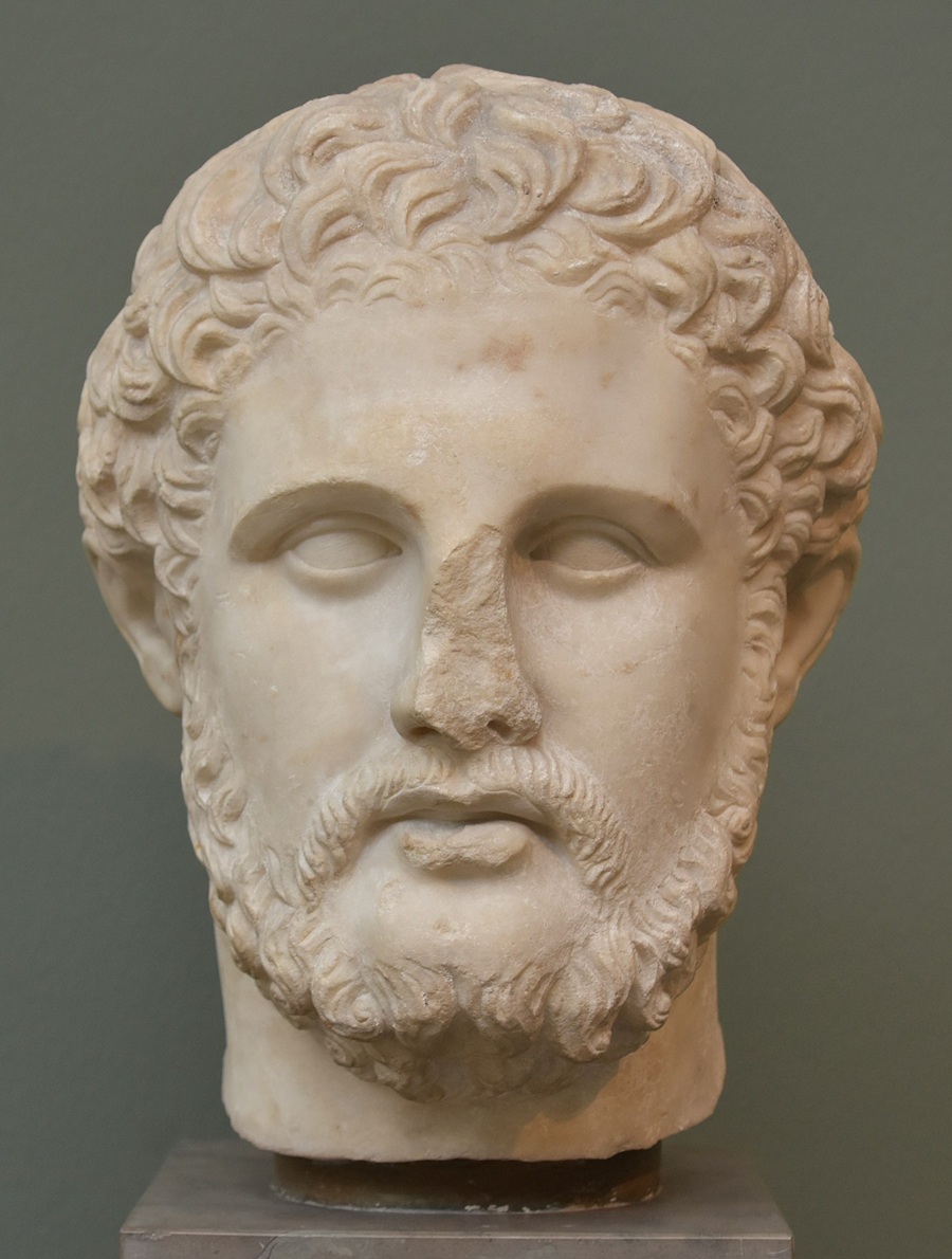 Philip II of Macedonia - Ny Carlsberg Glyptotek,
Copenhagen - Photo: Richard Mortel, Wikimedia Commons (CC BY 2.0)
In the 3rd
century
the Spartans also lost southern Kynouría. Around 275 BC, according to
an
inscription found at Delphi (Fouilles de Delphes III
I 68 = SIG (3) 407), Týros still
belonged to the 'Lacedaemonians'. But by 223 BC at the latest,
Zarax - south of Kynouría on the east coast of the Peloponnese - had
become
part of the territory of Argos (SEG 17.143), as must
have been the case
for more northerly coastal settlements such as Políchne, Prasiaí and
Týros. The Argive
conquest of southern Kynouría was probably part of the war between
Sparta on
the one hand and Macedonia and the Achaean League on the other during
the 220s;
Argos was a member state of the Achaean League.
Our
next data relate to the
so-called Social War (220-217 BC): a conflict between Macedonia, the
Achaean
League and Messene on the one hand, and the Aetolian League on the
other. In 219 BC, the
Spartans sided with the Aetolians; the Spartan king Lycurgus, according
to the
historian Polybius (Polybius 4.36), attacked southern Kynouría: he
retook
Prasiaí and Políchne, among other places, but besieged the fortified
inland village of Glympeís in vain. A year
later, near the same village, he forced a contingent of Messenians
allied to the
Achaeans into a humiliating retreat (Polybius 5.20).
Under Roman rule, Kynouría was
eventually divided: Argos remained in the possession of the Thyreátis,
Prasiaí became
part of the League of the Free Laconians, in which communities formerly
under
Sparta were organised. This is the situation found by
Pausanias (second-century
AD), author of a Description
of Greece (Pausanias 3.21.7 and 3.24.3). In the
same century, Herodes Atticus, Athenian plutocrat and Roman consul,
owned a magnificent
villa in the Thyreátis.
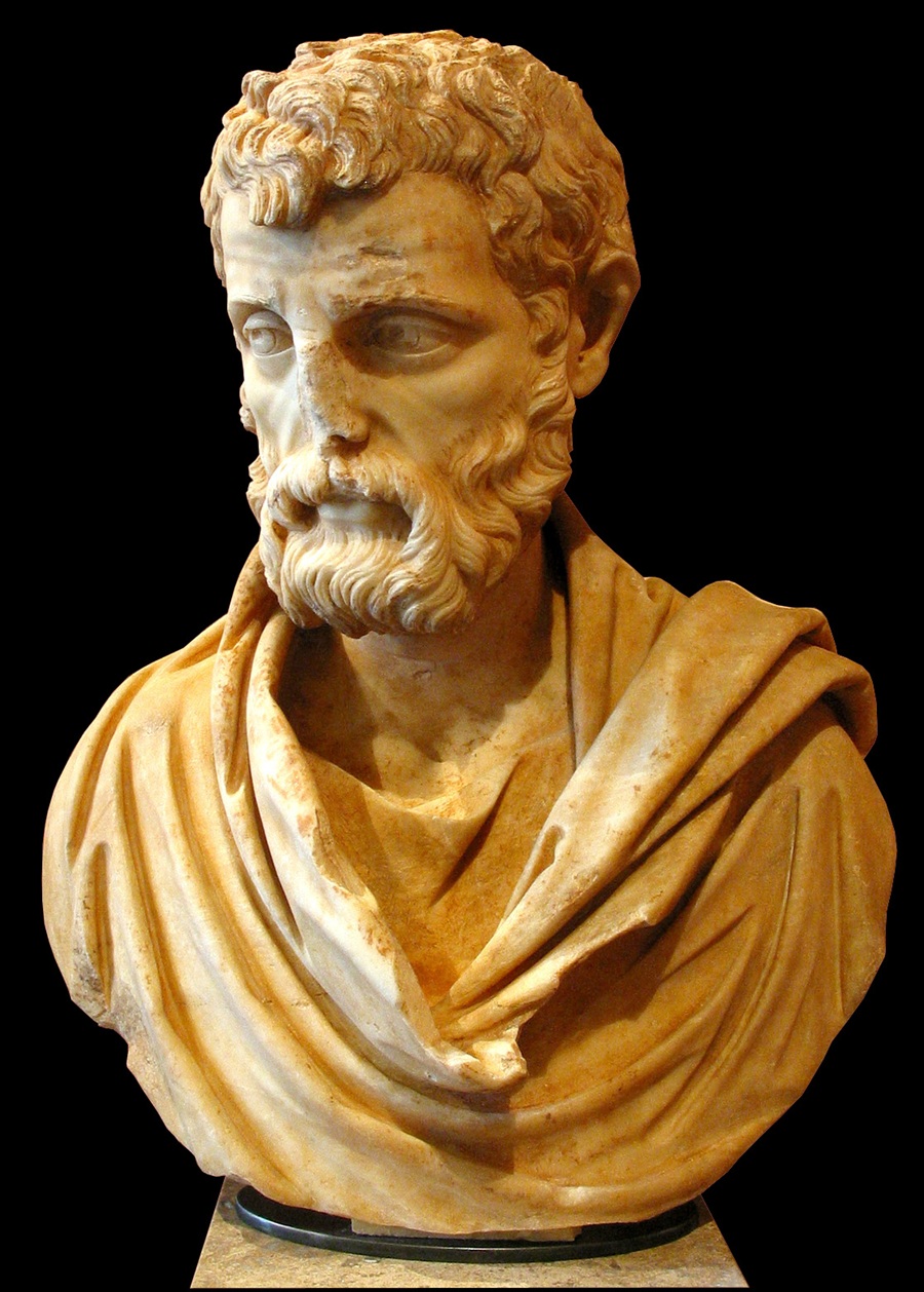 Herodes Atticus - Louvre, Paris - Photo: Alphanidon,
Wikimedia Commons (CC BY-SA 3.0)
Such villas usually combined an economic and a
recreational function: they were pleasant places to live, but the
northern
plain of Kynouría also offered good opportunities for growing a variety
of
crops. Herodes Atticus was fabulously wealthy and spent his ample
financial
resources on several major building projects, including the famous
odeon (auditorium)
at the foot of the Athenian acropolis.
I have not found that much about the history of
Kynouría after Antiquity, nor have I looked very hard. In the period
between
600 and 800, Slavic tribes settled in the Peloponnese, and this may
not have left Kynouría completely untouched. In northern Kynouría and
the
neighbouring parts of Lakonía and Arkadía, place names that sounded too
Slavic
for the tastes of the authorities were still in use at the beginning of
the
twentieth century. Some of them were replaced by Greek toponyms. For
example,
the present village of Élatos was called Dragalevós
until 1926, Elaiochóri
Másklina until 1927, and Karyés Aráchova
until 1930. Other Slavic names have
survived, e.g. Meligoú.
In
the 13th century, Kynouría was
for a time part of
the Principality of Achaea, which had been carved out of the Byzantine
Empire by participants ('Franks') in the Fourth Crusade (1204). The
castle on
a
hill
south of Áyios Ioánnis in northern Kynouría (Κάστρο της Ωριάς,
'Castle
of the Fair Maiden') was
probably built around
the mid-13th century by the Frankish prince of Achaea, Guillaume de
Villehardouin. Meanwhile, Venice started to establish strongholds along
the coasts. The Frankish domination of Kynouría did not last long.
In 1262, the main fortresses of the south-eastern Peloponnese, such as
Monemvasía and Mystrás, were returned to the Byzantine emperor in
exchange for the Frankish knights captured in the Battle of Pelagonia
in 1259 (one of those freed was Guillaume de Villehardouin himself).
Information is scarse and ambiguous, but it seems that from 1272
Kynouría was firmly in Byzantine hands. For the next century
and a half, the south-east
was used as a base for the recapture of the peninsula from the
Franks. This resulted in the establishment of the Despotate of Mystrás
around the middle of the 14th century. It was a province of the
Byzantine empire, governed by a member of the imperial dynasty. The
Venetians may have taken over the area around Ástros in the early
15th century. By 1430, the Frankish power in the Peloponnese had been
eliminated, but in 1460 the peninsula was conquered by sultan
Mehmet II, who had taken Constantinople seven years earlier. For the
time being, a number of Venetian fortresses remained outside Ottoman
control, and the same may have been true of (part of) Kynouría.
Incidentally,
when reading about the history of the Peloponnese after Antiquity, it
is helpful to know that during the Middle Ages and early modern times,
the peninsula was usually called the Morea (Byzantine Greek: Μορέας,
Modern Greek: Μοριάς). For example, the 'Despotate
of Mystrás' was also called the 'Despotate of the Morea' (Δεσποτάτο του
Μορέως).
Kynouría
probably fell into Ottoman hands around
1540, at the same time as the two main Venetian fortresses in the
eastern
Peloponnese, Náfplio in the north and Monemvasía in the south. In the
1680s, the Venetians returned and conquered the Peloponnese, but in
1715 they were driven out again by the Turks. Like other regions of the
Peloponnese, Kynouría thus experienced two periods of Ottoman rule, the
first Tourkokratía
(before c. 1685) and the second (after 1715). The
south-eastern Peloponnese was an economically prosperous region under
Ottoman rule. Not only did the water-rich region around the
Párnonas produce a wide range of agricultural products, but the
inhabitants of towns such as Prastós also earned well from overseas
trade. Merchants from Kynouría often settled for a time in
Constantinople,
importing butter from Russia and the Crimea and selling it elsewhere in
the Ottoman Empire. In the 18th century, they began to participate in
maritime trade networks across the Mediterranean. The money earned was
spent in the country of origin, including on the construction and
decoration of mansions, churches and monasteries. The
coastal town
of Leonídio became a new regional centre. On these developments see
Arisoy 2018; Balta 2009.
During the Greek war of independence, the region
was devastated by Ibrahim Pasha who, at the behest of the Sultan, began
to reconquer
the Peloponnese in 1825. He was finally stopped at Navarino, where his
fleet
was destroyed by the English, Russians and French (1827). It was during
these
years that Prastós, traditionally the most important town in Kynouría,
and Moní
Loukoús, a monastery near Ástros, went up in flames. Earlier, in 1823,
the
second national assembly of the Greeks had met in Ástros to adopt a new
constitution and form a national government.
Some information about
Kynouría in the second world war can be found in two articles by
Stratís Kouniás, on the
website
www.leonidio.gr, and on the website of the mountain village of
Kosmás. A
garrison of Italian carabinieri was stationed in Leonídio until the
summer of
1943. In August of that year, these were driven out by the partisans of
the
communist-led resistance movement EAM, who had defeated the Italians at
Kosmás
in late July. In that battle, the Italian governor of Trípoli had been
killed.
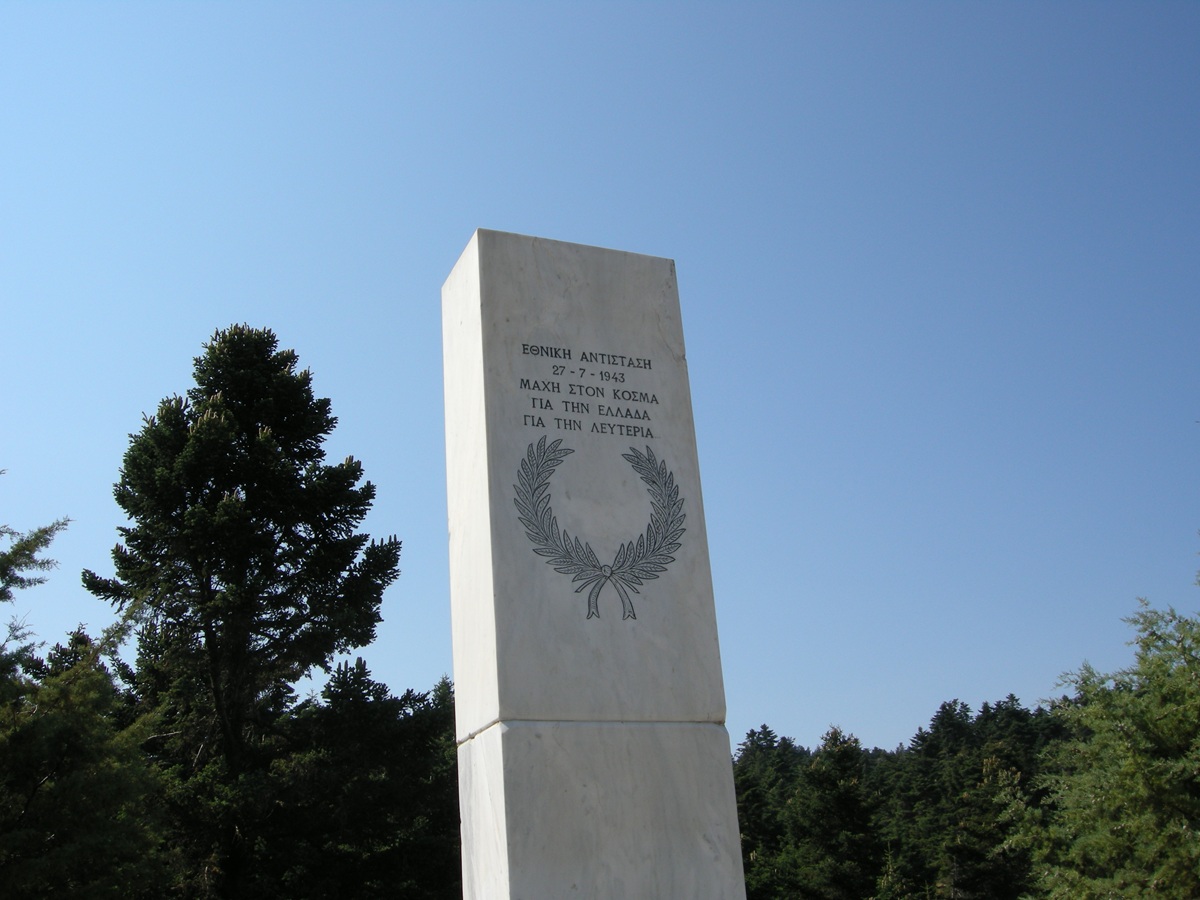 Monument for the
Battle of Kosmas (1943) - Photo: Jaap-Jan Flinterman, summer 2013
By the summer of 1943, most of Kynouría was controlled by EAM
partisans, but in 1944 the Germans, aided by Greek
collaborators, carried out repeated attacks in the region. In January
1944,
Kosmás went up in flames. In late June/early July (i.e. during or
immediately
after the grain harvest) of the same year, the last and largest German
attack
took place. On that occasion, according to Stratís Kouniás, 400-500
civilians
were killed. The Germans executed non-combatants and captured partisans
and
transported about 600 people to Germany as forced labour. Some
prisoners were
used as hostages to deter attacks on trains: they were locked in cages
linked
in front of locomotives. Eleven prisoners were shot at Leonídio on 6
July.
Two memorials recalling these events.
On the left, a monument to 48 non-combatants from Áyios Pétros who were
killed
by the occupying forces in the last June days of 1944. On the right, a
memorial plaque
to the eleven executed in Leonídio.

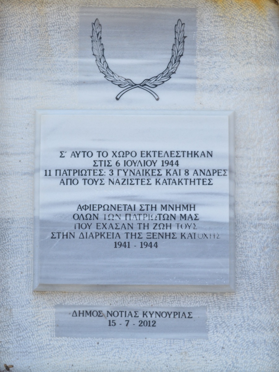 Photos: Jaap-Jan Flinterman, summer 2015 (left) and summer
2017 (right)
In
the Greek civil war, the last
major battle in the Peloponnese, in January 1949, took place at Áyios
Vasíleios, in the southern Párnonas Mountains; more information on the
Greek civil war in Kynouría can be found here.
Sights
around Ástros
About four kilometres
north-west of Ástros
(satellite photo), to the right of
the road to Tripoli, lie the remains of a
villa
belonging to the Athenian billionaire Herodes Atticus
(101/3-177/9 AD),
one of the richest and most influential men of the Roman Empire in the
second
century AD and a prominent representative of the so-called Second Sophistic.
Already in the first half of the 19th century, the site was visited by
travellers such as William Martin Leake from England, Guillaume-Abel
Blouet from France, and Ernst Curtius from Germany; at the
beginning of the 20th century, the Greek archaeologist Konstandinos
Romaios
identified it as the site of a villa of Herodes. The identification was
based
in part on the inscription below, which mentions the names of Herodes'
grandfather (Hipparchos) and father (Attikos): ΙΠΠΑΡΧΟΣ ΑΤΤΙΚΟΥ |
ΠΑΤΗΡ,
'Hipparchos, father of Attikos'.
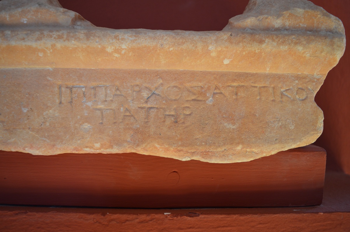 Inscription from the
villa of Herodes Atticus: 'Hipparchus, father of Atticus' - Photo:
Jaap-Jan
Flinterman, summer 2019 (Museum Ástros)
A striking confirmation of Romaios'
identification of the site came in 1995, with the discovery of a
similar
inscription reading ΑΛΚΙΑ ΗΡ[ΩΔΟΥ] | ΜΗΤΗ[Ρ], 'Alkia, mother of
Herodes' (photo
below). Cf. Spyropoulos 2006,
pp. 29-30. Presumably, in both cases we are
dealing with the architrave of a shrine in which an effigy of an
(ancestral)
parent was placed.
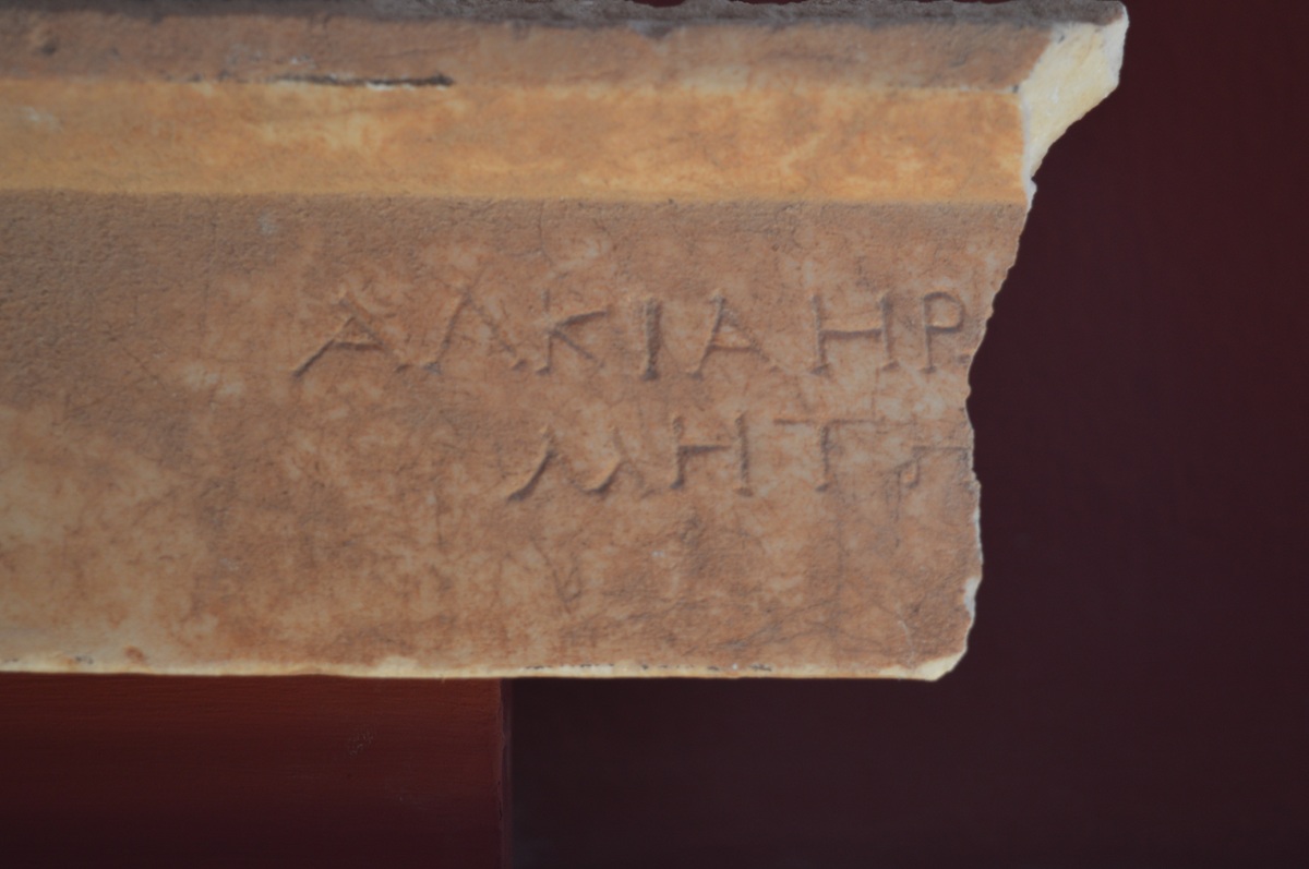 Inscription from the
villa of Herodes Atticus: 'Alcia, mother of Herodes' - Photo: Jaap-Jan
Flinterman, summer 2019 (Museum Ástros)
During
the years 1980-2001, the villa was systematically
excavated by Greek
archaeologists. The central, also largest part of
the
complex was formed by an elongated enclosed garden with a west-east
orientation
(actually it is northwest-southeast, but we are not going to make it
too
difficult and call the long sides the north or south side and the short
sides
the west or east side). The garden was surrounded on three sides by a
colonnade; the floors of the colonnade were decorated with mosaics.
Including
the colonnade, this part of the complex measured about 80 by about 32
metres.
An artificial watercourse around the garden was fed from a spring
building
('nymphaeum') on the fourth, western side. On the eastern side of the
garden,
behind the colonnade, were a dining hall, living quarters, and a
so-called 'Gartenstadium', which opened to the east with, again, a
colonnade. From here, Herodes and his guests had a magnificent
view over the
northern part of the plain of the Thyreátis (or, to use its modern
name, the plain of Ástros) and the Argolic Gulf.
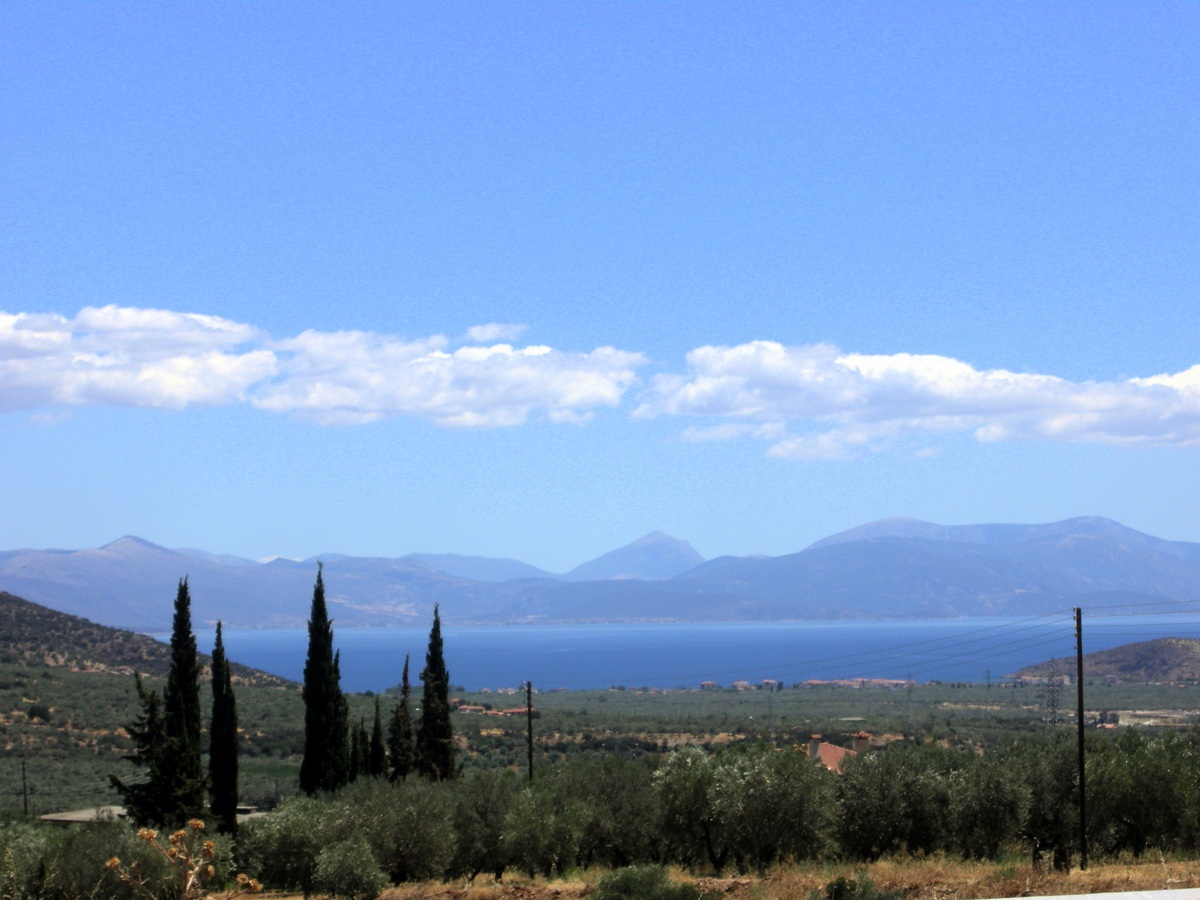 View from Herodes'
villa - Photo: Jaap-Jan Flinterman, summer 2008
To
the north of the enclosed garden was a
structure referred to by the excavators as 'Repräsentationsbasilika';
it dates
from the second half of the first century AD and is the oldest part of
the
villa. To the west of the garden was a second basilica. On the south
side of
the complex were several buildings, the easternmost of which (also a
basilica)
was, according to the excavators, a sanctuary for Antinous, the youth
loved by the Emperor Hadrian. Antinous had drowned in the Nile during
an imperial
visit to Egypt in the fall of 130 and had been deified on the
inconsolable
emperor's orders. The site is not open to the public, but a walk along
the fence gives a
reasonable impression of the complex, as shown in the photo below,
taken in
2008. The walls in the foreground are what remains of the sanctuary for
Antinous.
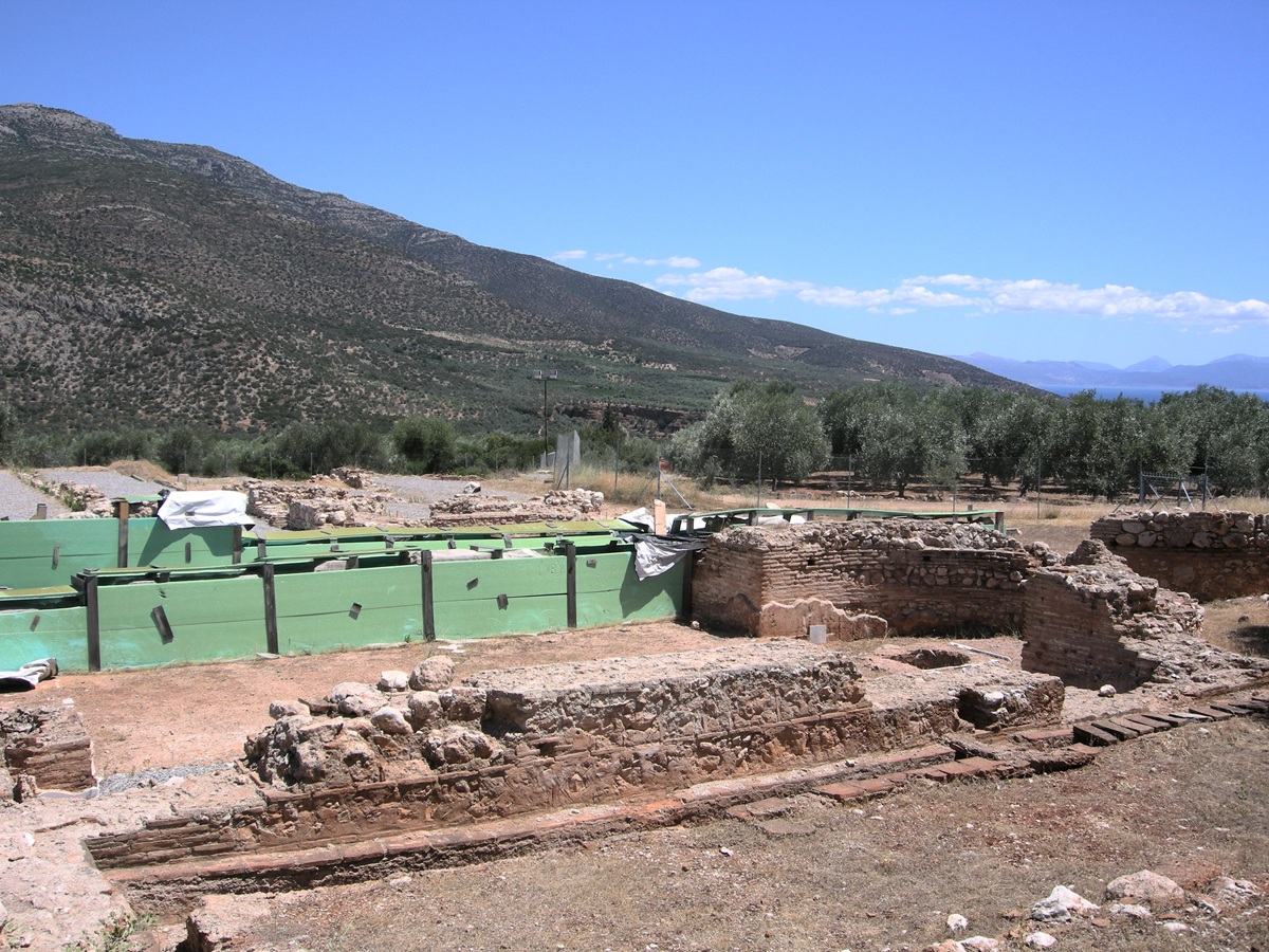 Villa of Herodes
Atticus, sanctuary of Antinous - Photo: Jaap-Jan Flinterman, summer 2008
During a visit in 2011, the site was
still closed to the public, but it appeared that a roofing project was
in progress to make the villa accessible as an open air museum. The
photo below was taken from the
northern fence. In the foreground are the remains of the
'Repräsentationbasilika'.
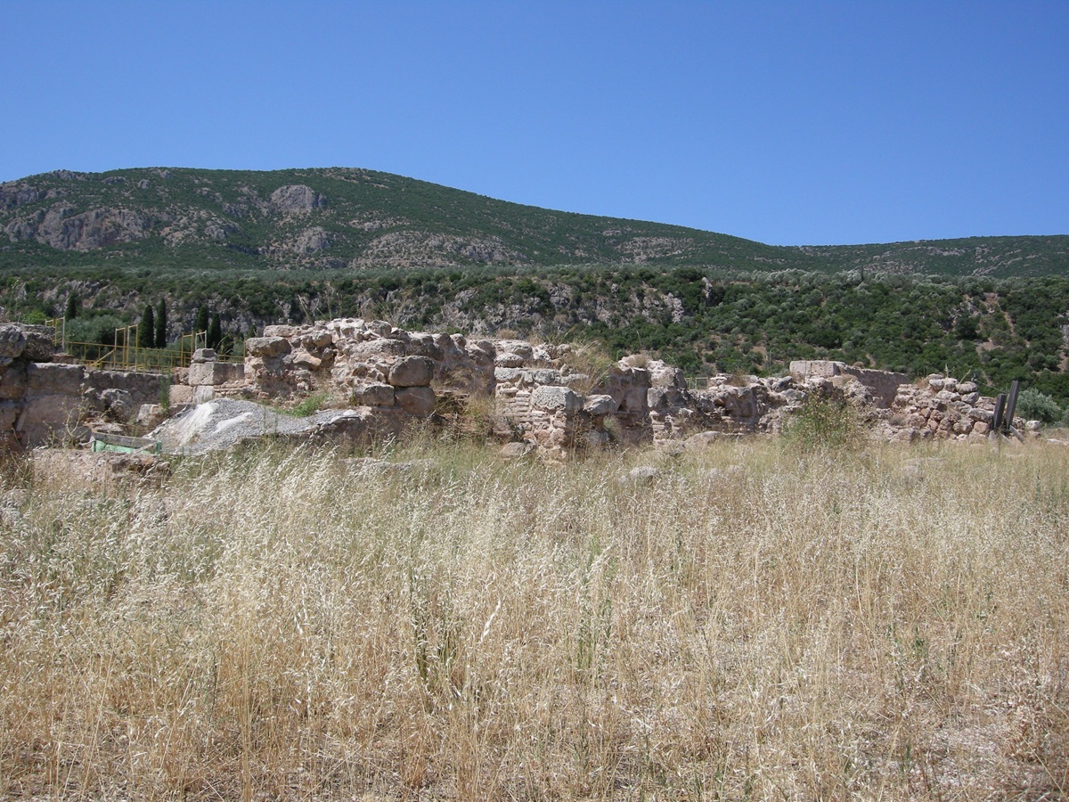 Villa of Herodes
Atticus, 'Repräsantationsbasilika' - Photo: Jaap-Jan Flinterman, summer
2011
Much more informative photos than
these were taken by people who had permission to walk around beyond the
fence
or who visited the excavation when it was not yet fenced off. Such
photos can
be found, for example, in the Classical archaeological image collection
of
Aarhus University in Denmark (search for 'Loukou') or on Dr
Heinz Schmitz's
website (scroll to 'Eva Dolianon Loukous'). The photo below,
taken from this
website, shows the enclosed garden, seen from the east. More photos here: a pdf
file of photos that is part of Parálio Ástros' site,
www.astrosparalio.gr
(three photos taken from a high position that give a good view of the
site's
floor plan, and two photos of mosaics). Green with envy I became when
looking
at this travel blog from 18 May 2011:
'There was a tall fence all around the
site but the main gate was open with an unlocked padlock hanging on it.
There
was nobody on the site so we went in and spent some time looking
around.' Nice
photos of the Repräsentationsbasilika and the central garden. What is
worrying,
of course, is that (i) the site was apparently completely unguarded;
and (ii)
the writers of the travel blog could not observe any activity on the
site ('It
was quite obvious that no work had been done on the site for some time
so it is
anyone's guess when it will be finished.'). During my last visit to the
site
(summer 2019), nothing could be seen of the roof under construction
from summer
2011. It is to be feared that the opening as an open air museum of
Herodes'
villa has become one of the victims of the dire state of Greek state
finances.
 Villa of Herodes
Atticus, the enclosed garden from the east - Photo: Dr. Heinz Schmitz
Jennifer Tobin, in her study of
Herodes Atticus, tells us that there was a lime kiln on the
site; over time –
the kiln was not deactivated until 1960 – a lot of sculpture must have
disappeared into it. (Meanwhile, lime kilns as reminders of a bygone
era have
also become objects of nostalgia: see the fine photos here.) But a fair amount
of sculpture has survived, such as a cult statue of Antinous, depicted
as the
god Dionysus (here, scroll down to 'Astros');
portraits of the emperor Hadrian,
of Lucius Aelius Caesar, Hadrian's intended successor (died in 138 AD),
of Herodes' foster sons Polydeucion and Memnon and of Herodes himself;
an Attic
votive relief for Asclepius from the 4th century BC; and a replica of a
sculptural group of Achilles with the amazon Penthesileia. This replica
was displayed
in the southern colonnade of the enclosed garden; according to the
excavators,
this sculptural group corresponded to a replica of the so-called Pasquino group
on the north side (but remains of it were last seen on the site by the
British
traveller Leake, in the early 19th century: Travels in the Morea,
volume 2, p. 488f.). Six amazons (photo below; see also Blouet's drawing) served as caryatids,
supporting the eastern
colonnade according to the excavators. Their arrangement corresponded
to that on the west side, in six
niches in the wall of the nymphaeum, of freestanding statues, one of
which has
been completely recovered. According to one of the excavators, G.
Spyropoulos,
these were the Saltantes Lacaenae of Callimachus, a
famous sculptor of
the late 5th century BC. Herodes is supposed to have acquired these
Classical
statues of dancing Spartan women, mentioned by Pliny (Naturalis
Historia
34.92), and placed them in his villa. Photographs taken from
publications by
Spyropoulos (including the statue of the dancing woman and the
Achilles/Penthesileia group) can be found here.
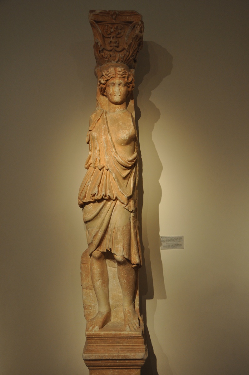 Villa of Herodes
Atticus, Amazon-Caryatid - Athens, National Museum (NM 705) - Photo:
www.livius.org
Apparently,
Herodes had little qualms about removing Classical remains from what
may have been their original context and
transferring them to his villa. The most startling example of this
willingness
is an inscription listing war dead
from the Athenian phyle
Erechtheis. According to the four-line epigram above the list,
those mentioned had died in battle
against the Persians. It does not seem impossible that this is what
remains of
the ten tombstones – one for each of the ten phylai ('tribes')
into
which the
Athenian citizenry had been divided since the late 6th century BC –
that once
marked the final resting place of the Athenians killed at the battle of
Marathon.
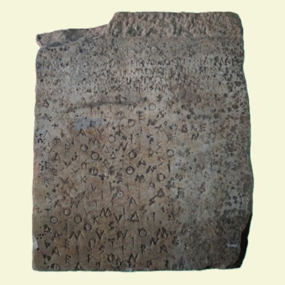 Stele of the dead of
the Erechtheis tribe - Archaeological Museum
of Astros inv.no. 535 - Hellenic Ministry of
Culture and Sports/Archaeological Receipts Fund (CC BY-NC-ND 4.0)
This tomb was described by
Pausanias about 160 AD (Description
of Greece 1.32.3). Herodes Atticus himself was from the
Athenian deme of Marathon
and was born into a family that claimed to be descended from Miltiades,
the
Athenian commander in the famous confrontation with a Persian landing
army in
490 BC. In addition to the inscription listing the fallen of the phyle
Erechtheis, fragments of two other similar inscriptions (same shape of
the
letters and layout) have also been found on the site of the villa. On
the basis
of these finds, G. Spyropoulos has formulated the rather adventurous
hypothesis
that Herodes had the entire funerary monument transferred from Marathon
to his
villa in Kynouría, thus enriching his Peloponnesian villa with a
tangible
reminder of the glorious past of his native city and his lineage. At
Marathon,
he would have raised the burial mound that can still be admired there,
which
would therefore have been there not since the 5th century BC, but since
the 2nd
century AD. Some scepticism about this reconstruction is in order. In
order to
make it plausible that the burial mound dates not from the 5th century
BC, but
from the 2nd century AD, one would at least have to be able to prove
the presence
of material in the mound from the period between the 4th century BC and
the 1st
century AD. In a
Greek-language publication, The Tombstones of the
Fallen in
the Battle of Marathon from Herodes Atticus' villa at Éva in Kynouría
(Athens 2009), Spyropoulos refers on this point to a more detailed
analysis in
a forthcoming book. Walter Ameling, in a
2011 article, rejected this part of
the hypothesis: he saw no reason to believe that the monument at
Marathon completely
changed its appearance around the middle of the 2nd century AD.
As for the authenticity of the inscription,
Ameling was reluctant to commit himself, but pointed out that the shape
of the
letters and the layout made it less plausible that this was an Imperial
imitation. The peculiar layout is further discussed in a 2012 article
by
Catherine Keesling: one line is reserved for each name on the
inscription, and the
letters of each line are deliberately placed between the letters
directly above
them. Keesling points to parallels for this layout in Attic
inscriptions from
the late 6th and early 5th centuries BC. The idea that one of the ten
tombstones for the Athenians killed in the battle of Marathon was
actually
found in the villa at Ástros is currently fairly widely accepted
(although there
are sceptical voices, see for example here).
The first serious scholarly
publication of the text of the inscription was by G. Steinhauer, Horos
17-21 (2004-2009), 679-692. As published by Steinhauer, the inscription
has
since been included in the Supplementum Epigraphicum Graecum
(SEG
LVI 430); the SEG is the annual compilation of all
newly discovered
Greek inscriptions (and of new publications on previously published
epigraphic
texts). Steinhauer also briefly discusses the find in Herodes' villa in
a book
on Marathon. He does not seem to have any doubts about the
authenticity of the
inscription, but he does not take Spyropoulos' theory about the burial
mound at
Marathon at face value. Some suggestions for improving the text as
published by
Steinhauer and a revised English translation can be found in a post by
Pierre
MacKay on this blog on 9 April 2011; there
is also a rather sharp
black-and-white photograph and a drawing of the stone. A German
translation can
be found here.
An important contribution to
the reconstruction of the text of
the inscription (especially the first line of the epigram is
problematic) can
be found in a 2014 article
by Richard Janko. He also presents a 'normalised
transcription and translation into English elegiacs' of the epigram.
For full discussion and more recent bibliography see Strazdins 2023,
174-192.
The sovereign appropriation of
Athenian heritage by Herodes Atticus takes on an added significance in
the
light of his own burial and the vicissitudes of his tomb. A fascinating
article
on the subject was published in 2008 by Joseph L. Rife, from whom I
borrow the
following details. Herodes himself had expressed a desire to be buried
in
Marathon. After all, that was where he came from. But when the sophist
exchanged the temporary for the eternal in the late 170s, the Athenians
did not
respect his last wish: they wanted to give the great deceased an
official
burial in the city. No sooner said than done: the corpse was seized,
carried in
procession to the city by the Athenian ephebes, and buried near the
marble
stadium that Herodes himself had built for the Panathenaean games of AD
140;
according to Rife, the remains of the tomb lie above the stadium, in
the
accompanying image on the right.
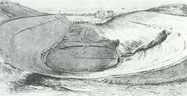 The Panathenaic stadium after the excavations of 1869/70
Photo: Wikimedia Commons
During
or shortly after the funeral, an altar
stone dedicated to 'Herodes, the heros of Marathon'
was placed at the
tomb; as such, the deceased was apparently the object of cultic
veneration.
Rife, who seems to have been unaware of the find at the villa near
Ástros when
he wrote the article, rightly points out that the designation 'heros
of
Marathon' must inevitably have evoked associations in the minds of
passers-by
with the Athenian hoplites who had fallen in battle against the
Persians in 490
BC. The inscription on the altar stone was intended to have much the
same
effect as a burial in Marathon itself: a lasting link between the
memory of
Herodes and the memory of the historic battle. Unintentionally,
however, the
inscription on the altar stone must also have recalled how, less than
20 years
earlier, Herodes had interfered with the monument to the fallen at
Marathon.
The sophist had always been a controversial figure in his native city,
and many
Athenians will not have mourned his death too much. Disagreements
between large
sections of the Athenian citizenry and Herodes had led to a trial
before the
emperor Marcus Aurelius as recently as 174. His appropriation and
relocation to
the Peloponnese of a national monument hors catégorie
will not have met
with universal approval. Probably within a few decades of the sophist's
death,
someone removed the name of Herodes from the altar stone to the heros
of
Marathon and also chiselled away the name of the stone's founder. We do
not
know what moved an unknown person to take up the chisel, but it is an
attractive conjecture that, among other things, he was offended by
Herodes'
treatment of the tombstones of the true heroes of Marathon.
Incidentally, Herodes'
sarcophagus was reused shortly after 250, some three-quarters of a
century
after his burial. '[H]is memory at Athens had (...) shifted
dramatically', Rife
concludes.
Enough of Athens, back to
Kynouría.
The Archaeological Museum of Astros,
which houses most of the finds from Herodes' villa, has
been closed for years. I myself benefited from a brief opening
in July 2019. Many of the larger finds from the more recent excavations
of the
villa during the 1980s and 1990s were still in storage, but
what was on display was well worth a visit. The museum also has
exhibits from other archaeological sites in Kynouría, such as the
sanctuary of Apollo Tyritás on Profítís Ilías between Tyrós and Mélana
(see
below).
And even without the antiquities
collection, visiting the museum is rewarding for its beautiful garden
and for the
fact that it is a lieu
de mémoire in its own right: in 1823, the second
national
assembly of the nascent Greek state met here.
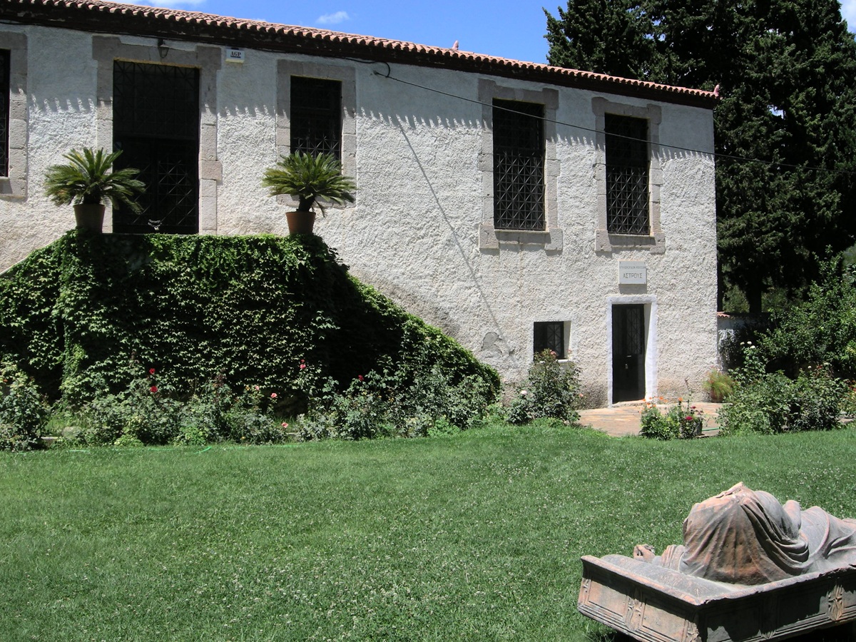 The Archaeological
Museum of Ástros - Photo: Jaap-Jan Flinterman, summer 2008
The museum is a former
secondary
school. It was founded in 1805 as an annex to the school established in
the
village of Áyios Ioánnis in 1798 by the local benefactor Dimítrios
Karytsiótis
(1741-1819),
who had amassed a fortune as a merchant in Trieste. Unlike the branch
in
Ástros, the school in Áyios Ioánnis did not survive the destruction of
the
village by Ibrahim Pasha, in 1826; only an inscription mentioning its
foundation remains (photo below). A transcription of the inscription
and some information about it can be found here
(in Greek). The school in Astros was also set on fire by Ibrahim's
army, but was restored and reopened in 1829. See on the schools of
Karytsiótis Arvaniti
2001-2002.
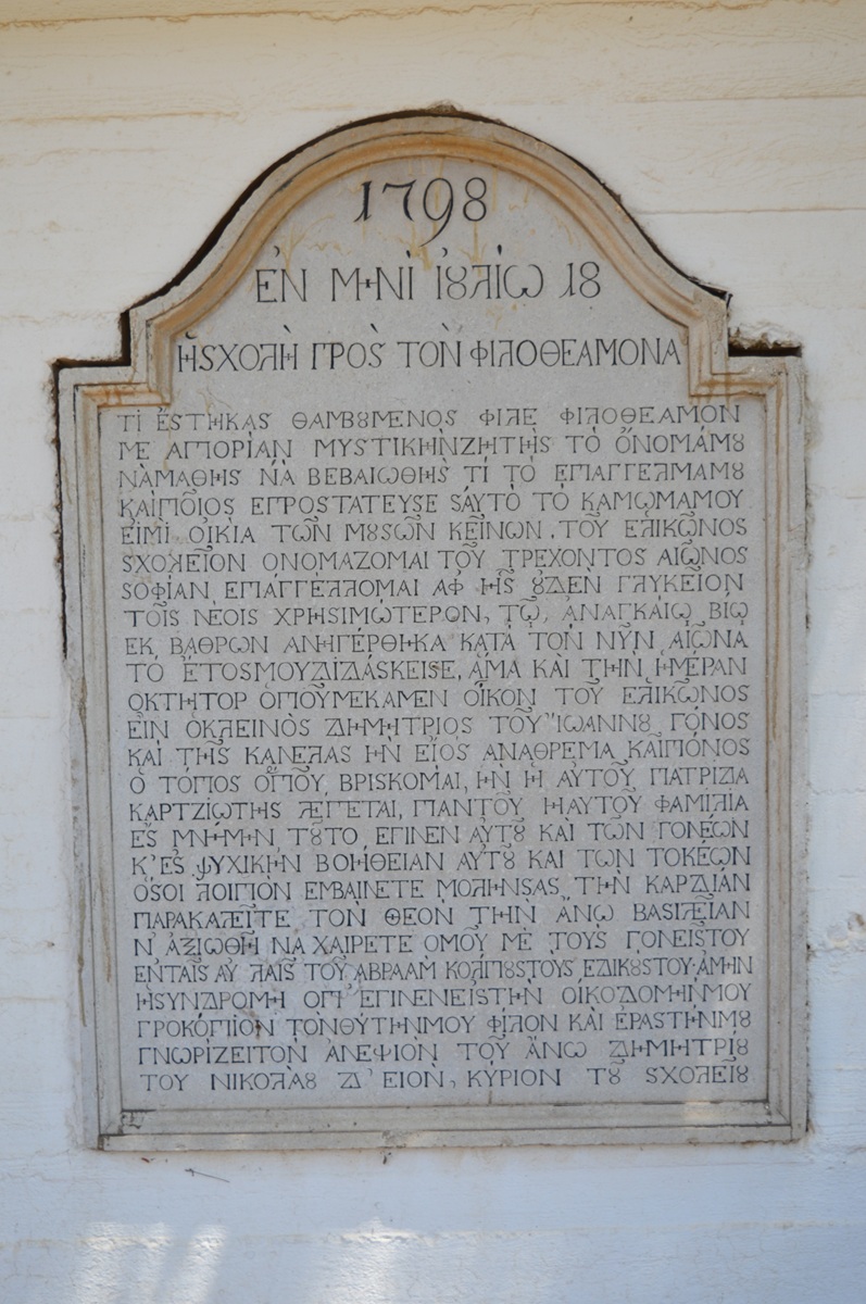 Áyios Ioánnis, inscription mentioning foundation of
Karytsiótis school - Photo: Jaap-Jan Flinterman, summer 2015
Some images
of sculpture
in the Museum of
Ástros, from the villa
of Herodes Atticus. Imperial portraits are well
represented, including those of Hadrian (117-138) (Spyropoulos 2006, p.
106
number
2, with image 16 on p. 105) and Marcus Aurelius (161-180) (Spyropoulos
2006,
pp. 107-108 number 3, with image 17 on p. 107). A striking feature of
Hadrian's
portrait is that instead of the usual Gorgon's head, the breastplate
bears an
image of the winged head of Antinous. The emperor's lover is identified
with
Perseus or Hermes by the wings in his hair, and this
heroization/deification
makes it plausible that this bust of the emperor was made in or after
the year
of Antinous' death (130 AD).
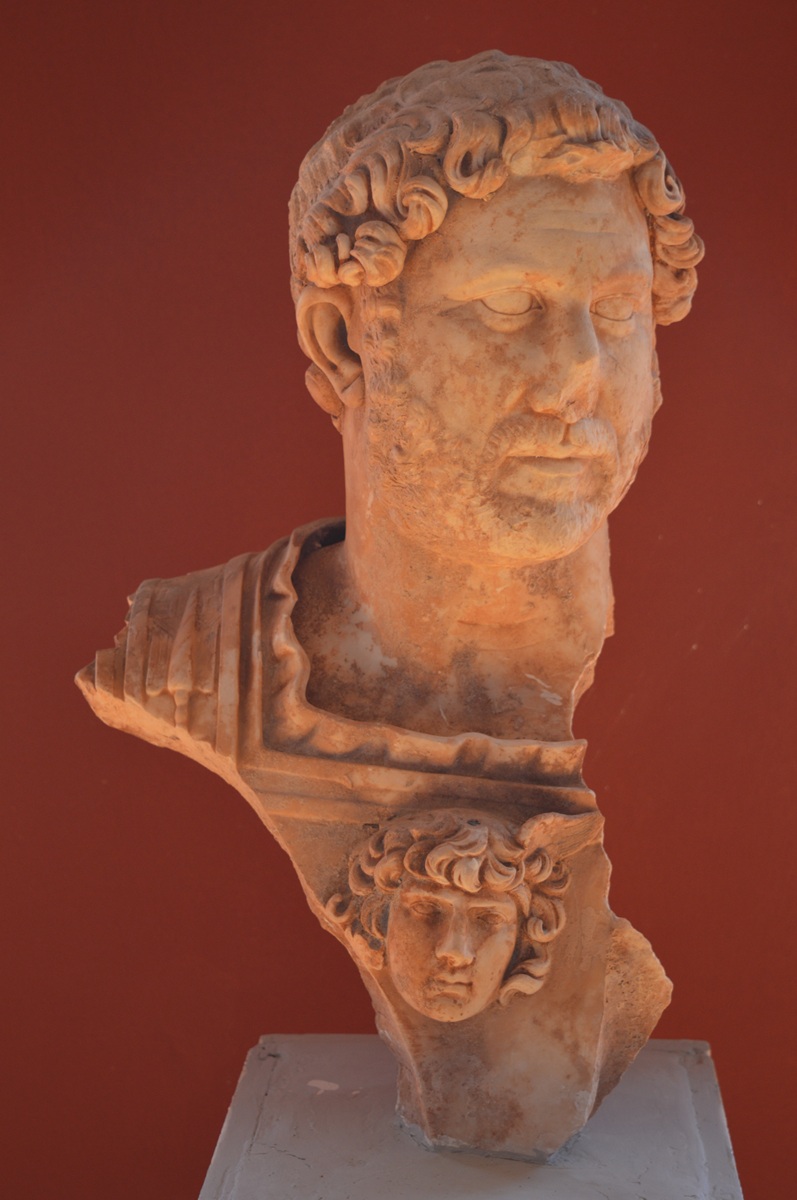
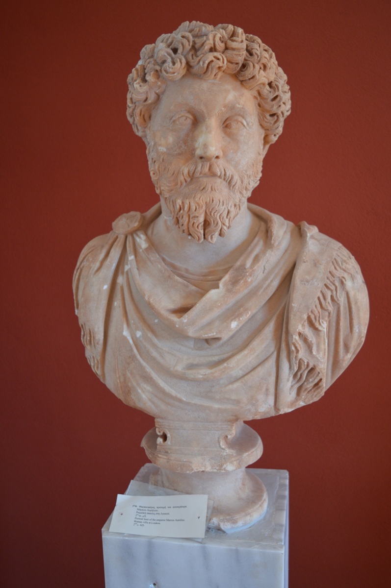 Portrait busts of the
emperors Hadrian and Marcus Aurelius from the villa of Herodes Atticus
- Photos:
Jaap-Jan Flinterman, summer 2019 (Museum Ástros)
Personally, I find the following
portrait of an unknown man to be the highlight of the collection, a
magnificent
example of Antonine sculpture; the excavators of Herodes' villa date it
to the
reign of Marcus Aurelius (Spyropoulos
2006, p. 122 number 14, with image 28 on
p. 124).
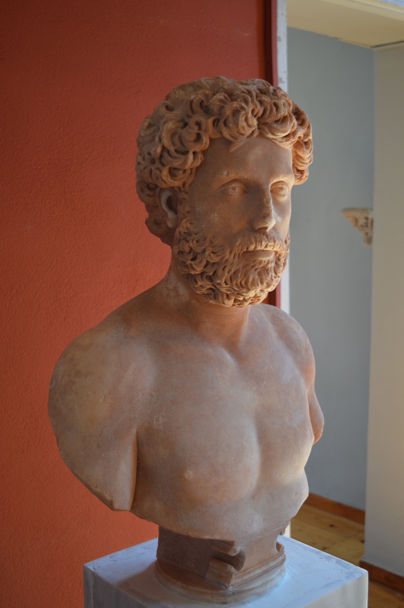 Portrait bust of an
unknown man (second half 2nd century AD) - Photo: Jaap-Jan Flinterman,
summer
2019 (Museum Ástros)
Finds from Herodes' villa are also on
display at the Panarcadian Archaeological Museum in Trípoli and the
National
Archaeological Museum in Athens. In Athens, Jona Lendering took the
picture
below of a relief depicting a young man for me (the museum number is NM
1450;
the relief measures 97 by 68 cm). The vase on the column on the right
is a loutrophoros;
such vases were regularly used as grave markers. The relief was made
after the
death of the boy depicted, but he had become an object of cultic
veneration as
a hero. This is suggested by his 'heroic' nudity, the snake in his
right hand,
and the armour, parts of which are scattered throughout the relief. The
relief
was made in the decades around the middle of the second century, but
the artist
was inspired by funerary reliefs from the Hellenistic period, the
so-called 'Heroenreliefs'.
The relief from Herodes' villa is not a funerary relief, but it may
have had a
'commemorative' function. It is an attractive suggestion that the boy
is one of
Herodes' three foster sons, all three of whom died young and for whom
Herodes
mourned as if he had lost his own children: Achilles, Memnon and
Polydeucion
(Philostratus, Lives of the Sophists 558-9).
Scholars disagree as to
whether any of the three is depicted on this relief and, if so, which
one.
Polydeucion seems at first sight the best candidate, since he is the
only
foster son of Herodes of whom we know that he became the object of a
hero cult.
However, the author of the most
recent comprehensive treatment of the relief that
I know of opts for Achilles (Jansen 2006). One of his arguments is
difficult to refute: the
boy depicted bears no resemblance to Polydeucion, of whom we have
numerous
portraits (see below for an example from the Trípoli Museum). We do not
have a
single portrait of Achilles, but the prominence of the arms would fit
well with
a deceased who had borne the name of the greatest Greek war hero before
Troy.
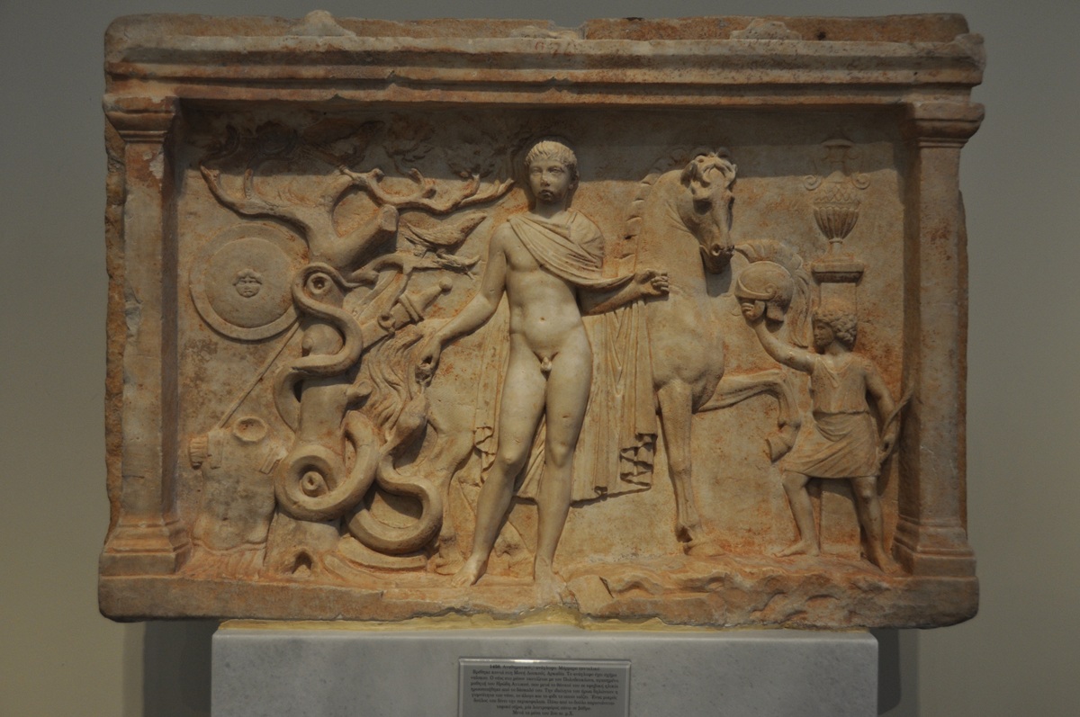 Relief from villa
Herodes Atticus - Photo: www.livius.org (National Archaeological
Museum,
Athens)
At the Panarcadian Archaeological
Museum in Trípoli, I photographed two objects from Herod's villa
exhibited
there: a portrait of Polydeucion ...
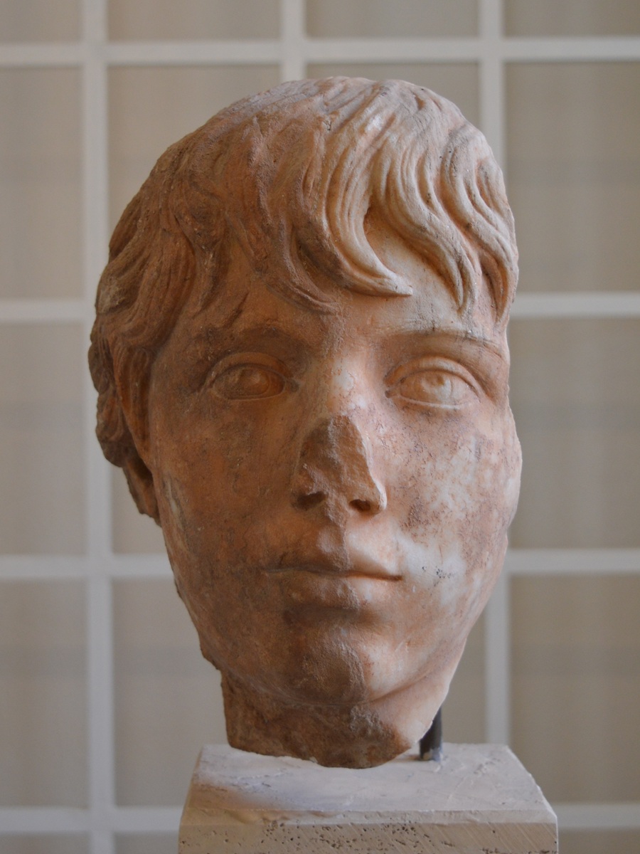 Polydeucion - Photo:
Jaap-Jan Flinterman, summer 2019 (Museum Tripoli)
... and a Classical (late 5th/first half 4th century BC) relief of a
young
horseman and an umpire (Spyropoulos
2006, pp. 76-78 number 14).
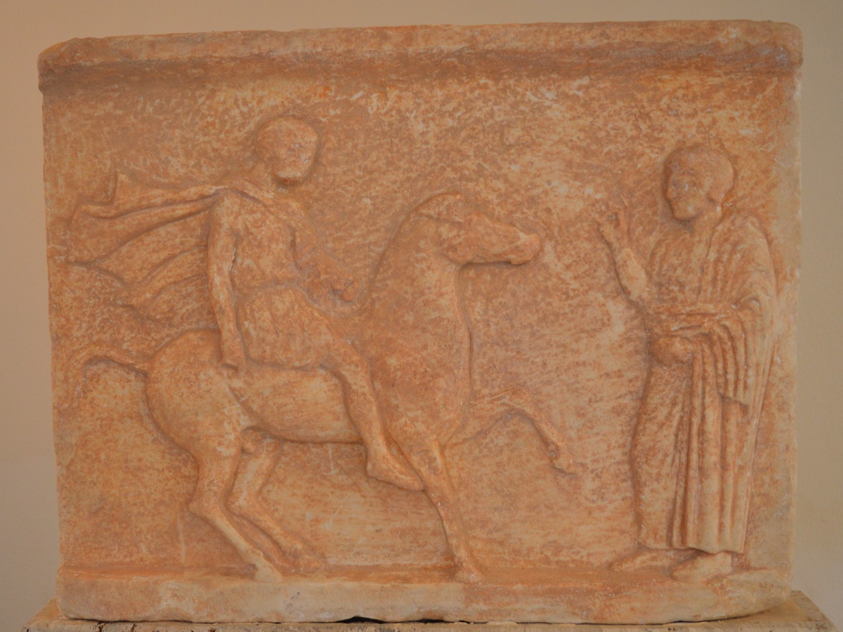 Classical relief from
villa Herodes Atticus - Photo: Jaap-Jan Flinterman, summer 2019 (Museum
Tripoli)
For a portrait of Memnon from Herodes' villa, we
have to go to the Altes Museum in Berlin, where the below effigy of
Herodes'
black foster son ended up via the art trade. That Memnon was black we
know
thanks to Philostratus, Vita
Apollonii 3.11, who calls him an 'Ethiopian'. That
was the usual designation for blacks in ancient Greek texts. He no
doubt owed
his name to his skin colour: in Greek mythology, Memnon was king of the
Ethiopians, and as such part of the Trojan saga cycle.
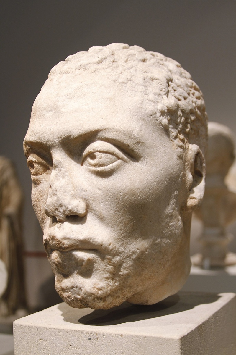 Memnon, portrait bust
from the villa of Herodes Atticus, Altes Museum Berlin - Foto:
Wikimedia
Commons, José Luiz Bernardes Ribeiro (CC-BY-SA-04)
Opposite
Herodes' villa, on the left-hand side of the road from Ástros to
Trípoli, is Moní Loukoús,
'one of the most enchanting monasteries in
the Peloponnese',
according to Daniel Koster.
Its existence is first documented in texts
from the 17th century, but it may be considerably older.
Founded
as
a monastery for men,
it has been inhabited and maintained by nuns since 1946. The full name
of the
monastery, Ιερά Μονή τής Μεταμορφώσεως τού Σωτήρος Χριστού, indicates
that it
is dedicated to the Transfiguration of Christ; cf. for the Orthodox
iconography
of this episode from the Gospels (Matthew 17; Mark 9; Luke 9) this
fresco in
the Serbian monastery of Gračanica in Kosovo. The unofficial name of
the monastery, 'Loukoús', is commonly associated with the Latin lucus, 'sacred
grove', but how this Greek monastery came to have a Latin nickname
remains a mystery. Perhaps
it has something to do with the fact that the monastery was for a time
in the
hands of the (Roman Catholic) Capuchin Order during the Venetian rule
of the
Peloponnese (1685-1715).
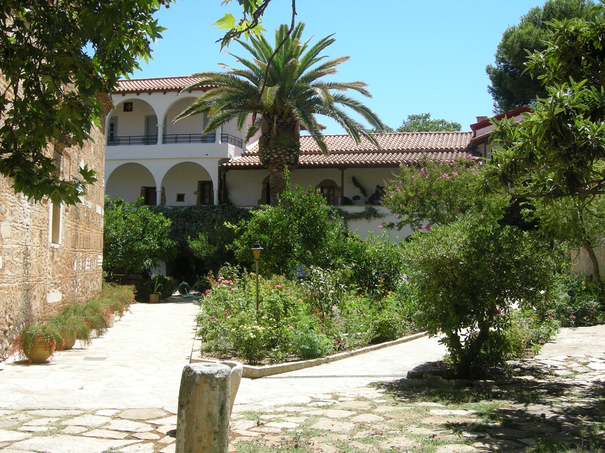 Moni Loukoús - Photo:
Jaap-Jan Flinterman, summer 2008
The
church of Moní Loukoús in its present form dates from the 17th century,
but it cannot be ruled out that it had one or more predecessors. When
the monastery was destroyed by Ibrahim Pasha's troops in 1826, the
church was spared. It is said that Ibrahim's soldiers were frightened
off by an icon of St Eustathius, which began to bleed when it was
maltreated by a soldier.
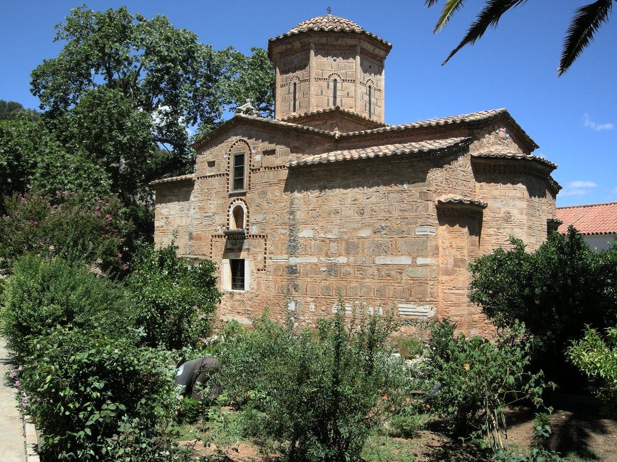 The church of Moní
Loukoús - Photo: Jaap-Jan Flinterman, summer 2008
Building
materials from the nearby ruins of the villa of Herodes Atticus were
widely used in the construction of the church. An especially creative
solution was chosen for the suspension of the church bell.
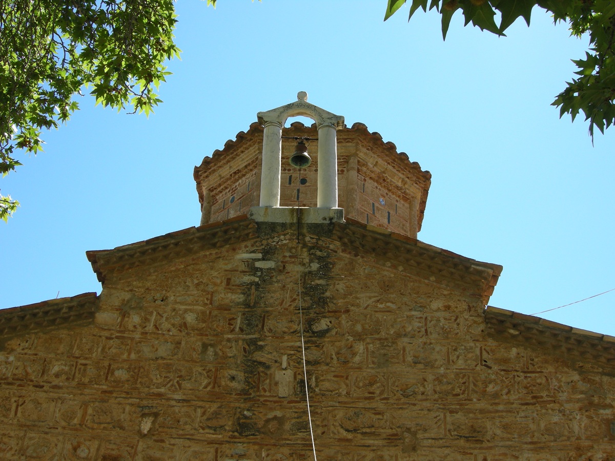 Moní Loukoús -
Suspension of the church bell - Photo: Jaap-Jan Flinterman, summer 2008
To
the south-east of Moní Loukoús, there is a curious aqueduct that is
completely
covered in calcium carbonate. It dates from the Roman period and must
have supplied water
from a nearby well to Herodes' villa. A very nice series of photos
taken in autumn 2012 of both the aqueduct and the villa can be found
here.
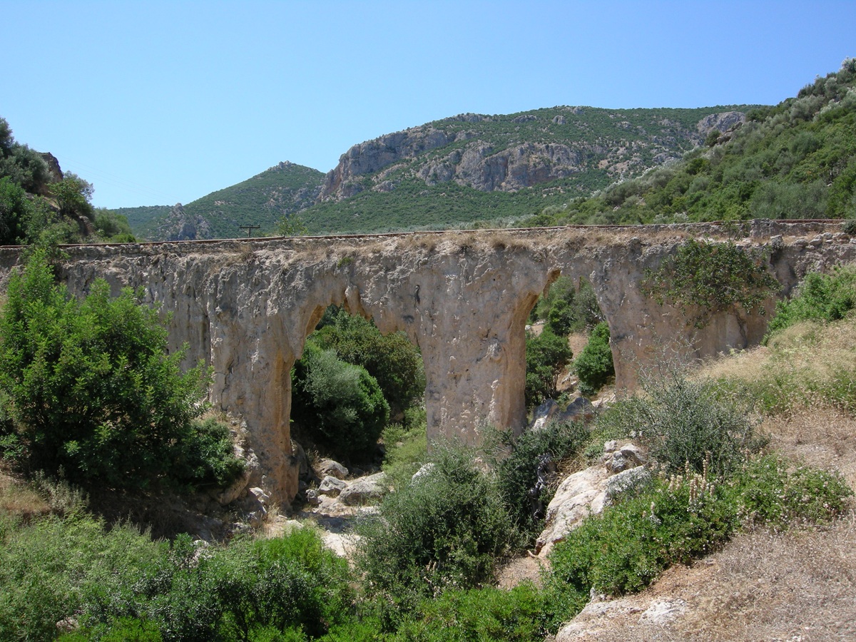 Aqueduct south-east
of Moní Loukoús - Photo: Jaap-Jan Flinterman, summer 2011
The website of the Diocese of Mantineía and Kynouría has a page with information on
the history of the monastery.
Four
kilometres east of Ástros is Parálio
Ástros ('Ástros by the Sea'). An
informative book on this town was published in 2023 by
Panayiótis Faklaris. The
nucleus of the settlement is built on the southern slope of a hill with
two peaks
jutting out into the sea (satellite photo).
On the southern peak there is a castle.
 The castle of Parálio
Ástros, seen from the north - Photo: Jaap-Jan Flinterman, summer 2019
Faklaris dates the castle to the early 15th century and attributes it
to the Venetians, but a 17th/18th century
date (during the Venetian rule of the
Peloponnese in the decades around 1700 or the second Tourkokratía) has
also been suggested (Arvaniti 2007;
Arvaniti 2021).
When Leake
visited the site in 1806, he saw 'the remains of a modern castle' (Travels in the Morea,
volume 2, p. 484). In
1824, it came into the
possession of the three Zafirópoulos brothers, who were from the area
(Áyios
Ioánnis) and had made their fortune as merchants. Their trading company
had
branches in Ýdra, Constantinople, and Marseilles. They had returned to
their homeland
at the start of the Greek uprising of 1821, where they would play a
leading
role in the following years.
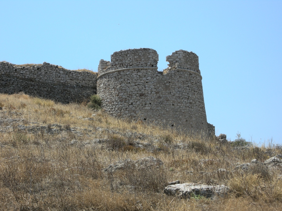 The north-western
tower of the castle of Parálio Ástros - Photo: Jaap-Jan Flinterman,
summer 2010
The castle was restored, its fortifications strengthened, and
the brothers built mansions within its walls. When Ibrahim Pasha burned
down
the villages of Kynouría in 1826, the Zafirópoulos brothers' castle
served as a
refuge for the population. It managed to withstand a direct attack by
the enemy
army. The Greek Castles
website has a page on this castle, here.
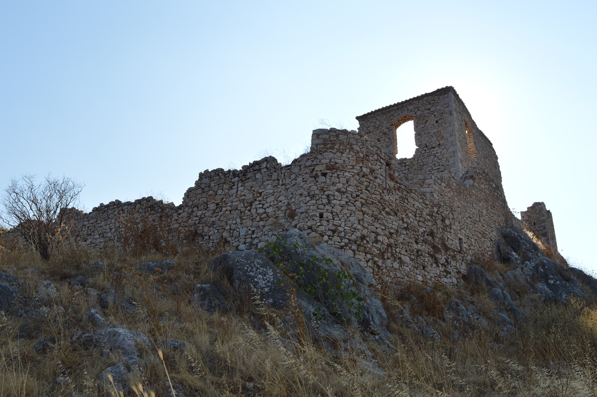 Castle of Parálio
Ástros, north-east corner - Photo: Jaap-Jan Flinterman, summer 2019
On
the western, landward side of the hill, north of the
castle, the remains of an ancient wall can be seen (photo below). This
is usually associated with an Athenian attack on the Thyreátis in 424
B.C. As
we have seen above,
the Aeginetans had received permission from the Spartans to
settle in Thyréa in 431 BC, but were attacked there by an Athenian
fleet in
424 BC. According to the historian Thucydides, they were forced to
abandon a wall near the sea that they were building and to retreat to
the upper city,
which was about ten stadia (about two kilometres) from the sea
(Thucydides
4.57). The wall north of the castle is commonly identified as
Thucydides' 'wall
by the sea'.
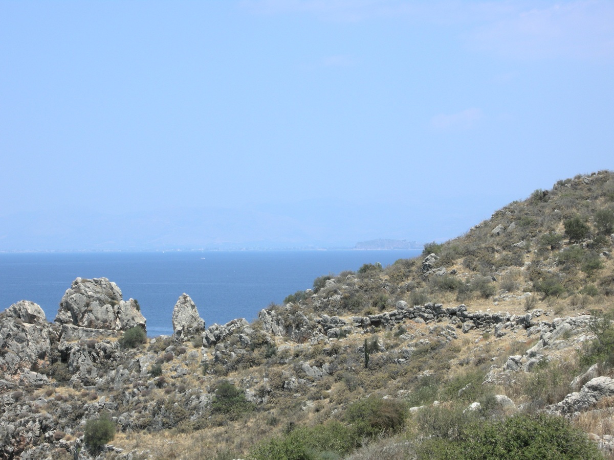 Nisí Paralíou
Ástrous, the 'wall by the sea' - Photo: Jaap-Jan Flinterman, summer 2010
Below
is a crop of a photo taken from further away but under slightly more
favourable
atmospheric conditions.
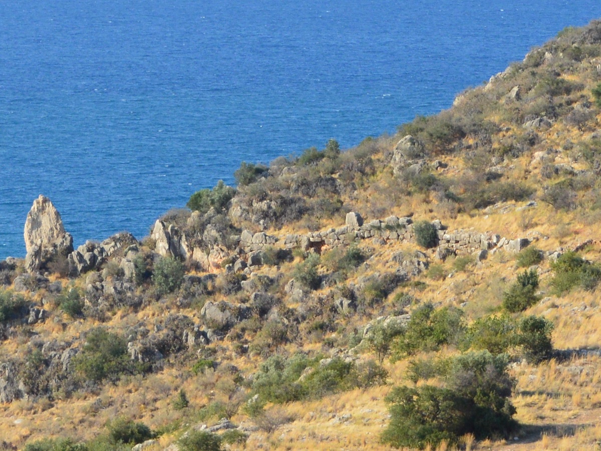 aka 'the wall of the
Aeginetans' - Photo: Jaap-Jan Flinterman, summer 2017
The
view to the south from the hill above Parálio Ástros (photo below)
gives a good
impression of the articulation of the Kynourian coast, with its
numerous bays
and capes.
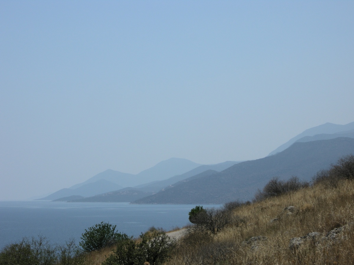 View from Nisí
Paralíou Ástrous to the south - Photo: Jaap-Jan Flinterman, summer 2010
Eight
kilometres south-west of Ástros, above the road to Ágios Pétros (satellite photo), a 630-metre high
hill stands out among the foothills of Mount Párnonas (photo below). Its
top and part of its
northern slope are surrounded by the remains of an ancient wall. The
locality
is known as Ellinikó
(Ελληνικό Άστρους), the hilltop is called Teichió (Τειχιό),
after the wall (Greek: τείχος) that is its distinctive
feature. The ruined wall is what remains of the enceinte
of an ancient fortified settlement. In 1976 and 1977 this
hill was thoroughly investigated by the Greek Settlements Seminar of
Utrecht University
(Netherlands). The settlement was measured and mapped, and the surface
remains
were carefully described. The results of this research can be found in
two
publications by Yvonne Goester: a popularising publication in volume 51
(1979) of
the journal Hermeneus (in Dutch) and the full
report (in English) in volume 1 (1993) of
the journal Pharos.
 Ellinikó Ástrous -
Teichió - Photo: Jaap-Jan Flinterman, summer 2010
The
identification of the site has been controversial, but this now seems
to have been resolved. Israel Walker (1936) believed that the main town
of northern Kynouría, Thyréa, was located here; until recently,
Fakláris was of the same opinion, but he has since abandoned this
identification. Most experts, including Pritchett, Goester and Shipley,
hold that these are the remains of Eua, a large village mentioned by
Pausanias (Description
of Greece
2.38.6). The most conspicuous remnant of the settlement is the wall,
which has a circumference of about one kilometre. Goester
argues
that the wall dates from the second half of the 4th century BC and
suggests that its construction was related to the reoccupation of the
Thyreátis by Árgos. This dating is widely accepted in
more recent literature.
From
a path running along the south-east side of the hill, remnants of
the enceinte are reasonably visible below the top (photo below).
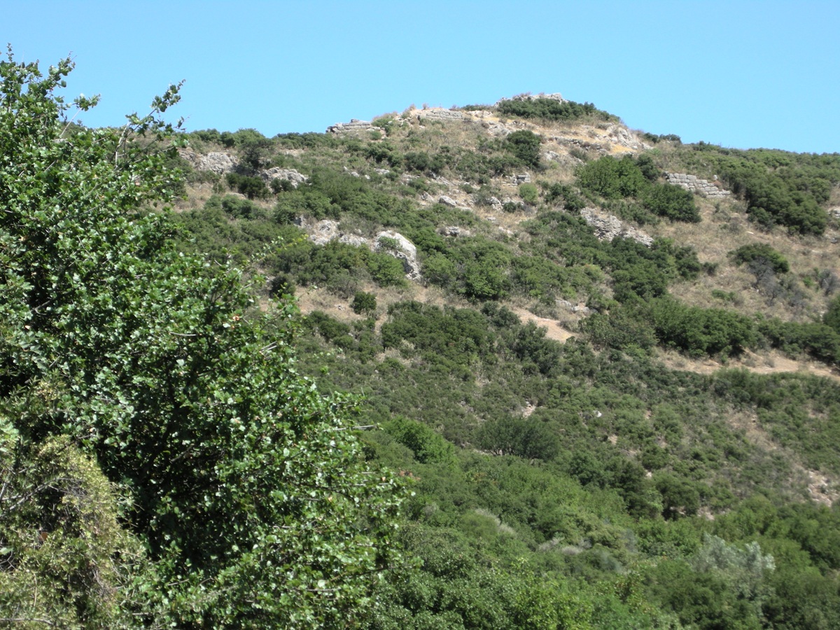
The south-east side
of Teichió - Photo: Jaap-Jan Flinterman, summer 2010
The
most impressive remains of the wall, over 20 metres long and up to 3.5
metres high, are on the north side. The photo below was taken from
several hundred metres away.
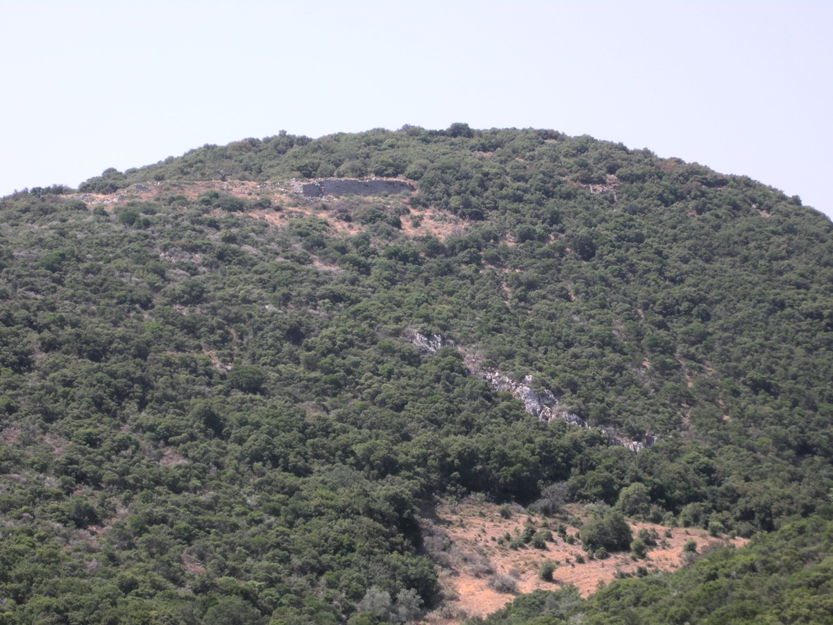 Teichió, remains of
the wall on the north side - Photo: Jaap-Jan Flinterman, summer 2011
Then
a section of a more recent photograph taken from roughly the same
position. The remains of the wall are in the centre of the crop.
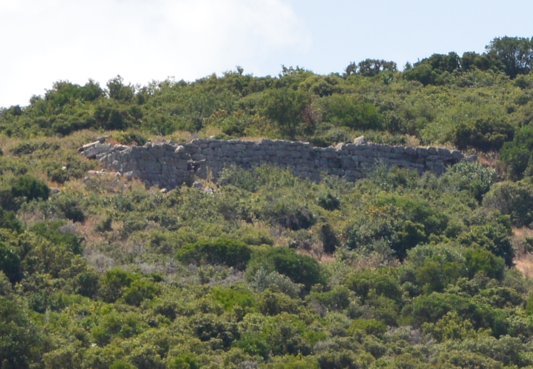 Teichió, remains of
the wall on the north side - Photo: Jaap-Jan Flinterman, summer 2015
A few photos taken during walks around and to the top of the hill. They
illustrate the strategic location of the settlement.
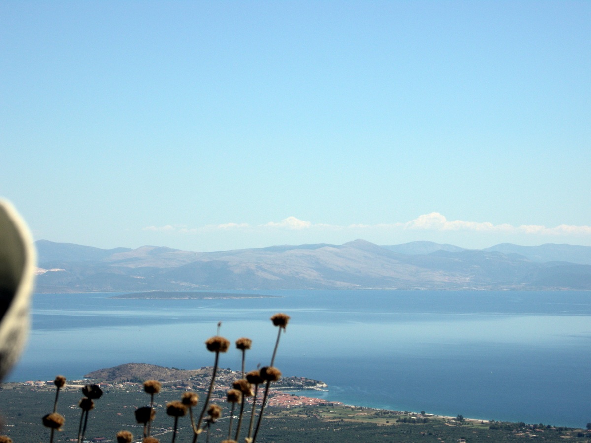 View from Ellinikó
looking north-east - Photo: Jaap-Jan Flinterman, summer 2010
Not only was it situated high above the plain of Ástros and the Argolic
Gulf ...
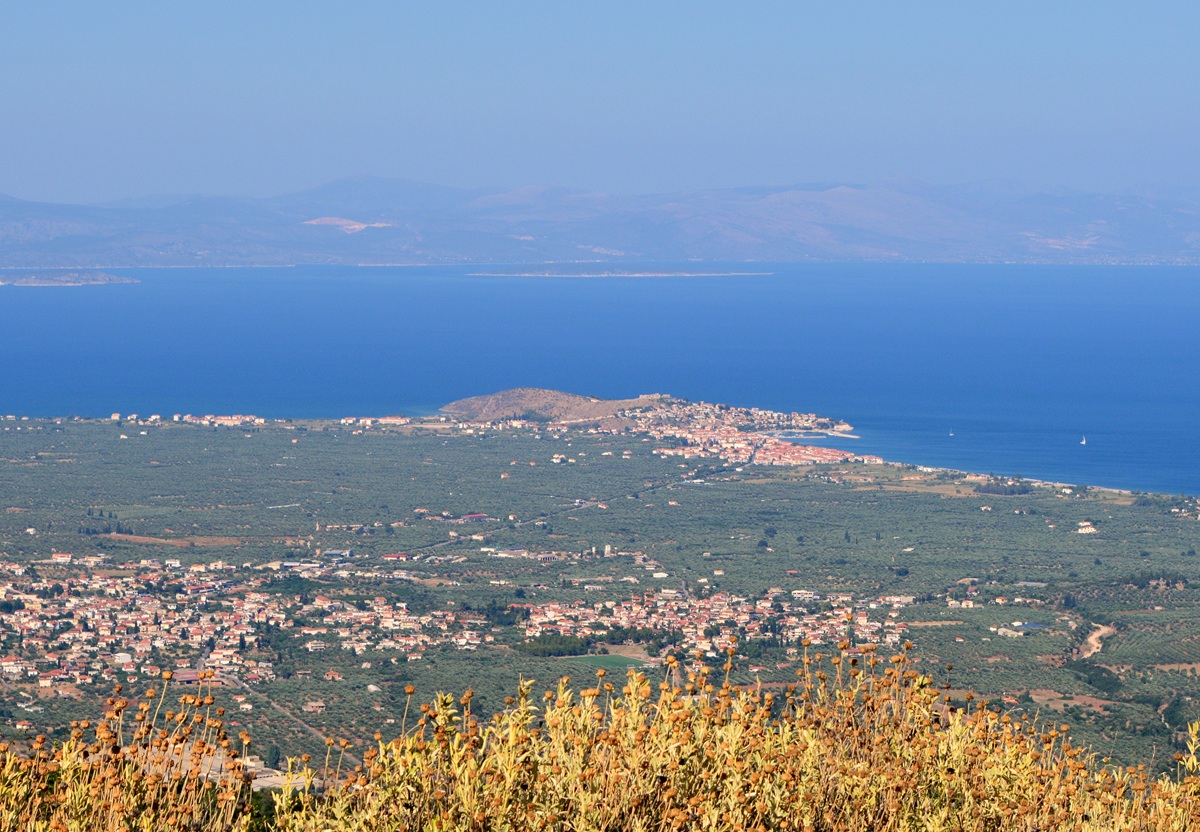 The plain of Ástros,
Parálio Ástros, and the Argolic Gulf as seen from Ellinikó - Photo:
Jaap-Jan
Flinterman, summer 2015
...
it also controlled the land roads north to the central massif
of Mount Párnonas, leading to the central and southern Peloponnese, to
Tegea and Sparta.
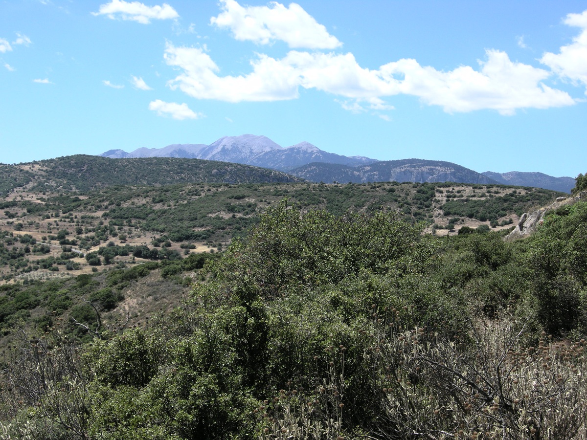 View from Ellenikó
looking south-west - Photo: Jaap-Jan Flinterman, summer 2010
Climbing
up the hill along a goat track on the north-east side, you pass the
enceinte at its northeasternmost point. This is tower no. 1 (pictured
below) in Goester's numbering system. Goester 1993 gives a
comprehensive
and informative description of the site.
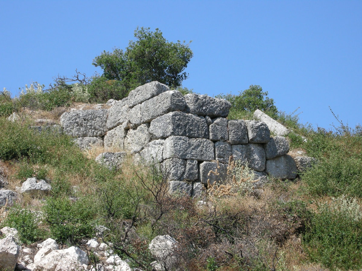 Teichió, the northeasternmost
point of the enceinte - Photo: Jaap-Jan Flinterman, summer 2011
About
25 metres to the west is tower no. 2 (pictured below), from which the
continuous section of well-preserved wall visible in the photo above
begins.
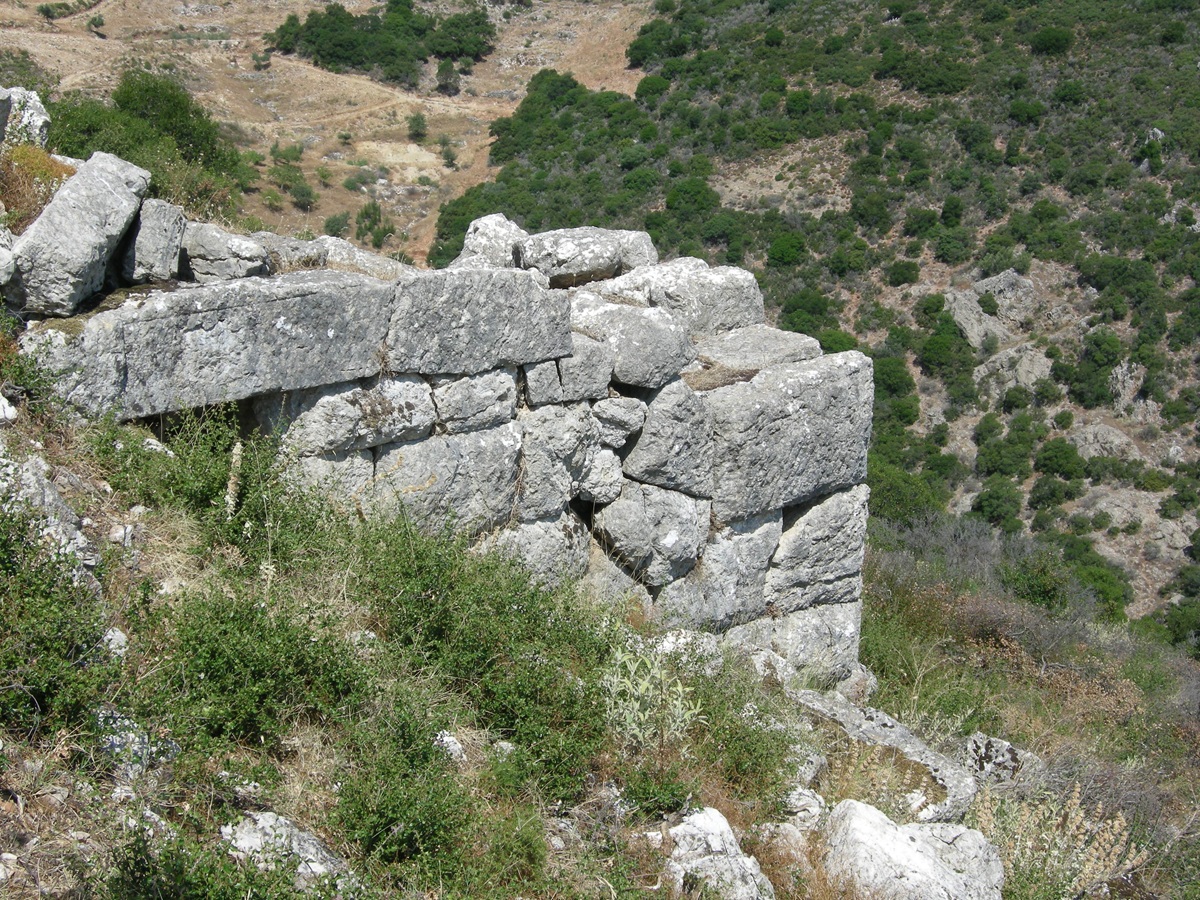 Teichió, Tower no. 2
Goester - Photo: Jaap-Jan Flinterman, summer 2011
On the inside, the ground level reaches the top of the wall (photo
below), and although the photo above
makes it look easy to approach the wall from the outside, in practice
it is quite difficult due to the nature of the terrain.
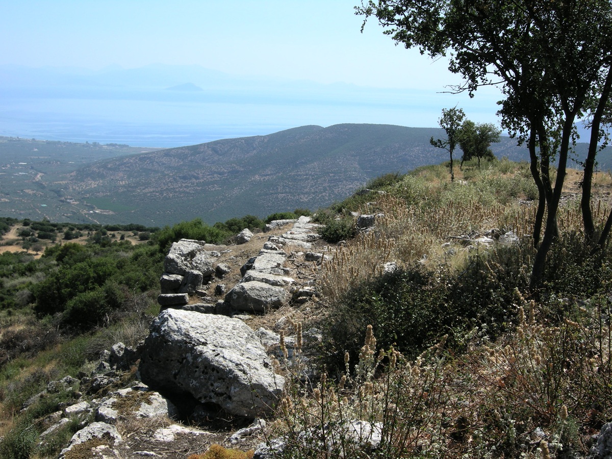 The
wall on the north side seen from above -
Photo: Jaap-Jan Flinterman, summer 2011
The
photo below was therefore taken from tower no. 2. Incidentally, this
and two other photos of Ellinikó are by Mieke Prent and Stuart MacVeagh
Thorne, who, as archaeologists, made better photographic
choices than I
did at Teichió.
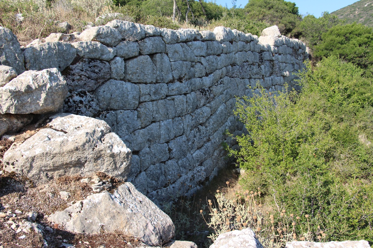 The wall on the north
side seen from tower 2 - Photo: Mieke Prent, summer 2017
The wall was defended by eleven towers. The main function of these towers was to expose those attacking the wall
to flanking fire. An alternative, more economical device for achieving
the same objective was the 'indented trace', i.e. the construction
of the wall 'in staggered sections of short flank walls at right angles
to each section of the face of the curtain' (Scranton 1941). At
Elliniko this device was used to the west of tower no. 3, i.e. to the west of the continuous section of
well-preserved wall pictured above. Here we find five short flank walls
('jogs').
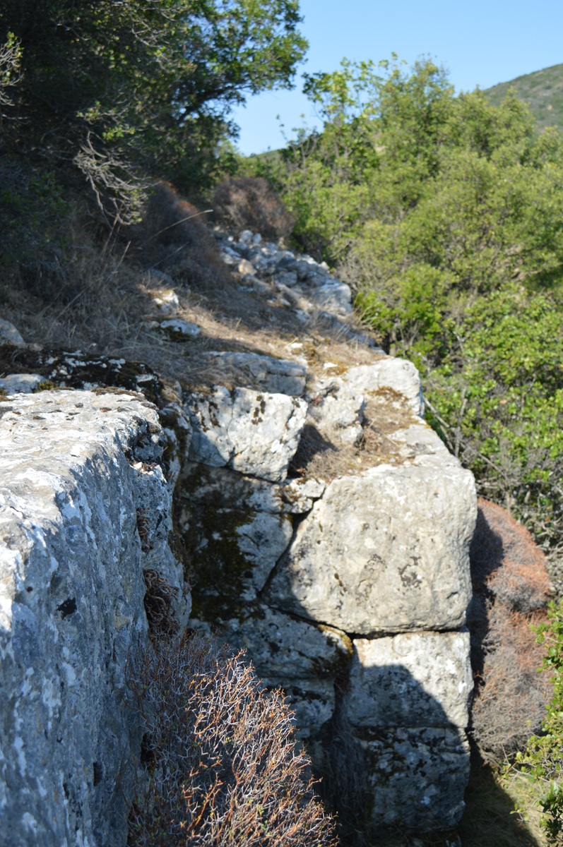 Jog to the west of tower no. 3 - Photo: Jaap-Jan Flinterman, summer 2017
To
the southwest, the hill is connected by a saddle to another hill almost
as high. To compensate for this defensive weakness, the enceinte at
this point was fortified with a triangular bastion (tower 6). This is
the most sophisticated piece of military architecture found at Teichió.
Below are four photographs of this bastion. The first shows the bastion
from a position inside the wall. On the top left are the peaks of
the central massif of the Párnonas.
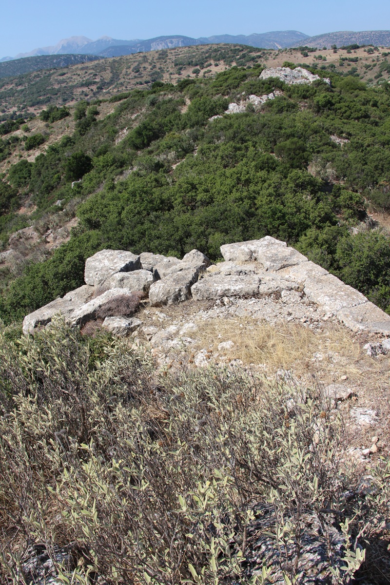 Teichió, southwestern
bastion - Photo: Mieke Prent, summer 2017
The
second is from the remains of the wall to the north of the bastion. The
picture shows how the wall was constructed: two shells of hewn and
stacked blocks with a filling of loose rock.
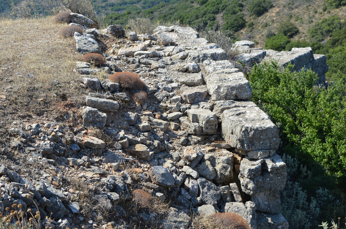 Teichió, southwestern
bastion - Photo: Jaap-Jan Flinterman, summer 2017
The third shows the bastion from a position outside the wall.
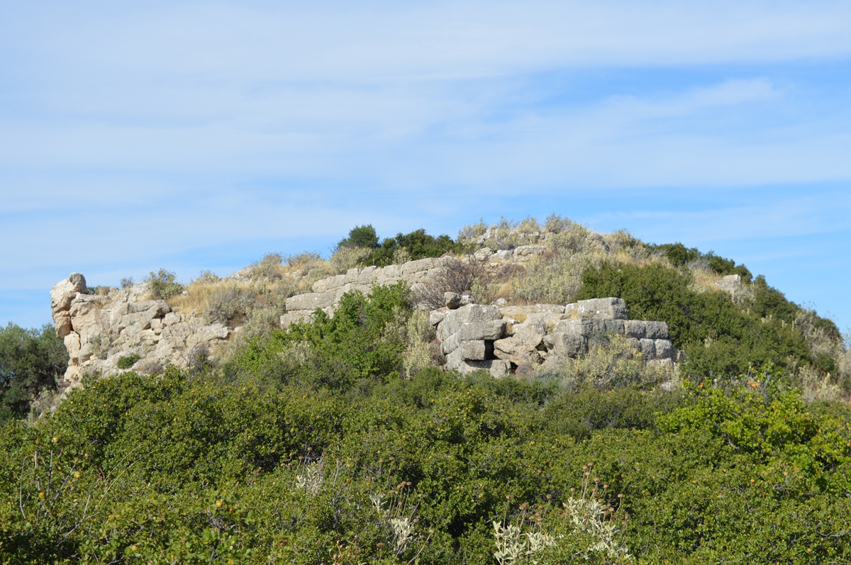 Teichió, the
south-western bastion from outside the wall - Photo: Jaap-Jan
Flinterman,
September 2023
The fourth shows that the stones here are more regularly hewn and
jointed than elsewhere in the enceinte.
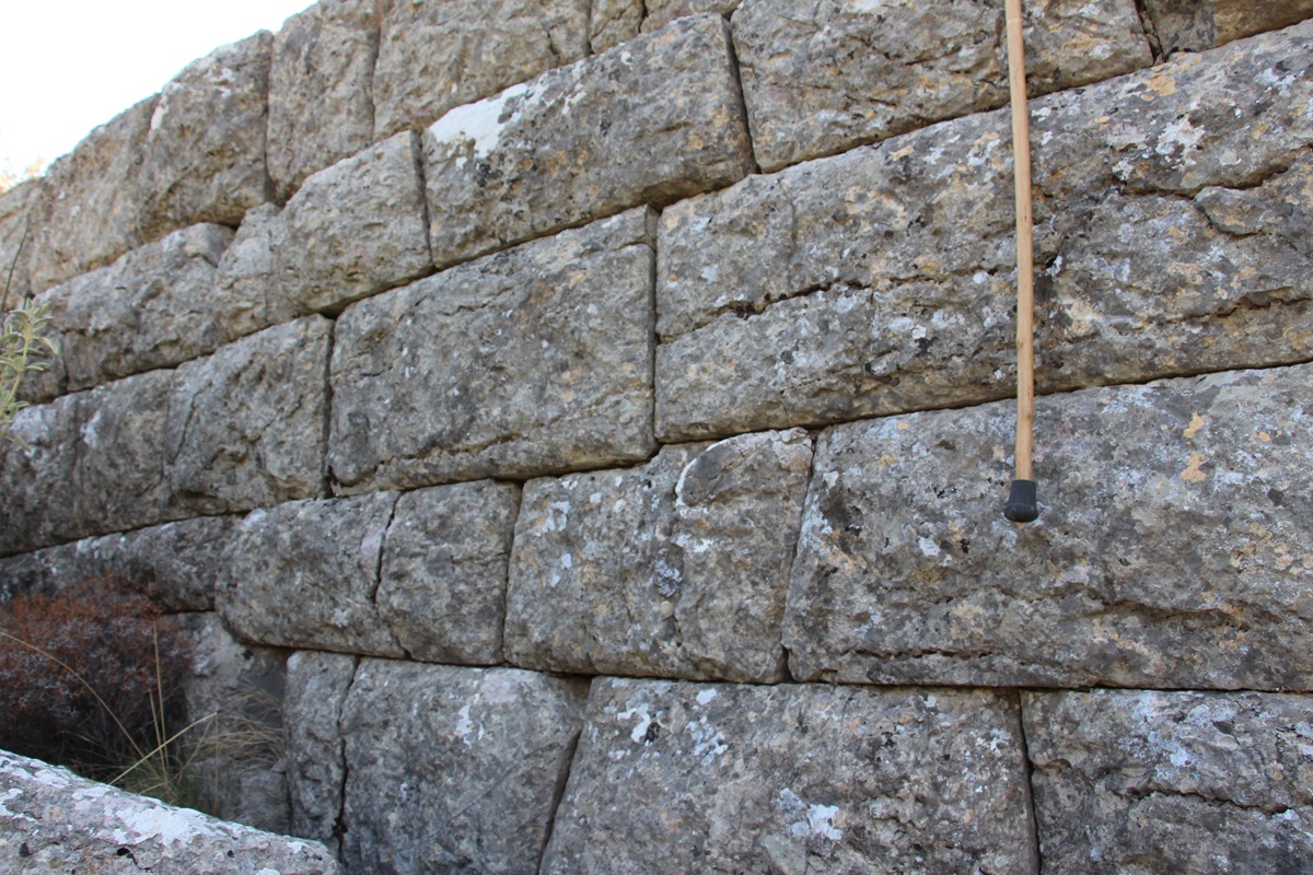 Teichió, northern
wall of the south-western bastion - Photo: Stuart MacVeagh Thorne,
summer 2017
The fact that one part of a fortification is built in a more
regular way than the rest of it may give rise to the suspicion that it
is a later addition. Goester thinks that
the different style of masonry in tower 6 is not in itself an argument
for dating this part of the fortification later. Balandier and
Guintrand
(2019), on the other hand, argue that the south-west bastion must be an
addition from the middle of the third century BC. Perhaps future
excavations will clarify the matter. In the meantime, a possible
re-inforcement of the south-western part of the enceinte with a
bastion, about the middle of the third century, does not really affect
the arguments for a dating of the present perimeter to the late fourth
century BC.
Approximately
700 metres north-north-east of Teichió, at a place known locally as
Anemómylos, is a structure built in 1960 as a makeshift shelter, the
roof of which has since collapsed.
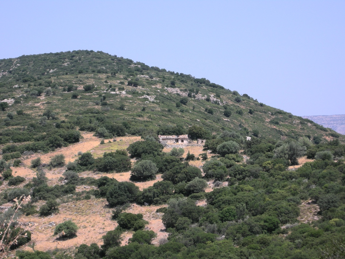 Anemómylos - Photo:
Jaap-Jan Flinterman, summer 2011
Its lower part consists of the well-preserved remains of an ancient
building measuring just under ten by six metres.
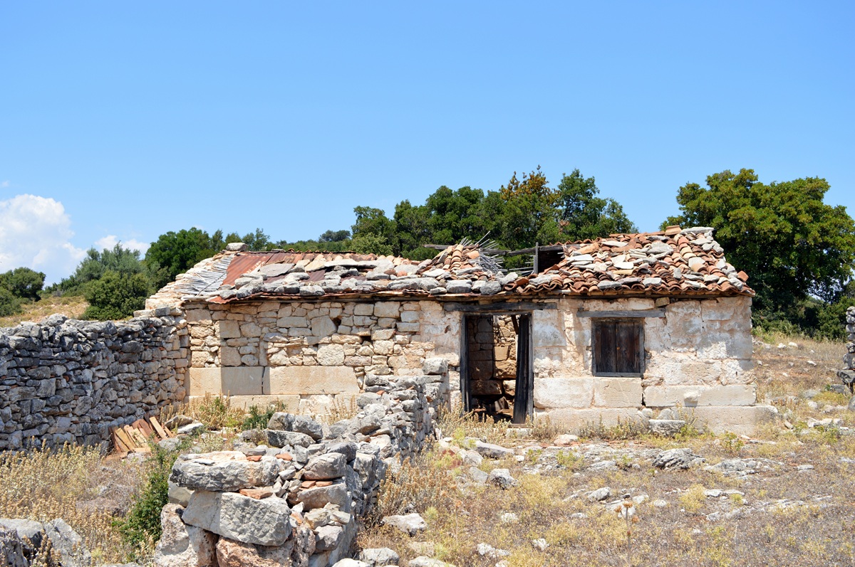 ... the
well-preserved remains of an ancient building ... - Photo: Jaap-Jan
Flinterman,
summer 2011
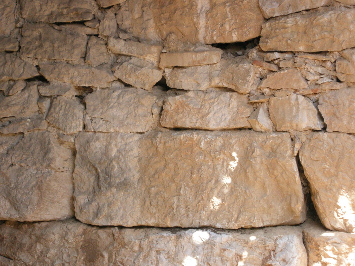
It was probably a small temple, constructed from carefully hewn
limestone blocks, visible on both the exterior ...
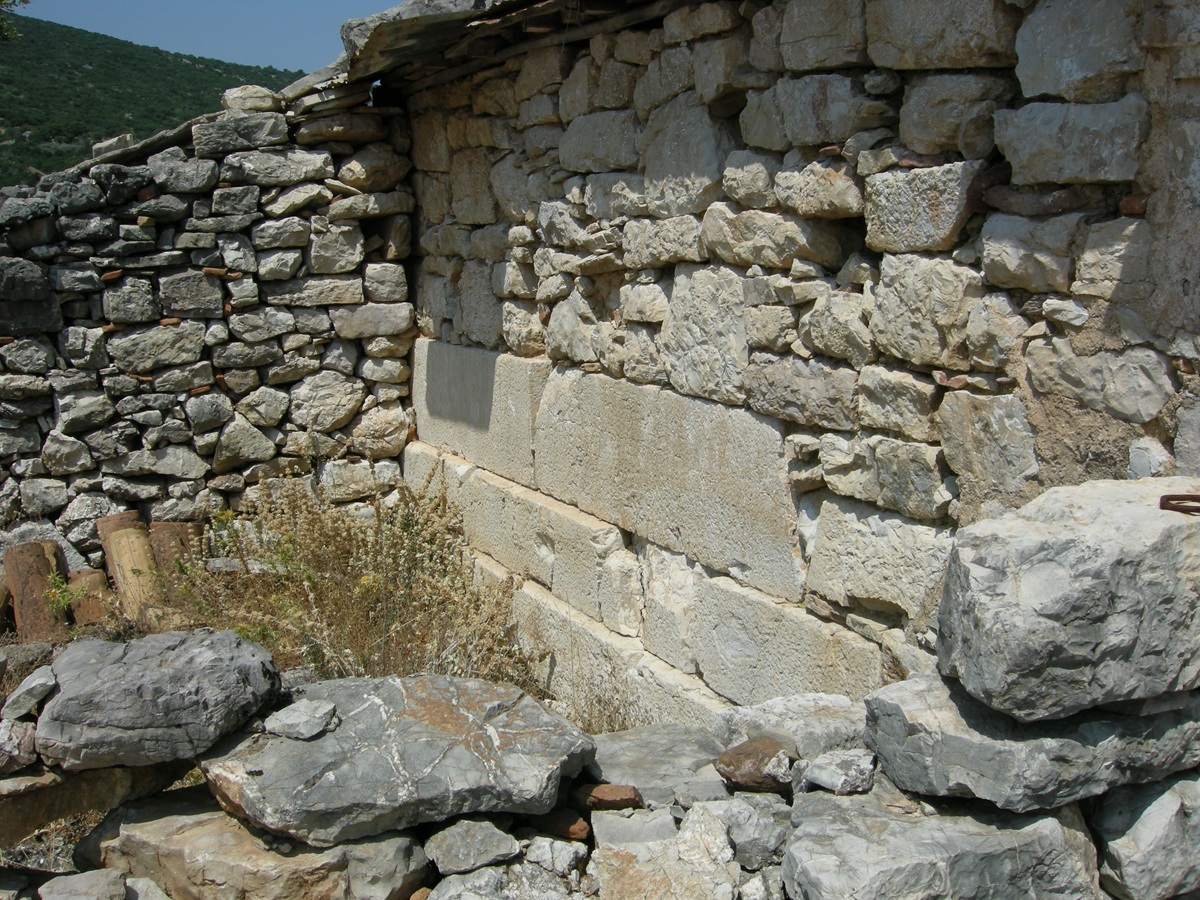 Anemómylos, western
half of the south wall of the temple - Photo: Jaap-Jan Flinterman,
summer 2011
...
and the interior. Fakláris dates the temple to the second half of the
fourth century BC. More photos of the small building can be found on
this page of the German-language
website www.argolis.de.
 Anemómylos, inner
side of the northern wall of the temple - Photo: Jaap-Jan Flinterman,
summer
2011
If
Eua was indeed located on Teichió, this building could well have been a
temple to the healing deity Polemocrates (cf. Gorrini 2014). According
to Pausanias (Description
of Greece
2.38.6), there was a sanctuary at Eua for this healing demigod, who was
considered to be a grandson of Asclepius. Near the remains of the
temple, in the 1960s, a tile stamp was found with the text ΕΥΑΤΑΝ
ΔΑΜΟΣΙΟΙ, i.e. ΕΥΑΤΑΝ (ΚΕΡΑΜΟΙ) ΔΑΜΟΣΙΟΙ, 'roof tiles of the citizens
of Eua' (something like 'municipal roof tiles'). At the beginning of
this century, another roof tile (stamp) with this text surfaced,
finally settling the debate on the identification of Teichió in favour
of Eua. In the words of the 2009
publication
by Grigoris Grigorakakis
reporting the discovery of the second tile: 'The identification of
Teichió with ancient Eva is considered certain, since two stamped tiles
from it bear the ethnic ΕΥΑΤΑΝ.'
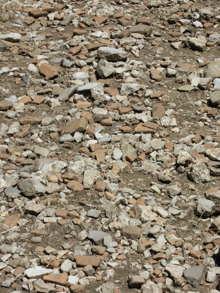 In some places the
hill is littered with sherds - Photo: Jaap-Jan Flinterman, summer 2010
We noted above
that in 338 BC Argos was confirmed in its possession of the Thyreátis
by the Macedonian king Philip II. It is likely that the region had
already become disputed territory in the preceding decades. Shortly
after the turn of the century, a collection of about 135 inscribed
bronze tablets was found in Argos. The texts date from the first half
of the fourth century BC. They are financial records of the temple
treasure of Pallas Athena, which also functioned as a 'state bank'. As
far as I know, the texts have not yet been published, but they have
been reported (Kritzas 2006;
Kritzas 2013). These
records mention places in the
Thyreátis such as Neris and Eua as villages under Argos. In 371 BC, the
Spartans suffered a devastating defeat at Leuctra in central Greece at
the hands of the Thebans under Epaminondas. This defeat marked the end
of undisputed Spartan hegemony in the Peloponnese. The new documents
from Argos indicate that after the Battle of Leuctra, Argos managed to
regain possession of the Thyreátis, at least temporarily.
Presumably,
Argos and Sparta were not the only interested parties (for the content
of this and the following paragraph, see Nielsen
2002 and Roy 2009).
The geographical lexicon (E 145 Billerbeck) of Stephanus of Byzantium
(6th
century AD) calls Eua a πόλις Ἀρκαδίας, a 'city of Arcadia'.
The Byzantine geographer relies for this information on a 4th-century
BC historian, Theopompus of Chios (FGrHist
115F60). More specifically, Stephanus claims to have taken the
information about Eua from the sixth book of Theopompus' Philippica. The
work of Theopompus is lost except for fragments like this one, but we
do know that in Book 6 of his Philippica
he dealt with the history of the years 354-353 BC. Apparently, in those
years, there was reason to call Eua an 'Arcadian city'. By 370 BC,
Arcadian cities and tribal communities in the central Peloponnese had
united in a confederation to take maximum advantage of the end of
Spartan hegemony, and in the following years, regions outside the
Arcadian core area had been incorporated into this confederation. It is
not inconceivable that the Arcadians attempted to do the same with the
Thyreátis. The existence of an Arcadian claim to the Thyreátis is also
supported by the existence of a mythical genealogy mentioned by
Pausanias (Description
of Greece
8.3.3). According to this genealogy, one of the sons of the Arcadian
primeval king Lycaon was called Thyraeus. Thyréa, in the Argolis, and
the Gulf of Thyréa are said to have been named after this Thyraeus.
Such myths were not idle inventions: they supported serious political
claims by constructing ancient kinship relations.
In
short,
there is good reason to believe that in the decades following the
battle of Leuctra in 371 BC, the Thyreátis, including Eua, became a
bone of contention between Argos, the Arcadian confederacy, and Sparta,
which would not have wanted to give up its territorial gains of the
sixth century BC without a fight. To what extent the various parties
were successful in their claims is unclear. Clarity did not come until
338 BC, when Philip II formally returned the Thyreátis to Argos.
Interestingly, Theompompus refers to Eua as a 'city (polis) of Arcadia',
while at the same time the Argives granted the settlement no more than
the status of a village (kōmē).
Were the Arcadians trying to mollify the inhabitants of Eua by granting
them a little more status than the competition was willing to do?
Today,
Ástros forms an agglomeration with Chimeriní Meligoú (originally the
winter residence of the inhabitants of the mountain
village of Oriní Meligoú). On the
south-eastern edge of this agglomeration, to the right of the
Ástros-Leonídio road, is a modest hill, Kastráki Meligoús.
If you take
the short walk to the top, the whole of the Ástros plain lies at your
feet. Below is the view to the north-east. The built-up
hill by the sea is Parálio Ástros.
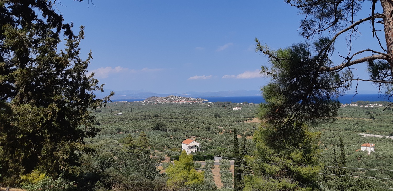 Kastráki Meligoús,
view to the north-east - Photo: Jaap-Jan Flinterman, summer 2024
Some scholars suggest that the central city of the region was located
here in the 5th century BC: Thyréa, which was conquered and destroyed
by the Athenians in 424 BC. It must be admitted that Kastráki Meligoús
would have been an ideal 'acropolis' for the central city of the plain.
However, there is no archaeological evidence to support this
hypothetical identification: few, if any, remains from the Classical
period have been found here. The sparse architectural remains from
Antiquity date from the Hellenistic and Roman periods. There is also a
17th-century church and the ruins of a fortified mansion from the
Ottoman period. Nevertheless,
the hill is certainly worth a visit. Below is the view to the
south-east.
 Kastráki Meligoús,
view to the south-east - Photo: Jaap-Jan Flinterman, summer 2024
At
the foot of the mountain to the right of the photo is a small hill by
the sea; there are some trees at the top. This hill is the next place
we will
visit: Nisí Ayíou Andréa.
Sights
around Áyios Andréas
Nisí Ayíou Andréa,
a hill on the coast south of the mouth of the Vrasiátis (satellite photo), has the remains
of a Classical urban settlement with walls and
a rectangular street plan. The identification of the site is still
controversial. According to Faklaris, it was the site of Anthéne
(Ἀνθήνη), mentioned by Thucydides (5.41.1-2) and Pausanias (Description of Greece
2.38.6). Shipley also opts for this possibility; Pritchett preferred
Thyréa, rebuilt after the Athenian raid of 425/4 BC (Thucydides
4.56-57).
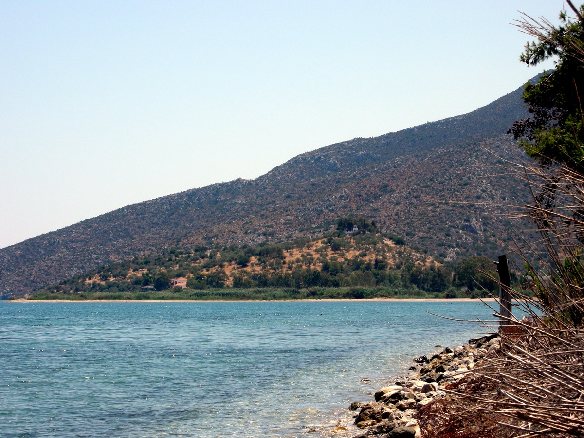 Nisí Ayíou Andréa
seen from the north - Photo: Jaap-Jan Flinterman, summer 2008
But
whatever it may have been, Nisí Ayíou Andréa is definitely worth a
visit: at the time of its foundation, in the Classical period, it must
have been the most important settlement in the Thyreátis, and there is
reason to believe that it still held this position in Late
Antiquity. Another argument in favour of a visit is that it is easily
accessible: in Áyios Andréas, take the exit to the Paralía
('beach'), keep to the right at the fork after the cemetery and before
the Vrasiátis riverbed
and you will easily reach the small port of Paralía Ayíou Andréa,
located at the foot of the hill. The photo above was taken more than a
kilometre north of the mouth of the Vrasiátis and shows the position of
the hill by the sea. The photo below shows a north-east view from the
hill to
the mouth of the Vrasiátis, near the port of Paralía Ayíou
Andréa, and the Argolic Gulf.
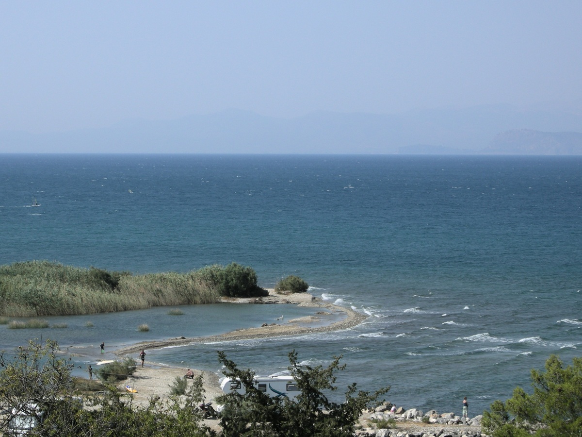 View from Nisí Ayíou
Andréa to the mouth of the Vrasiátis - Photo: Jaap-Jan Flinterman,
summer 2008
From
Nisí Ayíou Andréa you have a north-western view of the lower Vrasiátis
River, which flows through the southern part of the Ástros Plain (at
least when the river has not dried up, as in the photo below).
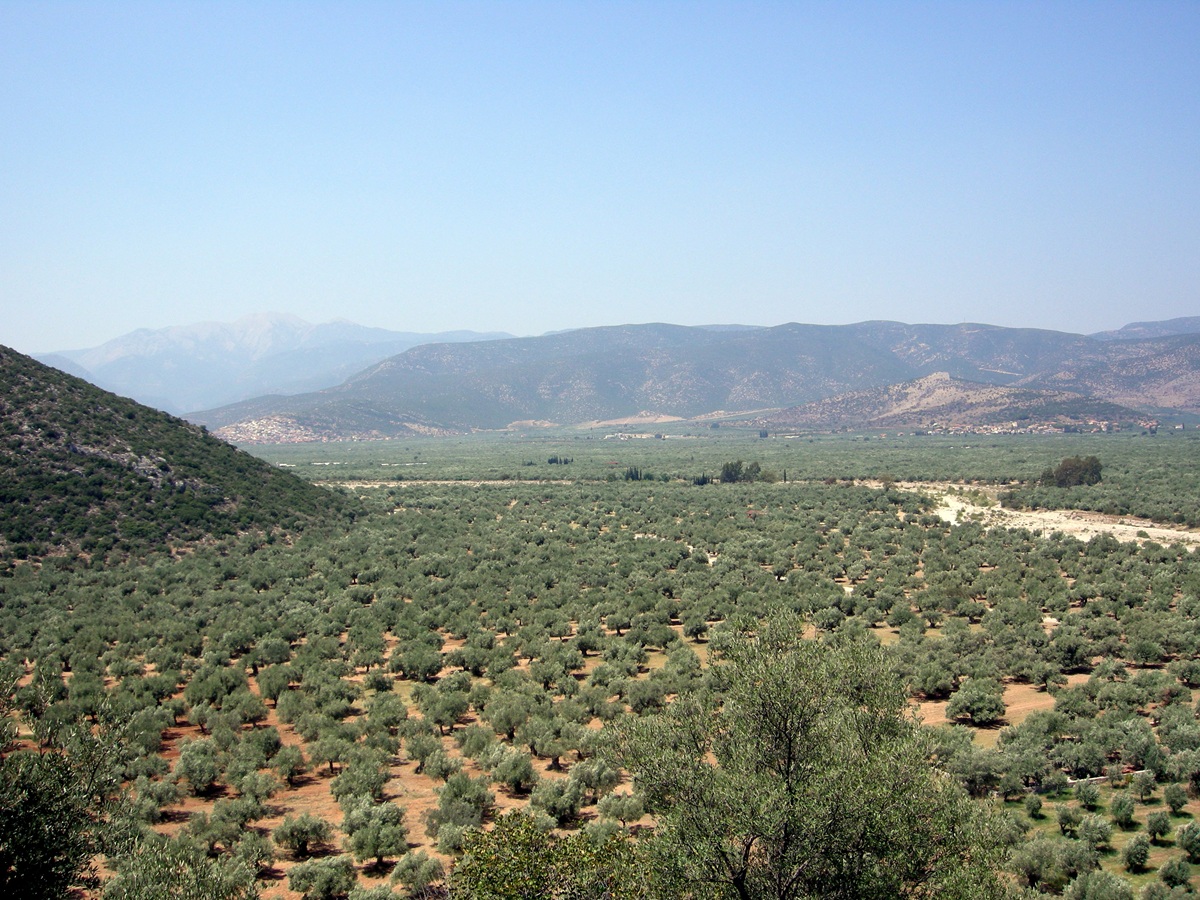 The lower Vrasiátis
river - Photo: Jaap-Jan Flinterman, summer 2010
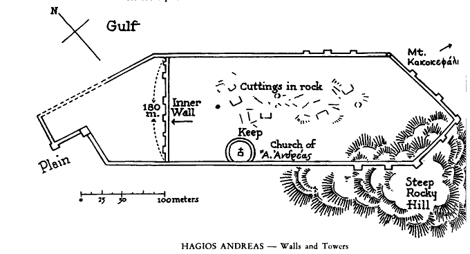
The somewhat schematic map of the site of Nisí Ayíou Andréa, below, is
taken from Israel Walker's Kynouria
(1936), 'the first study of the region illustrated with many
photographs and drawings'. A better map can be found in Goester (1993).
Goester also gives an illuminating description of the site. Even though
most of the curtains and towers are barely above ground level, it is
still possible to trace the enceinte.
The wall remains in the photo below
are remnants of what is referred to on the map above as the 'inner
wall', which separated the actual settlement from the seafront
buildings.
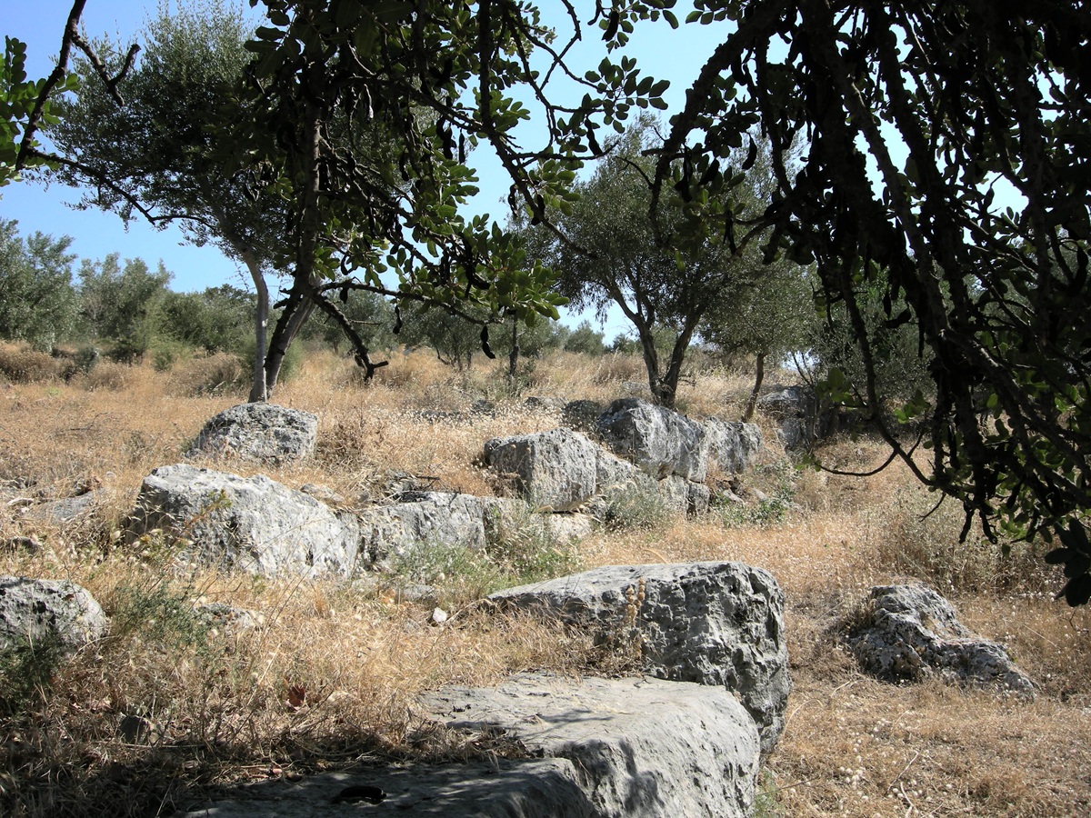 Nisí Ayíou Andréa,
'inner wall' - Photo: Jaap-Jan Flinterman, summer 2008
At
the top of the hill there is a small church surrounded by a garden of
pine trees. The gate in the enclosure is built on what was probably a
bastion of the settlement's 'acropolis': the highest part of the hill,
with a separate wall.
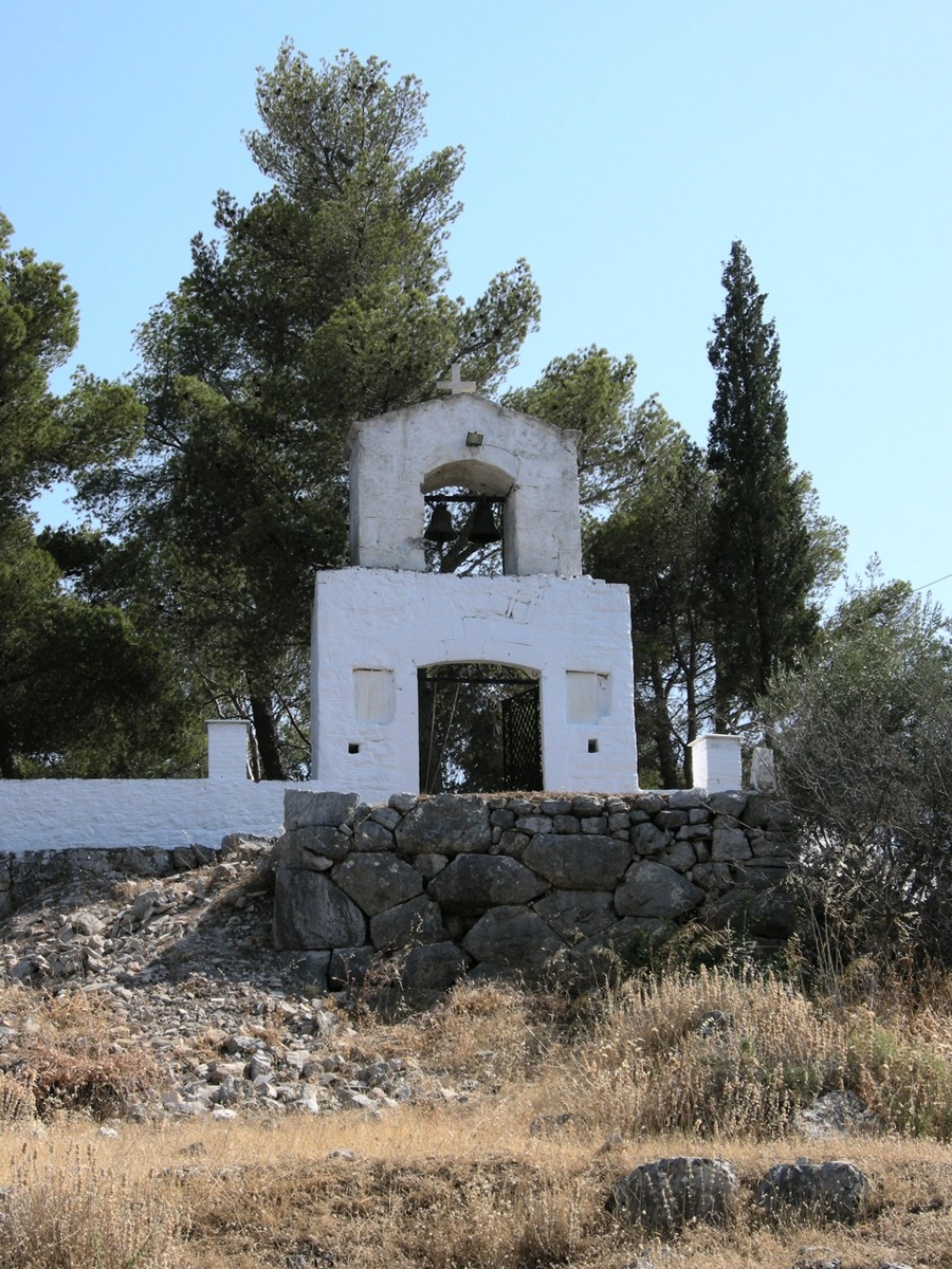 The gate to the
garden of pine trees - Photo: Jaap-Jan Flinterman, summer 2008
In
the western, landside section of the enceinte, south of the hilltop,
blocks have shifted (photo below). This may have been caused by
earthquakes.
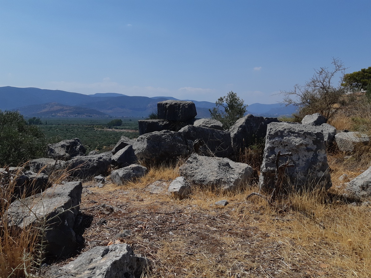 Western section of
the wall, south of the hilltop - Photo: Jaap-Jan Flinterman, summer 2024
The photo below
shows part of what remains of the north-western section of the
enceinte, the wall between the chapel/acropolis and the 'inner wall'.
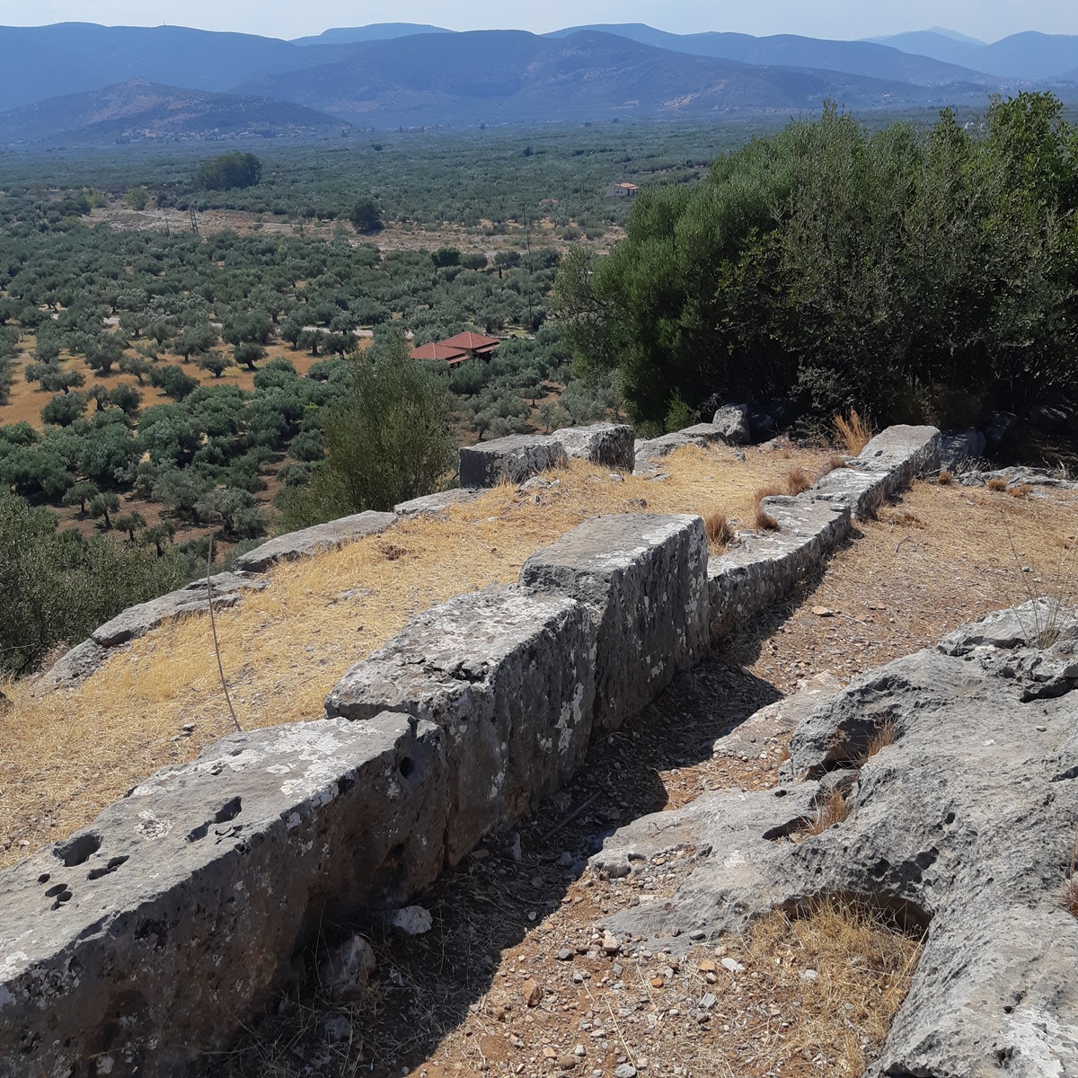 Nisí Ayíou Andréa,
enceinte between chapel/acropolis and 'inner wall' - Photo: Jaap-Jan
Flinterman, summer 2024
Descending
from the hill to the port of Áyios Andréas, there is a magnificent view
of the coast of North Kynouría, the ancient Thyreátis. In the
background is Mount Závitsa, which marks the border with the Argolid.
The distant hill jutting out into the sea is Nisí Paralíou Ástrous. The
nearby 'peninsula' is Cherronísi, our next destination. Between Nisí
Paralíou Ástrous and Cherronísi lies the Bay of Ástros, the ancient
Thyreatic Gulf.
 The coast of North
Kynouria from Nisí Ayíou Andréa - Photo: Jaap-Jan Flinterman, summer
2024
More photos of Nisí Ayíou Andréa can be found on a web page dedicated
to the site by Nigel Copage, here.
A few kilometres upstream (satellite photo),
insofar as the word 'upstream' can be applied to a river that is dry
for much of the year, are the ruins of an old (Ottoman-era?) bridge
over the
Vrasiátis: once an important link in a network of kalderímia (mule
tracks) that connected the towns and villages of the region.
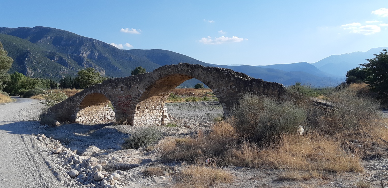 Ottoman-era (?) bridge
over the Vrasiátis - Photo: Jaap-Jan Flinterman, summer 2019
The
bridge is located where the modern road to Cherronísi (a hill
on the
coast about two kilometres north of Nisí Ayíou Andréa) crosses the
riverbed. Cherronísi means 'peninsula'. The photo below was taken from
Nisí Ayíou Andréa. In the foreground is the mouth of the Vrasiátis.
Cherronísi is the second headland, the low hill that juts out into the
sea. The origin of the name Cherronísi is obvious. To the layman's eye,
there is little to see on Cherronisi, but both
Faklaris and Goester mention evidence of human presence on the hill
from the Early Helladic to the Geometric period (i.e. from the late
fourth to the early first millennium BC).
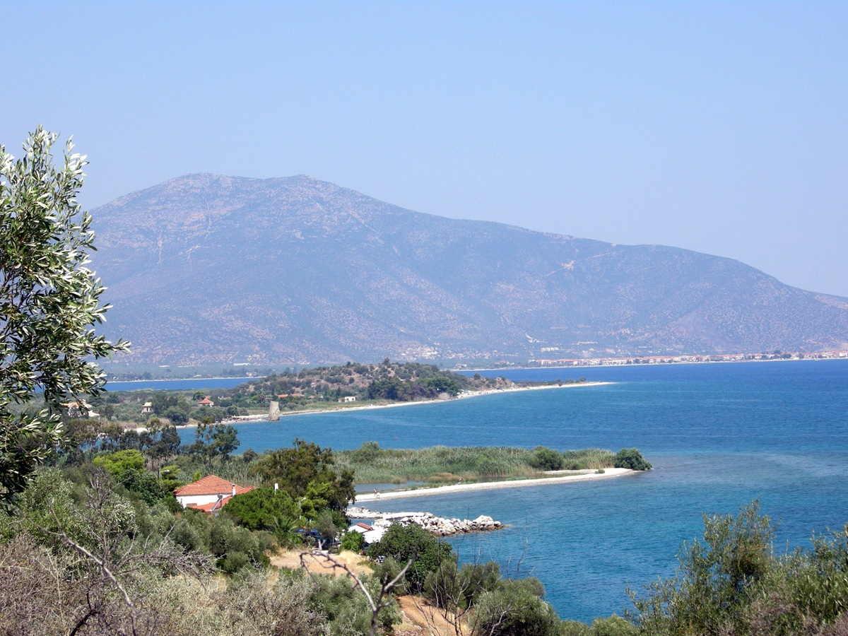 Cherronísi seen from
Nisí Ayíou Andréa - Photo: Jaap-Jan Flinterman, summer 2010
Cherronísi
marks the southern boundary of Ástros Bay. The photo below shows the
view across the bay from where the coast curves inland. In the
distance, the double hill on
which Parálio Ástros is built.
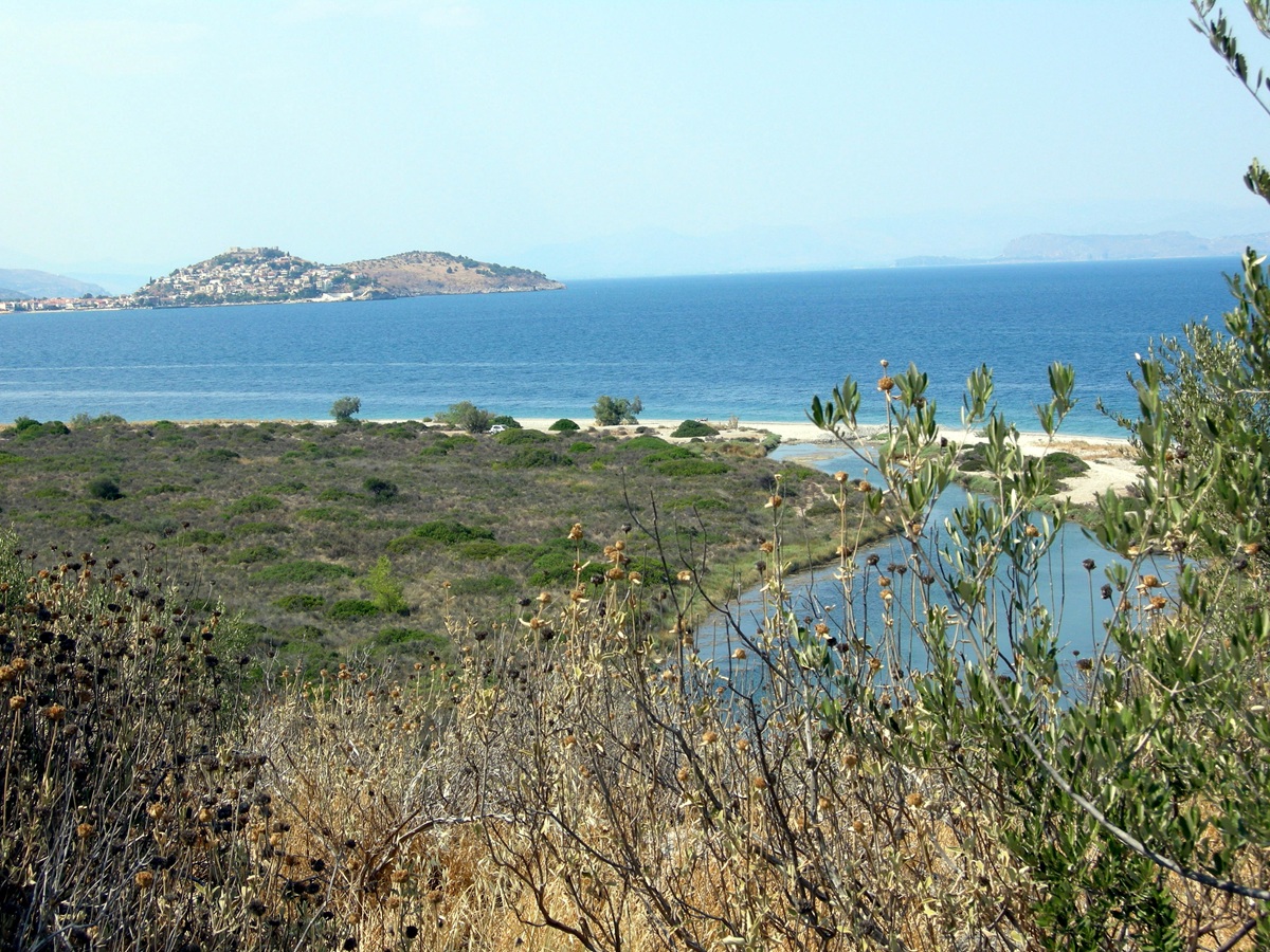 View of the Ástros
Bay from Cherronísi - Photo: Susanne Feiertag, summer 2013
Also from Cherronísi, now facing south-west, is the following photo of
the foothills of Mount Párnonas.
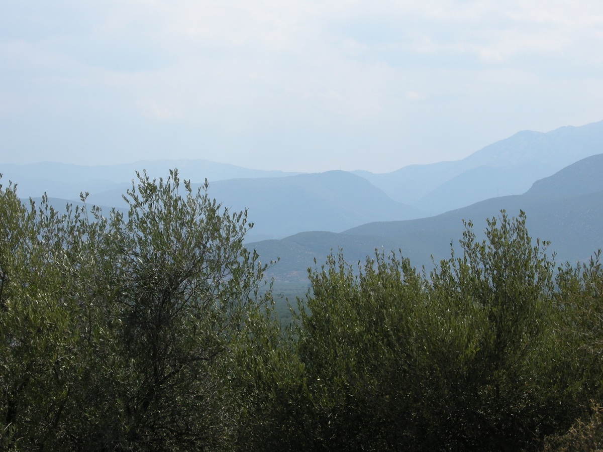 The foothills of
Mount Párnonas as seen from Cherronísi - Photo: Susanne Feiertag ,
summer 2013
Back
to the dilapidated bridge over the Vrasiátis. Obviously, this place has
a special charm for fans of Sergio Leone's westerns. In the background,
the central massif of the Párnonas.
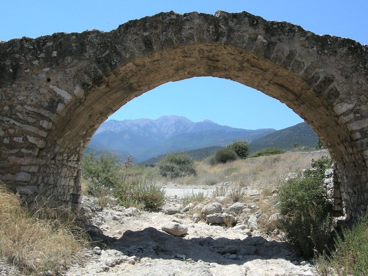 Dilapidated bridge
over the Vrasiátas; in the background Mount Párnonas - Photo: Jaap-Jan
Flinterman, summer 2011
If
you drive south from Áyios Andréas along the coastal road for about 20
kilometres, you will reach Tyrós. You will have crossed the border
between the two municipalities into which Kynouria is divided
(North and South Kynouria). This is the right time to point out that
both North and South Kynouria have nice looking tourist websites: Discover
Kynouria and Explore
South Kynouria respectively.
Sights
around Tyrós
On
a promontory to the south-east of Paralía Tyroú (satellite photo) lie the
remains of what was probably the fortified part, the
acropolis, of
an ancient settlement. On the northern side, a wall with a
semicircular and several square towers has been preserved for about 300
metres. The wall is 2.30 metres thick and up to 4 metres high in
places.
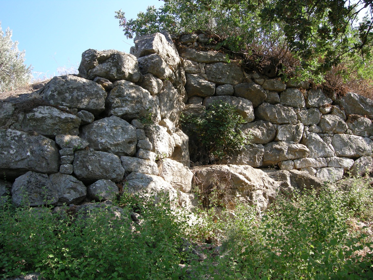
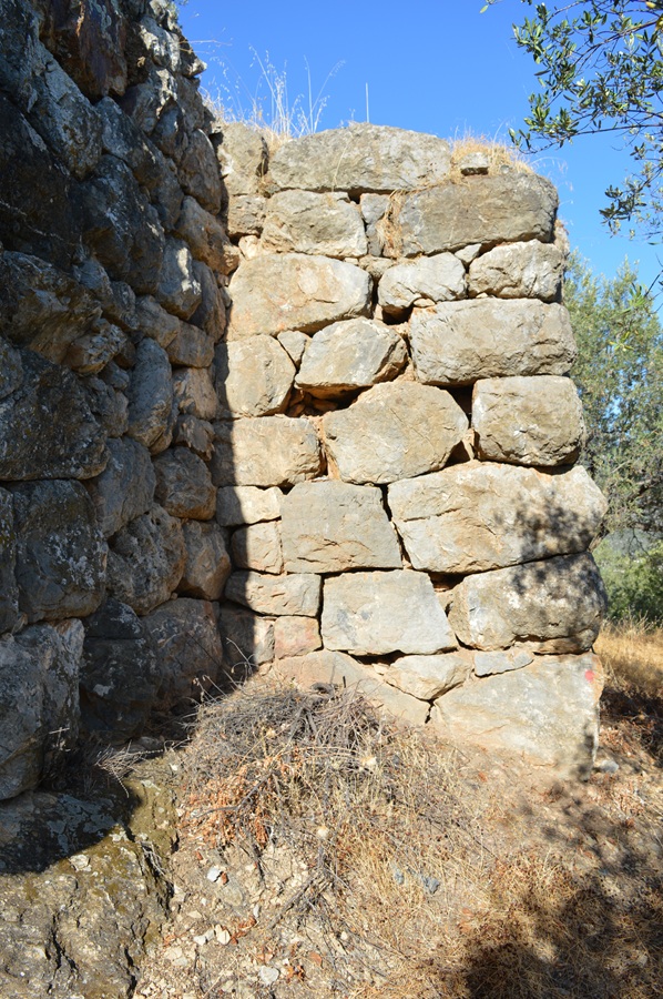 Towers in the enceinte
of ancient Týros - Photos: Jaap-Jan Flinterman, summer 2010 and
September 2022
This was undoubtedly the acropolis
of Týros (Τύρος), a settlement mentioned in
inscriptions from the 6th century (see
below) and the 3rd century BC
(Fouilles de Delphes
III i 68 = SIG (3) 407
which, strictly speaking, does not mention the toponym 'Týros', but the
plural ethnic label 'Tyrítai') and in the geographical lexicon (T 233
Billerbeck)
of Stephanus of Byzantium (6th century AD). Faklaris dates the
fortifications to the beginning of the 3rd century BC, and Guintrand
broadly agrees (around 300 BC). Guintrand suggests that the hill may
have been fortified after the reoccupation of the Thyreátis by Argos,
when Týros became the northernmost settlement on the eastern coast
under Spartan control. It was conquered by Argos in the 220s BC. Týros
flourished in the Hellenistic period, it survived into the
Roman era. As we have seen above, the ancient inhabitants of Týros
called themselves Tyrítai (Τυρῖται).
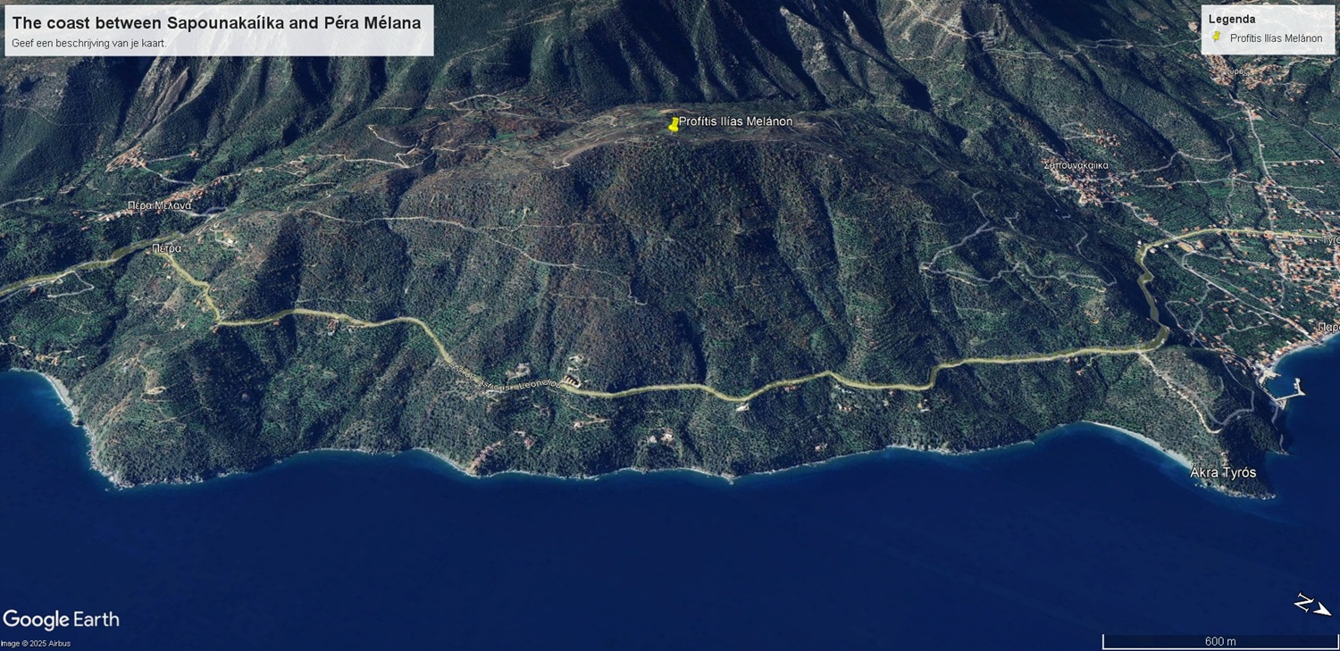 Profítis Ilías
Melánon
(Open link in Google
Earth)
On
a hill south of Tyrós, Profítis Ilías Melánon, (Προφήτης Ηλίας
Μελάνων), at an altitude of 564 metres, between Sapounakaíika and
Péra Mélana, lie the meagre remains of a sanctuary of Apollo Tyrítas
(Απόλλων Τυρίτας). Inscriptions on votive gifts confirm the identity of
the god worshipped
here. The most economical explanation for the surname 'Tyrítas' seems
to be that it is derived from the name of the inhabitants of the
settlement: 'Apollo of Tyros'. The
god could also be designated as ό ἐν
Τύρῳ Ἀπέλλων, 'Apollo in Tyros', witness an inscription on a
6th-century votive gift (Lanérès
& Grigorakakis 2017).
Architectural
fragments of a small temple dating from the late seventh or early sixth
century
BC were found during excavations in the early 20th century. The
location of the temple could not
be determined with certainty, but it was probably below the chapel that
now stands on the top of the hill.
 The chapel on the
Profítis Iílas Melanon - Photo: Jaap-Jan Flinterman, summer 2010
A
few metres north of the chapel the traces of a square altar were found
(photo below), and to the north-east a retaining wall, both dating from
the 4th
century BC. The votive gifts to the god found by the excavators date
mainly from the Archaic period. There was a cult site here from the 8th
or 7th to the 4th century BC, and the sanctuary flourished from the
late 7th
to the
5th century. By the time the altar and retaining wall were built, the
site's heyday had already passed. More photos of this hilltop and
some of the finds
now in the National Archaeological Museum in Athens and the
Archaeological Museum of Ástros can be found on the weblog
Leonídio-Poúlithra: click here.
 Remains of an altar
to Apollo Tyrítas - Photo: Jaap-Jan Flinterman, summer 2010
Pictured
below is one of the votive gifts found at the sanctuary, now on display
at the Archaeological Museum of Ástros: a bronze libation jug in the
shape of a horse. It dates from the early fifth century BC.
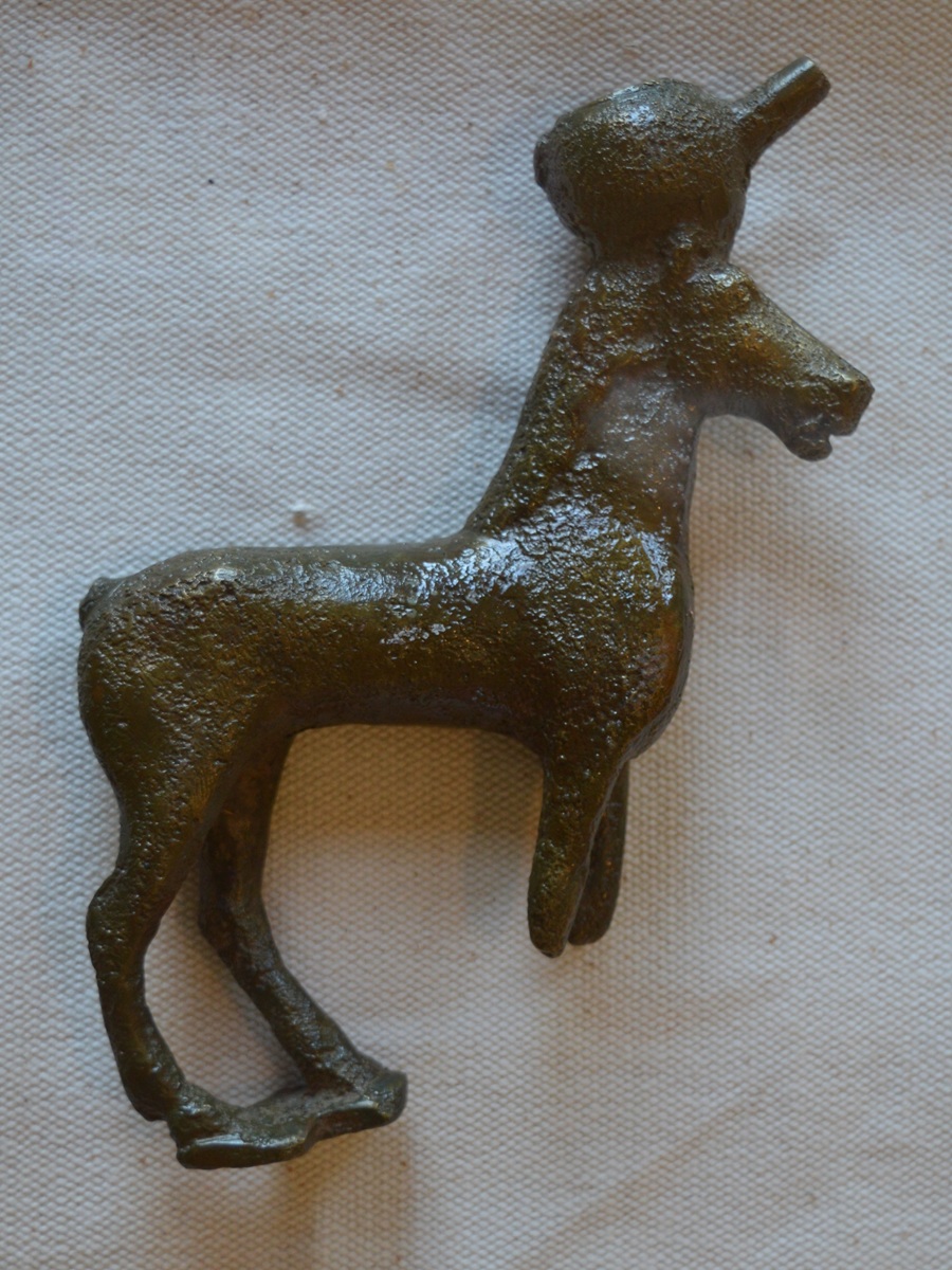 Votive gift for
Apollo Tyrítas - Photo: Jaap-Jan Flinterman, summer 2019 (Museum Astros)
The
locations of the ancient settlement (centre left, by the sea, on Kástro
hill) and the religious centre of the community, the sanctuary of
Apollo Tyrítas (on Profítis Ilías, the higher hill on the right) are
shown in the following photo, taken from the
north-west.
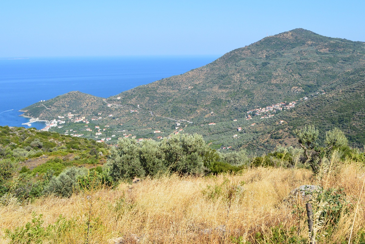 Kastro Tyroú and
Profítis Ilías - Photo: Jaap-Jan Flinterman, summer 2015
As
we have seen, the cult of Apollo Tyrítas was already in decline by
the time the settlement was fortified. It is noteworthy that the cult's
lifespan, from the 7th to the 4th century BC, roughly
coincided
with Spartan control of the area. 'Laconian
influence on material culture becomes apparent at the sanctuary (...)
by the late seventh and early sixth century' (Pavlidis 2018).
The cult may have enjoyed
Spartan patronage and Spartan support. In the 4th century, times had
changed: the Spartans were forced to pay more attention
to military
defence than to the cultivation of contacts with the
communities living on their territory through the patronage of
religious cults. And by the end of the 3rd century BC, they had lost
Týros to the Argives.
Beyond
the coastal strip of Tyrós lies the Palaióchora
plateau. To the south,
it merges into the Vaskína
plateau. Further south are the Dáfnonas
gorge and Leonídio.
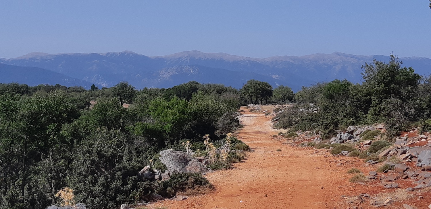 The Vaskína plateau -
Photo: Jaap-Jan Flinterman, September 2023
In summer, the plateaus bear a striking resemblance
to an African savannah (photo below). Pausanias (Description of Greece
3.24.4) records that the town of Prasiaí, on the coast near Leonídio,
was originally called Oreiátai. Modern literature on the region tends
to take the alleged name change with a heavy grain of salt. Faklaris
suggests that the name Oreiátai referred to a number of small
settlements on the Vaskína and Palaióchora plateaus, which formed the
hinterland of Prasiaí.
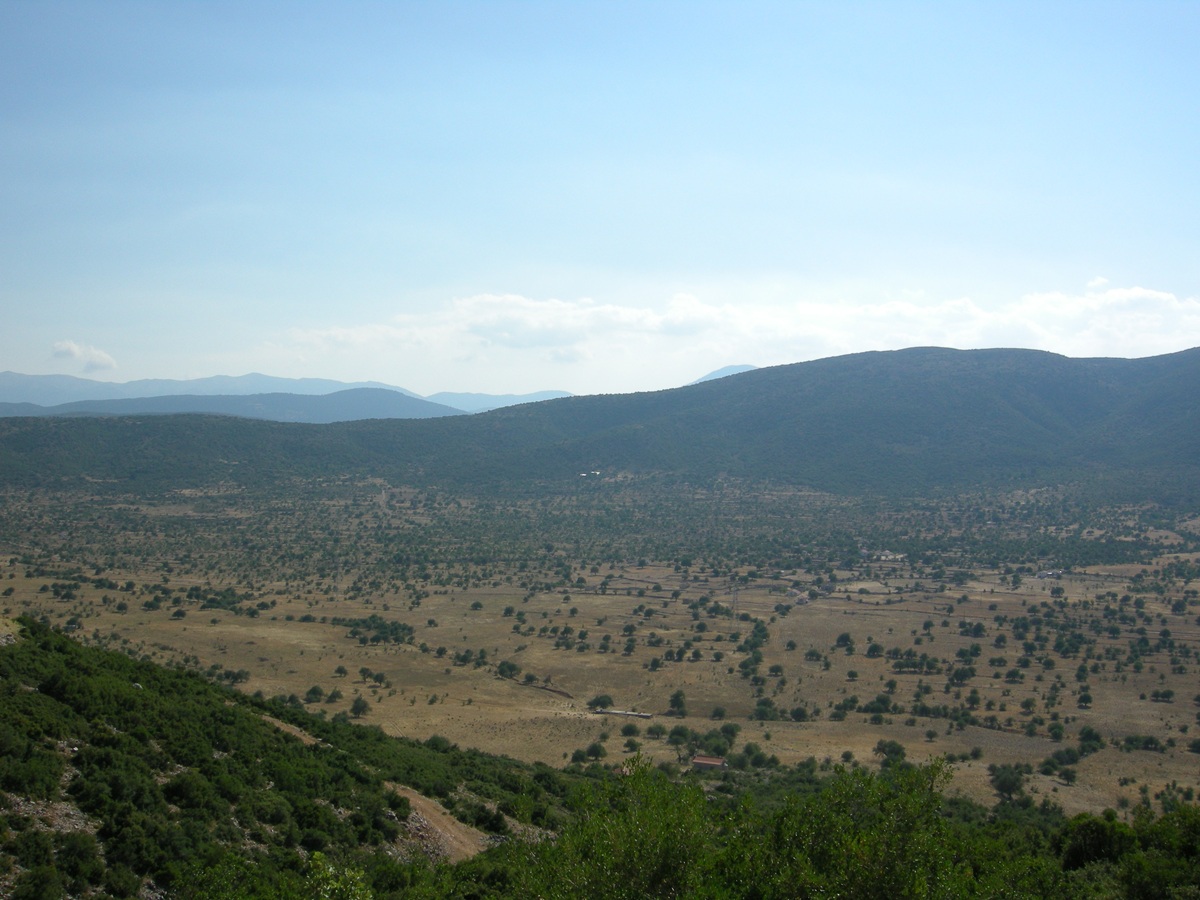 The Palaióchora
plateau - Photo: Jaap-Jan Flinterman, summer 2008
The
plateaus were traditionally an area where small livestock were kept. In
the photo below an old sheepfold.
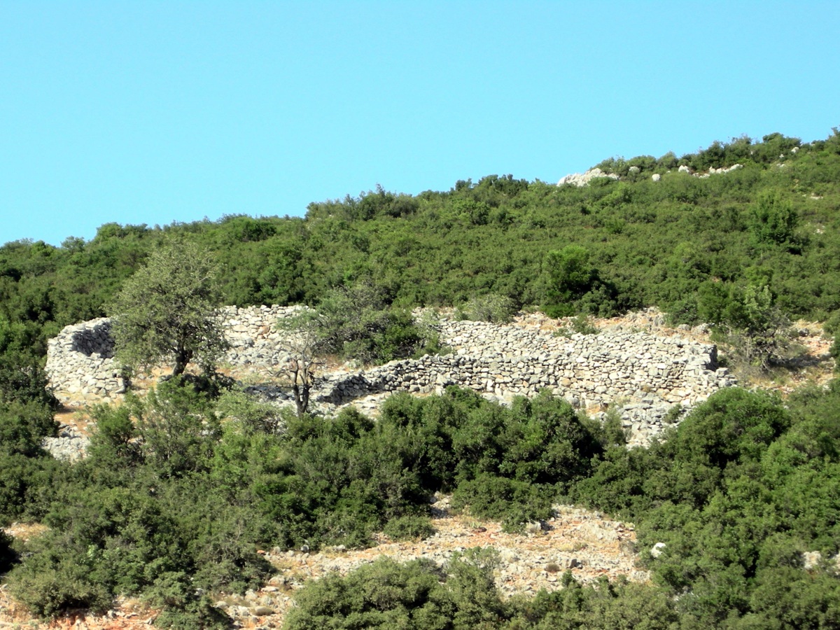 Sheepfold on the
Palióchora plateau - Photo: Jaap-Jan Flinterman, summer 2011
You can still regularly see flocks of sheep and goats today.
 Small livestock,
plateau above Tyrós - Photo: Jaap-Jan Flinterman, summer 2011
However,
another agricultural activity that was carried out on the plateau above
Tyrós until a few generations ago and which made the people of the area
practically self-sufficient, the cultivation of cereals, has almost
disappeared in recent decades. Threshing floors have fallen into disuse.
 Threshing floor in
disuse - Photo: Jaap-Jan Flinterman, September 2022
There
is evidence of a substantial human presence on the Palaióchora and
Vaskína plateaus during the Late Bronze Age. This evidence comes mainly
in the form of Mycenaean graves. Such graves have
been found near Vaskína, for example. In 2011, a Myceneaean cemetery
with six tombs dating from the 14th and 13th centuries BC was
discovered and excavated. The tombs were described by the excavators as
'built cist-tombs with corbelled walls and a roof covered by stone
slabs'. Together they contained the remains of 17 people (Grigorakakis
2016; Tritsaroli,
Grigorakakis & Richards 2023).
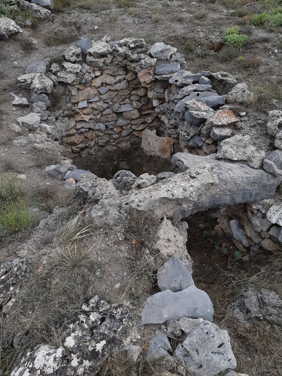
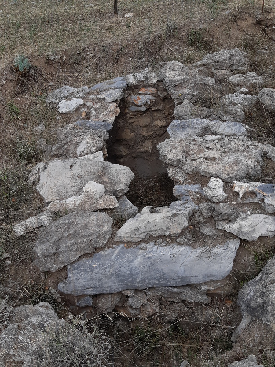 Mycenaean graves near
Vaskína - Photos: Jaap-Jan Flinterman, September 2023
From the edge of the plateau above Tyrós, the view is magnificent: deep
below you, Paralía Tyroú and the Argolic
Gulf, and (among other islands) Spétses and Ýdra.
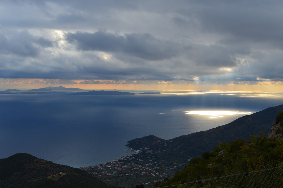 View from the edge of
the plateau above Tyrós - Photo: Jaap-Jan Flinterman, September 2022
Sights
in the southern Párnonas mountains and in Leonídio
One of the villages in
the southern Párnonas (satellite photo) is Áyios Vasíleios; the
idyllic platía below. See more photos here, on the weblog
Leonídio-Poúlithra. At
Áyios Vasíleios, according to Woodhouse
(The Struggle for Greece),
the strongest DSE brigade in the Peloponnese was eliminated on 22
January 1949 (p. 261): 'A major battle at Agios Vasileios in Kynouria
on 22 January destroyed the strongest brigade of the Democratic Army.'
The DSE (Dimokratikós
Stratós Elládas,
the Democratic Army of Greece) was the army of the communist side in
the civil war. A few weeks after the battle of Áyios Vasíleios, the
government army was in complete control of the situation in the
Peloponnese.
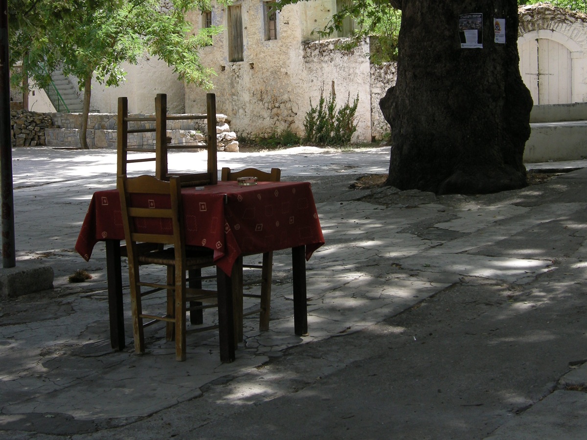 Áyios Vasíleios,
platía - Photo: Susanne Feiertag, summer 2008
What
happened here in January 1949? Woodhouse's description ('... destroyed
the strongest brigade of the Democratic Army') is probably not without
some exaggeration. That the DSE ceased to exist as a significant
military factor south of the Corinthian isthmus in the following weeks
was mainly due to the build-up of overwhelming numerical and
qualitative superiority by the government army throughout the
Peloponnese, as well as the arrest and imprisonment of some
4,500 people suspected of sympathising with the DSE at
the turn of the year. The events in southern Kynouría were a
consequence of these developments, not a cause of them. However, on 21
and 22 January 1949, communist partisans in the region did suffer heavy
losses. Information on the events can be found in two Greek-language
articles
by Kóstas Papadoyiánnis, published on the website www.leonidion.gr in
early February 2011. The following brief summary is based on these
articles. Part of the same story, but now told from the communist side,
can be found in the weblog Kokkinos
Fakelos of 4 February 2019, also
in Greek.
On
the night of 20-21 January, units of the 55th brigade of the DSE
launched an attack on Leonídio, hoping to capture supplies that would
alleviate the partisans' lack of food, clothing and ammunition. The
government army, the gendarmerie and members of a civilian militia put
up stiff resistance, and although the partisans eventually managed to
break through, so much time had passed that they were forced to
withdraw before they could take full advantage of their brief presence
in the town. The partisans returned to their bases in the southern
Párnonas, leaving behind eight dead and one or two comrades who were
shot after being captured. Of the wounded they took with them on their
retreat, at least one died of her wounds. This was the battle of
Leonídio.
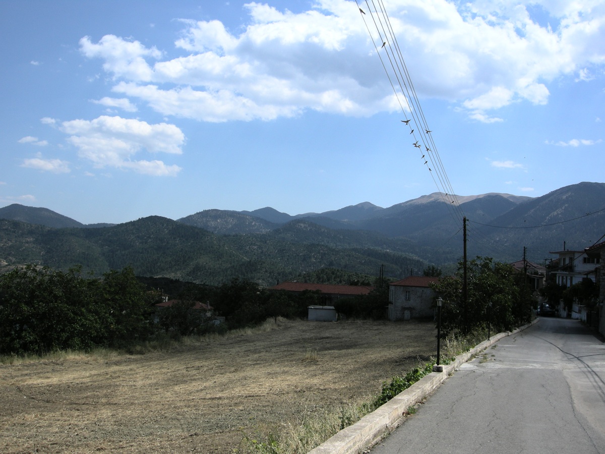 Áyios Vasíleios -
Photo: Jaap-Jan Flinterman, summer 2013
The
first battalion of the 55th brigade of the DSE, consisting of about 250
partisans, retreated to Áyios Vasíleios (pictured above) and spent the
night of 21-22 January there. The exhausted troops did not take the
usual precautions: no sentries were posted. Following news of the
attack on Leonídio, 1,200 government army commandos had set off from
Trípoli and Spárti to help defend the town. By the time they reached
Vamvakoú, a village on the western slope of Mount Párnonas, the attack
on Leonídio was over. The commandos were now ordered to march through
the mountains to Áyios Vasíleios and surround the village. At dawn on
22 January, the attack on the unsuspecting partisans began. Kóstas
Papadoyiánnis, the author of the article from which I have taken these
figures, speaks of 100 partisans killed, 35 wounded and 60 taken
prisoner; Stratís Kouniás,
a citizen of
Leonídio who responded to the article, puts the figure at around 70
killed. According to Papadoyiánnis, the government forces suffered six
deaths and 15 wounded. During the day, the commandos moved towards
Leonídio, taking with them their own dead and wounded, their prisoners
of war and also civilians; the village was presumably evacuated by
force. This was the battle of Áyios Vasíleios. All in all, the first
battalion of the 55th brigade of the DSE had lost about two thirds of
its strength in a few hours. A village on which the partisans had been
able to fall back had been depopulated. The 55th brigade consisted of
four battalions with a total of 850 partisans, so there was no question
(yet) of the total annihilation of which Woodhouse speaks: the
government army commandos therefore left control of the battlefield to
their opponents (for the time being). But the heavy losses inflicted on
the partisans in an area where they felt safe will not have helped the
morale of the DSE in the southern Peloponnese. The unfortunate
commander of the first battalion was blamed for the massacre of his men
by the commandos, court-martialled and shot.
An article by Stratís
Kouniás of 11 November 2010 on the same website (www.leonidion.gr)
paints a
picture of the last days of the civil war in southern Kynouría. The
article is about the private power station that supplied electricity to
Leonídio from 1925 to 1967. In October 1948, four partisans attacked
the plant, and at the end of the article Kouniás describes what
happened to them. From April 1949, the partisans still active in the
region (and elsewhere in the Peloponnese) operated in small groups;
this was the only way to avoid the authorities and to get (barely)
enough food. The
Descent of the Nine (1963), a novella by
Thanássis Valtinós (1931-2024) set in North Kynouría, paints a
haunting picture of the futile struggle for survival of such a small
group. The 3rd, Peloponnesian, division of the DSE, to which the 55th
brigade belonged, was nicknamed 'The Division of the Dead' (I merarchía ton nekrón)
in the historiography of the civil war. During 1949, the remaining
partisans were systematically hunted down and
liquidated;
the corpses of the commanders and the heads of the 'bandits' were
displayed in towns such as Trípoli, Kalamáta and Spárti. Of the four
perpetrators of the attack on the Leonídio power station, two survived
the civil war. One was captured at Áyios Vasíleios in January 1949 and
the other hid until 1950 before surrendering. Of the other two, one was
killed in an ambush in May 1949, while the other was captured and
executed in August 1950 for allegedly trying to escape. The leaders of
the remaining partisans in the Párnonas region - Vangélis Rongkákos,
Yiánnis
Phoúrkas and Níkos Látsis - were killed in August 1949, as described in
another article on www.leonidion.gr by Strátis
Kouniás (18 October 2014).
Rongkákos and Phoúrkas were killed in the area between Paliochóri and
Platanáki, in the southern Párnonas; Látsis
was captured there and taken to
Trípoli, but was killed by his guards on the way, between Kosmás and
Yeráki.
At
Leonídio there is a monument to fallen government soldiers (pictured
below): on 21 January 1949, six soldiers and four civilians were killed
in the battle of Leonídio; on 22 January 1949, six were killed in the
battle of Áyios Vasíleios. Passers-by are urged to bow the knee
'to the immortals'.
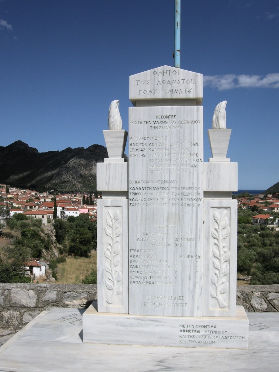 Monument for the
battle of Leonídio - Photo: Jaap-Jan Flinterman, summer 2008
In
Áyios Vasíleios itself, there are several monuments to the other side
of the conflict. Those approaching the village on the only access road
pass a monument (photo below) erected in 1982 by Vangélis Latsis,
kapetánios of the second company of the eighth regiment of ELAS of
Lakonía and Kynouría, in memory of the residents of Áyios Vasíleios who
died fighting the Italian and German occupiers in the ranks of EAM,
ELAS and EPON in the years 1940-1944. The Ethnikó Apeleftherotikó Métopo
(EAM), the 'National Liberation Front', was the communist-led
resistance organisation during the second world war. ELAS stands for Ellinikós Laikós
Apeleftherotikós Stratós ('Greek People's Liberation
Army', the military arm of the EAM), EPON for Eniaía Panelladiki Orgánosi Néon
('United Panhellenic Organisation of Youth', the youth wing of the
EAM). The column also bears the names of soldiers who died on the
Albanian front in the war against Mussolini's Italy in the autumn and
winter of 1940/1, before the EAM was founded. And the lower part of the
monument is dedicated to the memory of the andartes
(partisans) of the DSE who fell on the 'field of honour' on 22 January
1949 in battle with the LOK, the Lóchoi
Oreinón Katadroméon
(mountain commandos). In this part of the memorial there are about 50
names of partisans from different places in Kynouría and Lakonía, such
as Aráchova (Karyés), Brontamás, Kastánia and Levétsova (Krokeés).
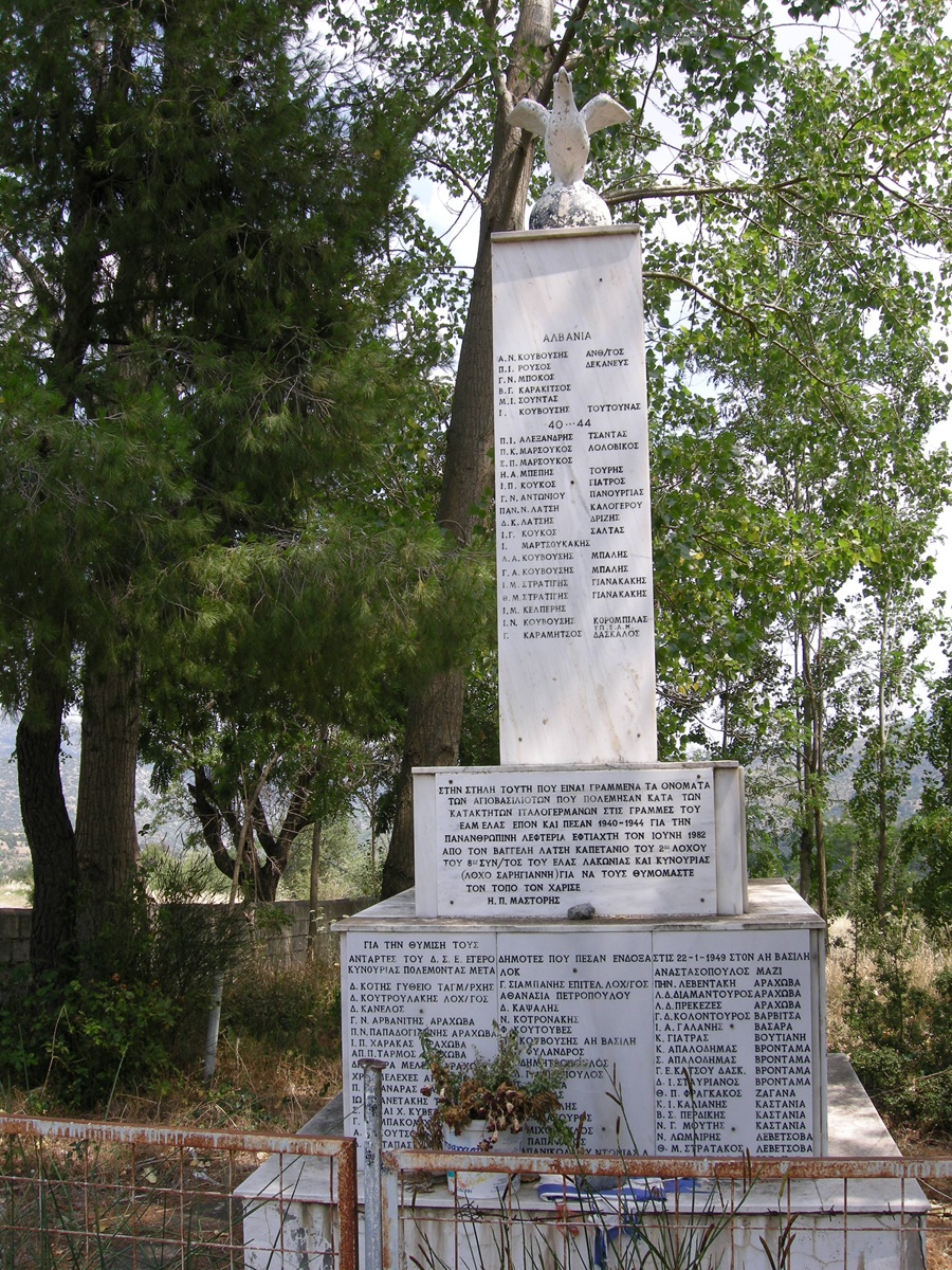 Monument along the
access road to Áyios Vasíleios - Photo: Jaap-Jan Flinterman, summer 2010
The
second company of the eighth regiment of the ELAS of Lakonia and
Kynouria is also referred to on the monument as the 'Sarriyiánnis
Company'. Sarriyiánnis
was the partisan who led the ambush
at Kosmás
in July 1943, which cost the Italian governor of Trípoli his life. He
went on to command the company named after him. In March 1949, during
the civil war, he was killed in the northern Peloponnese; at that time
he had commanded the 22nd brigade, one of the two brigades of the DSE
in the Peloponnese, since November 1948.
Near the platía of
Áyios Vasíleios is a memorial stone erected by the village 'to the
fighters of the national resistance and the fallen in the civil war'
(photo below). The term 'national resistance' (ethnikí andístasi)
refers to the 'national liberation front', the EAM. The use of the term
'civil war' (emphýlios
[polemos])
on an official monument represents a break with official language until
around 1980, before which the conflict was generally referred to by the
authorities as andisymmoriakós
pólemos,
the 'war against the gangs'. Through its iconography, the monument
evokes the continuity between the armed resistance of the EAM in the
second world war and the struggle of the communist partisans during the
civil war, but it tries to avoid offence by commemorating all the
victims of the civil war.
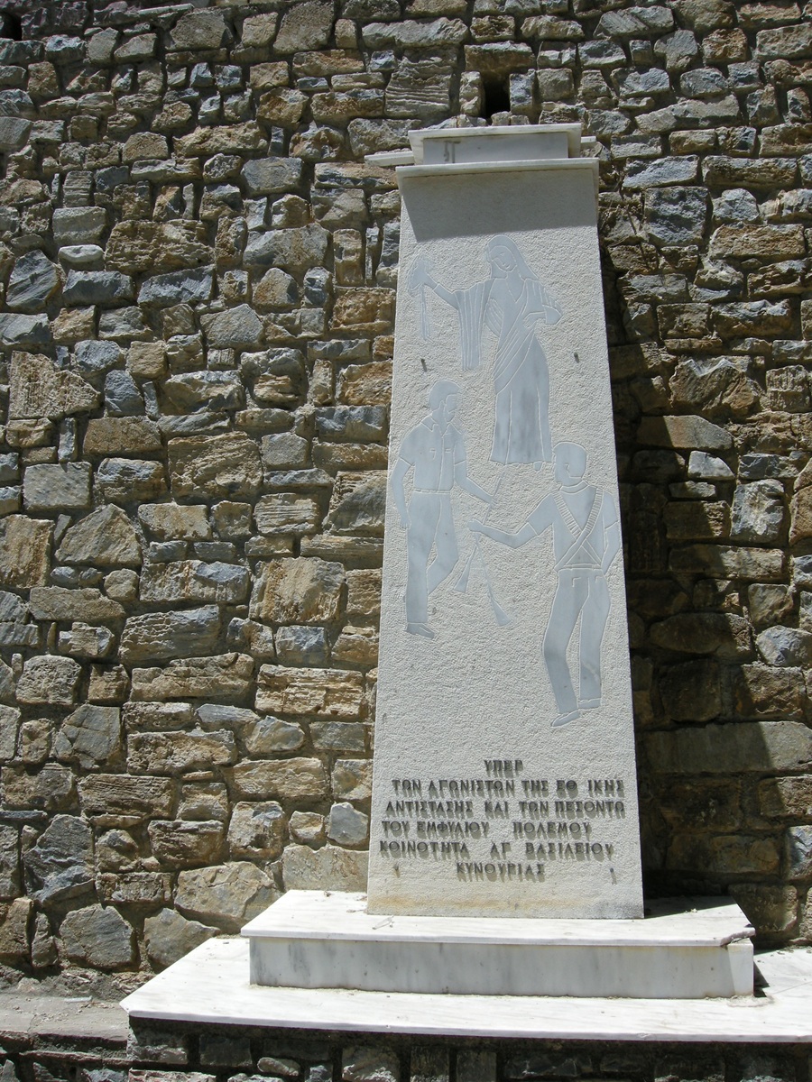 Monument to the
fighters of the national resistance and the fallen in the civil war -
Photo:
Jaap-Jan Flinterman, summer 2008
The
monument below also stands in the centre of the village of Áyios
Vasíleios. It was erected not by the village but by the Arcadian branch
of the Panellínia Énosi
Agonistón tís Ethnikís Andístasis,
the Panhellenic Union of Fighters of the National Resistance (PEAEA).
The lettering is therefore more robust and the text firmer than on the
monument above: 'Honour and glory to the heroic fighters of EAM-ELAS,
EPON and the Democratic Army of Greece'. The concentration of EAM, ELAS
and DSE monuments in Áyios Vasíleios is no coincidence. Many villagers
still identify with the choices their parents and grandparents made in
the 1940s: in the January 2015 elections (the last for which I had
access to separate data on the village's results) the Communist Party
(KKE) won 22 of the 63 votes cast, almost 35%, making it the largest
party in the village. By comparison, the KKE won 5.5% of the vote in
Greece as a whole, and less than 5% in South Kynouría.
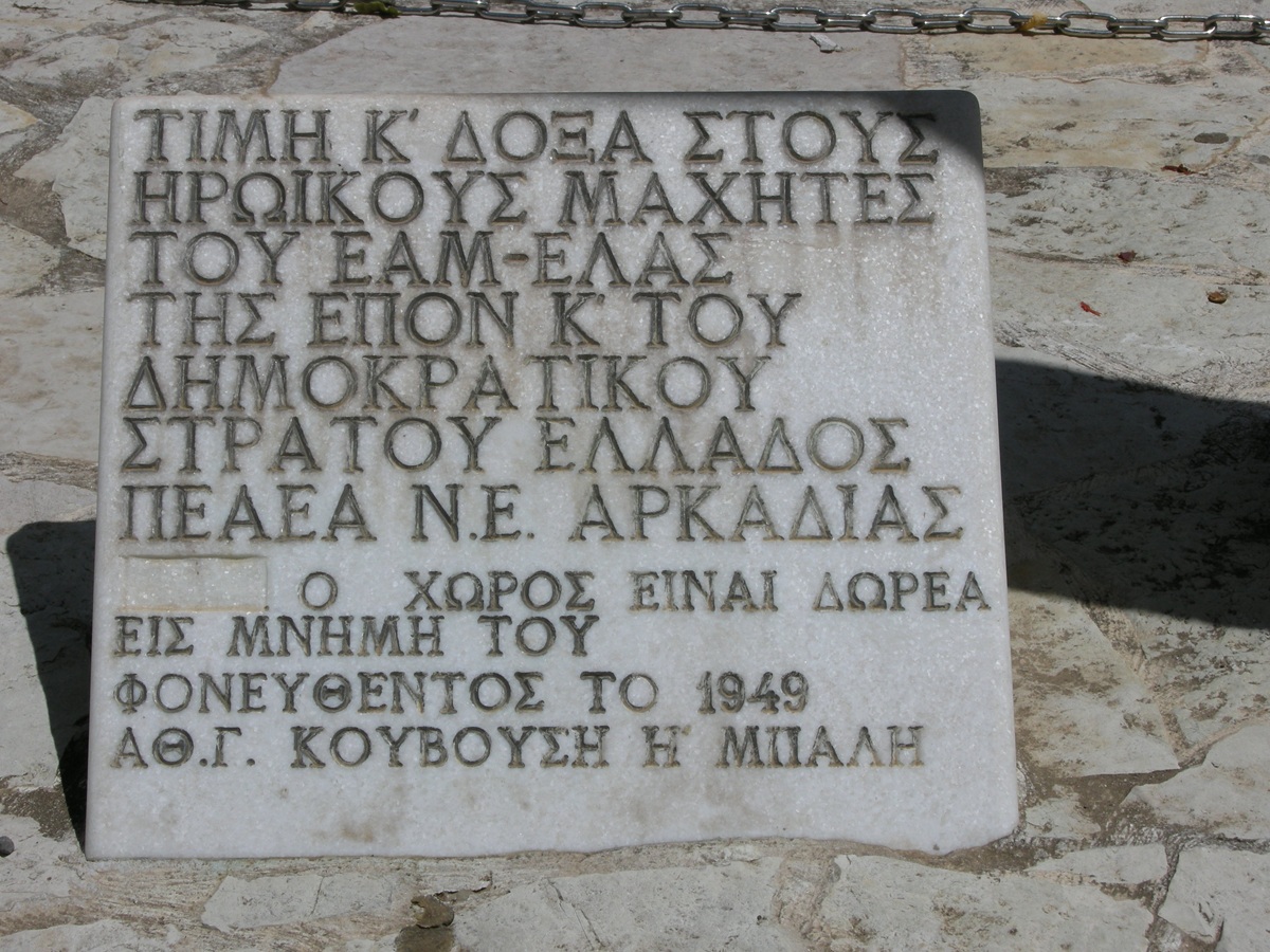 Áyios Vasíleios,
monument to EAM-ELAS, EPON, and DSE - Photo: Jaap-Jan Flinterman,
summer 2008
As
an outsider, it is perhaps best to keep a discreet
silence about a civil war. As early as 1943-1944, the Peloponnese
descended
into armed conflict between the communist-led armed resistance to the
occupation and
those who resented the often ruthless exercise of power by the EAM and
had no qualms about
collaborating with the Germans in their fight against it. In December
1944,
after the end of the occupation, EAM-ELAS clashed with government
forces and
the British army in Athens and was defeated. ELAS was disarmed. In
1945-1946, anti-communist death squads bore the main responsibility for
the continuation of the civil strife. Former ELAS partisans fled to the
mountains, many of them to Párnonas. From the summer of 1946,
with the approval of the KKE leadership, they began to fight back. They
formed
the nucleus of the DSE in the Peloponnese. We have already seen how it
all ended.
Anyone interested in the impressions
of a committed outsider at that time would still do well to read The
Flight
of Ikaros. Travels in Greece during a Civil War
(1959) by Kevin Andrews
(1924-1989). Andrews travelled the Peloponnese between 1948 and 1951 to
study medieval castles. The result was a scholarly monograph, Castles
of the
Morea (1953; revised edition 2006), and The Flight
of Ikaros, in
which Andrews recorded his impressions of his travels. In the preface
to the
1983 Penguin edition, he described the book as 'an outsider's abrupt
and
startled experience of a country in civil war and the beginning of an
aftermath
that it hasn't yet seen the end of'.
For
a powerful account of the effects of
war, occupation and civil war on a Greek village, visit the website
of the
village of Karítsa, in Lakonía, on the south-western slope of
the Párnonas
(satellite photo). This
site contains a number of bilingual
texts
(Greek-English). Much of what has been collected under this heading is
best
described as 'oral history': even if not all the details are
verifiable, the
overall impression is historically valuable. For the second world war
and its
aftermath, the most interesting texts are 'Black New Year' and 'The
Life and
Times of Diamantis Stylianou Hagias'. Karítsa, incidentally, was the
village from which the parents of Dimítrios
Karytsiótis moved to Áyios Ioánnis in the 18th century.
About
two kilometres south of Áyios Vasíleios is a hill marked by a medieval,
probably Frankish, fortified tower (pictured below). The
place is known
locally as Kástro. The website Greek
Castles has an informative page about it, here.
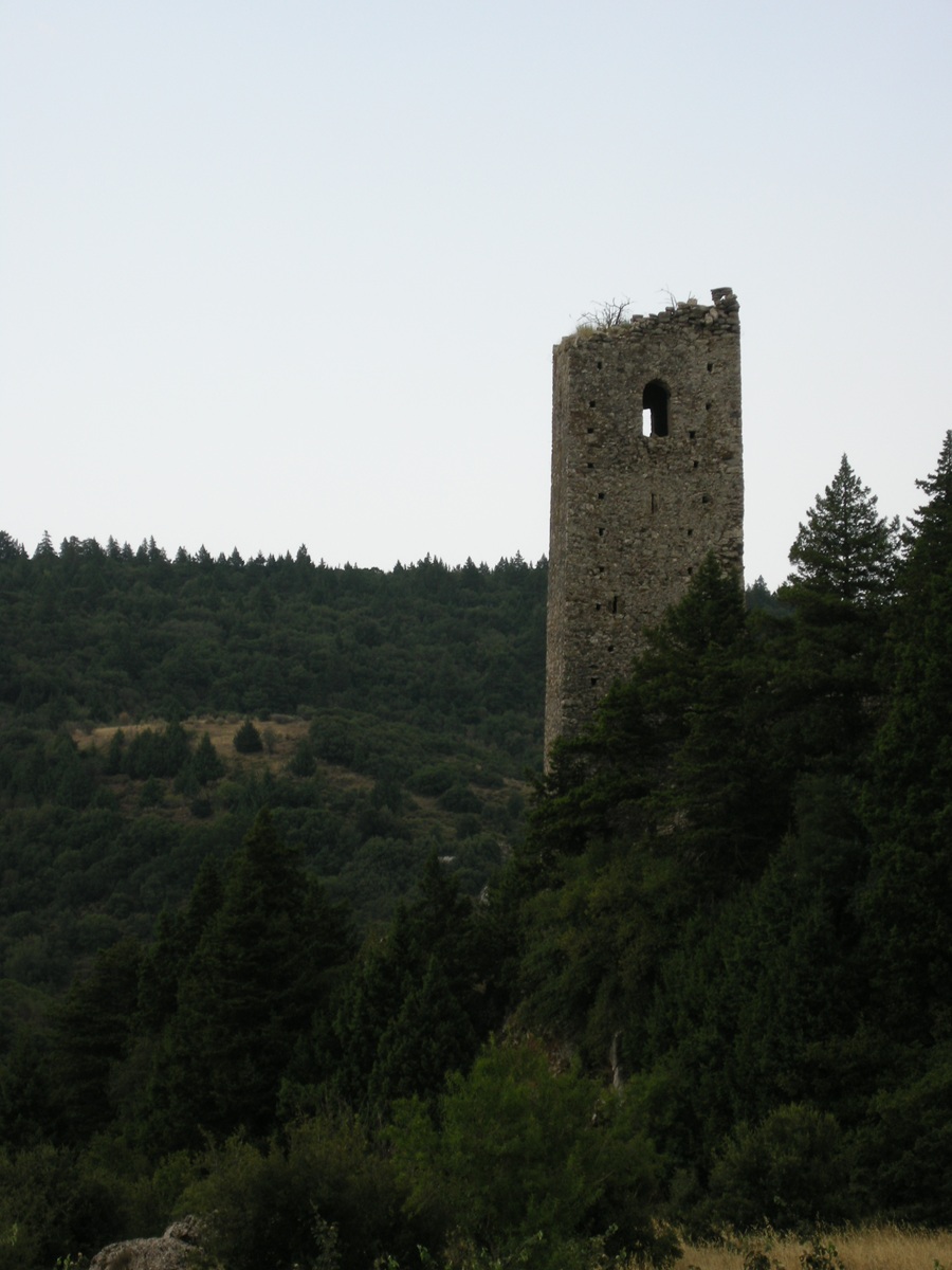 Medieval tower near
Áyios Vasíleios - Photo: Jaap-Jan Flinterman, summer 2010
Around
the top of the hill, the remains of an ancient (?) wall can be seen
(photo below). Most scholars agree that this was the site of
ancient Glympeís,
a village fought over several times during the social
war
(220-217 BC). In addition to Polybius (4.36 and 5.20), the place is
also
referred to by Pausanias, who mentions a village called
Glyppía (Description of
Greece
3.22.8). The ancient name has survived to the present day: Faklaris
reports that Áyios Vasíleios is called Lýmbia by the inhabitants of the
area, and until recently the name Lýmbia or Lymbochória was also used
to refer to the neighbouring villages of Platanáki and Palaiochóri. At
the time of the Greek war of independence, the name Lympochória would
have included Kosmás and even Yeráki.
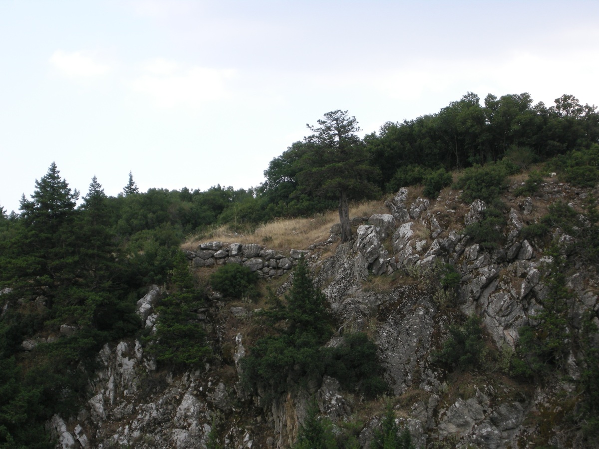 Kástro (Glýmpeis) -
Remains of ancient (?) wall - Photo: Jaap-Jan Flinterman, summer 2010
North
of the road from Palaiochóri to Áyios Vasíleios is a modest monastery
dedicated to the archangels Michael and Gabriel: Moní Ayíon Taxiarchón Mourás.
It was abandoned in 1834. The monastery church has been preserved; the
other
buildings were in ruins at the time of my visit, in 2011.
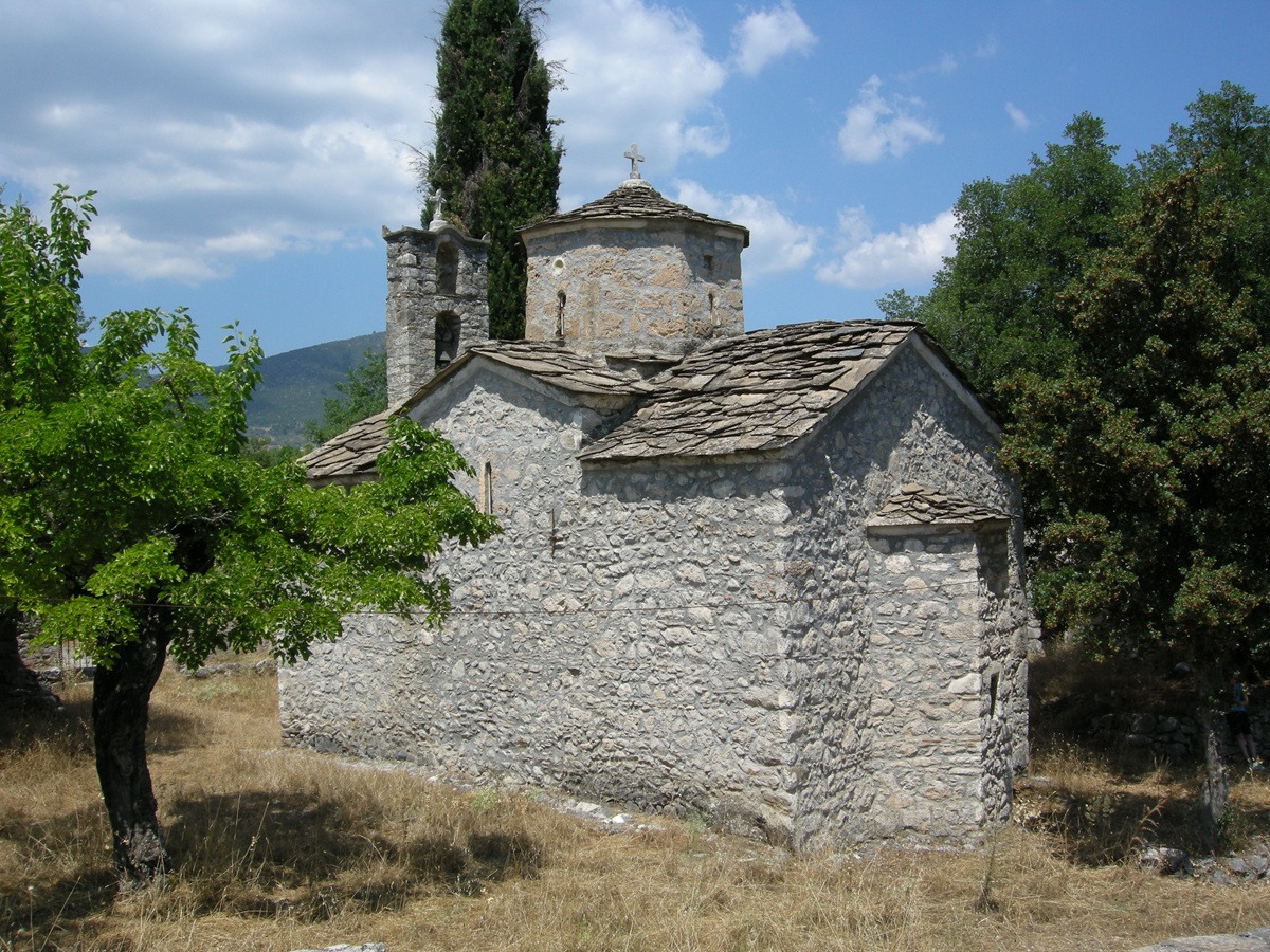 Church of Moní Ayíon
Taxiarchón Mourás - Photo: Jaap-Jan Flinterman, summer 2011
Since then, the
monastery seems to have been fully restored, as this video on YouTube shows.
Opinions may differ on the aesthetic merits of the result.
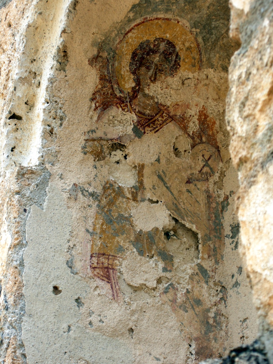
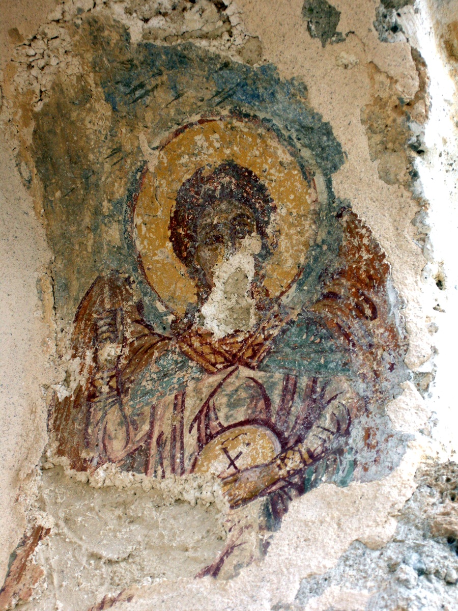 Moní Ayíon Taxiarchón
– The archangels Michael and Gabriel - Photos: Jaap-Jan Flinterman,
summer 2011
An
inscription on the threshold of the church gave 1953 as the
year of what must have been an earlier restoration. Perhaps the
weathered frescoes of the archangels in the niche above the church door
were painted or restored in the same year.
According to tradition, Moní
Panayías Elónis
was founded around 1500. There is written evidence of the monastery's
existence from the early 18th century. Founded
as
a monastery for men,
it has been converted into a women's monastery in 1972. It is well
worth a visit, not so much for the miraculous icon of the Panayía or
the beneficial effects of its spring water, but for its sensational
location, about 15 km on the road from Leonídio to Kosmás. Beautiful
photographs of the monastery can be found here. The website of the Diocese
of Mantineía and Kynouría has a page with information about Moní
Elónis.
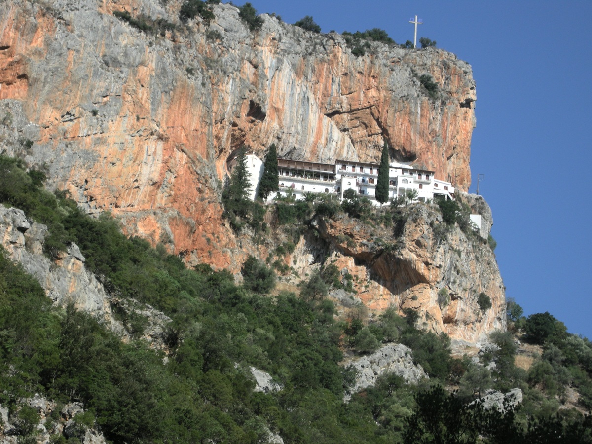 Moní Panayías Elónis
- Photo: Jaap-Jan Flinterman, summer 2008
According to the
authors of the above-mentioned
texts on Karítsa (who I could not find to be virulently
anti-communist), the monastery was used by the EAM/ELAS in 1944 as a
prison and execution site for opponents of the communist-led resistance
movement; Stratís Kouniás, in one of his articles, speaks of 'a camp
where the partisans kept black-marketeers and collaborators', in
another he calls it a 'concentration camp'. It was not the only
monastery in Kynouría to be turned into such a facility during the war.
Another case was Orthokostá, between Áyios Andréas and
Prastós. Orthokostá
is also the title of a novel by Thanásis Valtinós, set in northern
Kynouría in the 1940s (Ορθοκωστά,
Athens 1994; English translation: New Haven/London 2016). Its
publication sparked a fierce controversy, showing how fraught the
memory of occupation, resistance, collaboration, and civil war
still is.
Leonídio
(photo below) is the main town in southern Kynouría, as Ástros is in
the north. While Ástros became important in the 19th and 20th centuries
mainly as a winter residence and commercial centre for the farming
communities of the
hinterland, Leonídio owed its standing in no small part to its function
as the home of wealthy merchants who built imposing mansions there.
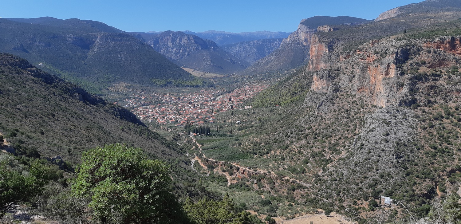 Leonídio - Photo: Jaap-Jan Flinterman, september 2022
In
recent decades, Leonídio has undergone a facelift with the restoration
of patrician houses such as the early 19th-century 'Tower of
Tsikaliótis' (pictured below), a fortified residence that now serves as
a museum and hosts exhibitions. Greek-language web pages about this
tower house, with some photos, can be found here and here.
 Tower of Tsikaliotis
- Photo: Jaap-Jan Flinterman, summer 2010
The
sensational location of the town at the foot of the reddish 'Tsakonian
Rocks' has always been there, of course. They border on the south side
the plateaus to the west of Tyrós.
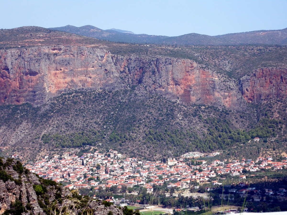 At the foot of the
Tsakonian Rocks - Photo: Jaap-Jan Flinterman, summer 2013
Wealthy
residents of Leonídio not only had representative mansions built, they
also claimed a prominent place among the deceased with beautiful grave
monuments. The cemetery of Leonídio is located to the north-east of the
town, along the old road to Pragmateftís. The grave of businessman
Leonídas Oikonómou features a mourning young woman, the work of the
famous 19th-century sculptor Yiannoúlis Chalepás. See more photos here. There is also a
Greek-language article on the art-historical significance of the
cemetery, here.
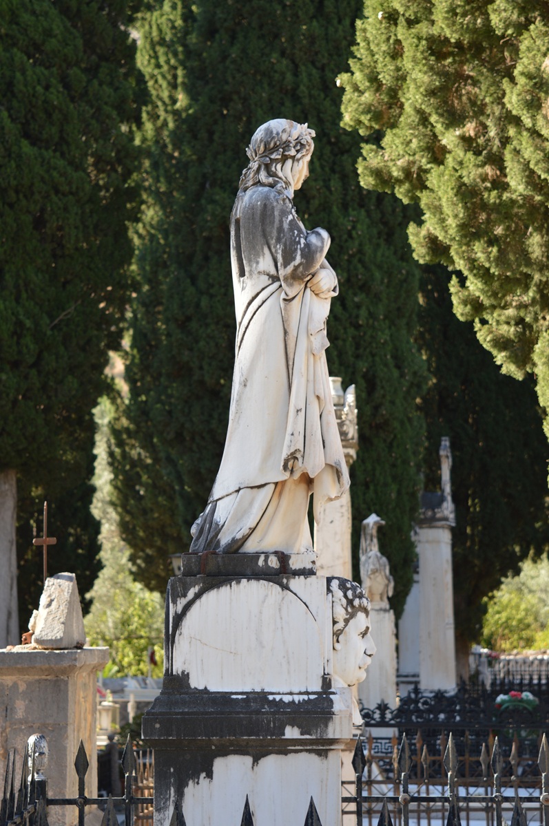 The grave of Leonidas
Oikonomou - Photo: Jaap-Jan Flinterman, summer 2017
Leonídio is located about four kilometres from the coast (satellite photo),
where the Dafnónas gorge widens into a fertile plain known in ancient
times as Διόνυσου κῆπος, 'Garden of Dionysus'. This name was linked to
a local myth recorded by the 2nd-century traveller Pausanias on his
visit to the city of Prasiaí. Here Ino was said to have nursed the
young Dionysus after the death of his mother Semele. Pausanias also
mentions the presence of a cult statue of the goddess Athena near
Prasiaí (Description of
Greece
3.24.3-5). It is suggestive that the ceiling of the most representative
hall of the Tsikaliótis Tower is decorated not only with images of the
phoenix (symbol of the resurrection of Christian Greece), but also with
vines (alluding to the wine god Dionysus) and images of Athena, as can
be seen in the informative tour of the residence in this YouTube video
(at 18:06). Were residents of Leonídio around 1800 familiar with
Pausanias' information about their city's predecessor? This
interpretation is contradicted by the fact that in the early 19th
century scholars located Prasiaí further north, at Kástro Tyroú or even
at Nisí Ayíou Andréa. It was only in 1868 that Conrad
Bursian suggested
that the remains of an ancient city near the coast at Leonídio should
be identified as Prasiaí. This identification now seems to be generally
accepted, although there is no epigraphic confirmation.
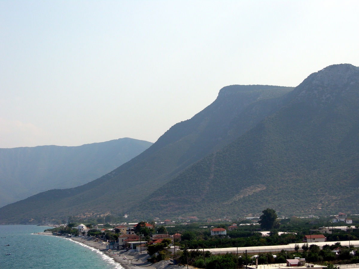 The coast near
Leonídio - Photo: Jaap-Jan Flinterman, summer 2010
The
remains of Prasiaí are scattered on the hill of Áyios Athanásios, which
overlooks Pláka, the small harbour of Leonídio. In the photo above,
Áyios Athanásios is the nearest hill; thinning of the vegetation shows
the course of part of the enceinte. In the photo below, some remains
of walls are just visible halfway up the hill. More photos of
the
remains of Prasiaí can be found here. Like Týros, Prasiaí may have
been
fortified in the late fourth or early third century BC, when the
Spartans had lost northern Kynouría (the Thyreátis) to Argos. However,
recent excavations have shown that there was a substantial settlement
here as early as the Late Bronze Age, and the foundations of a city
were laid in the 6th century BC (Lanérès
& Grigorakakis 2015; Grigorakakis &
Tsatsaris 2018).
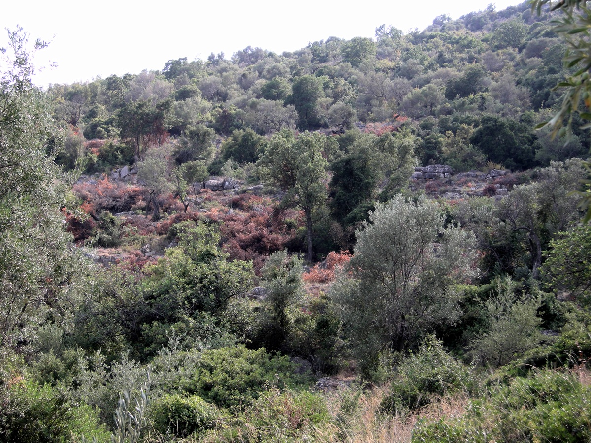
Remains of walls on
the Áyios Athanásios hill above Pláka Leonidíou - Photo: Jaap-Jan
Flinterman,
summer 2010
At
the top of the hill is a medieval (Frankish? Byzantine?)
castle. A Venetian list of Peloponnesian castles from 1467 mentions a
castle called 'Ales Linidi', which was already in ruins when the list
was compiled. This could well be the castle on the top of Áyios
Athanásios hill (McLeod 1972).
The Greek Castles
website has a page on it, here. Below are two photos taken
during a walk to the top.
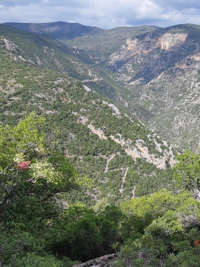
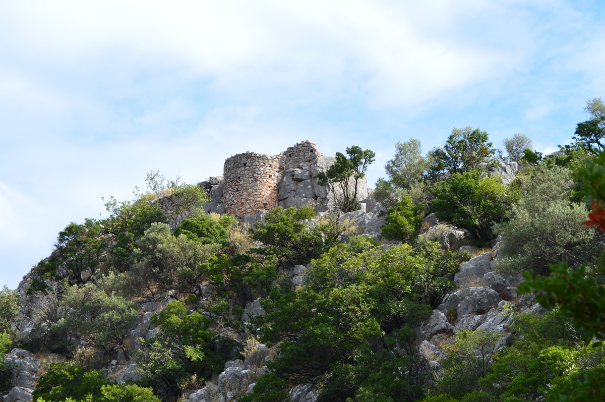 Mule track to and castle
at the top of Áyios Athanásios hill - Photos: Jaap-Jan Flinterman,
September
2022
Beautiful photos taken during a climb to the top of the hill can also
be found here, on the Leonidio-Poulithra
weblog.
I linked to this site above for photos of the sanctuary of Apollo
Tyrítas, Áyios Vassílios, Moní Elónis and the cemetery of Leonídio, but
there is much more beauty to be found there from South Kynouría. The
home of the webmaster, Dina Vitzileou, is Poúlithra, a village on the
coast about 5 km south of Pláka.
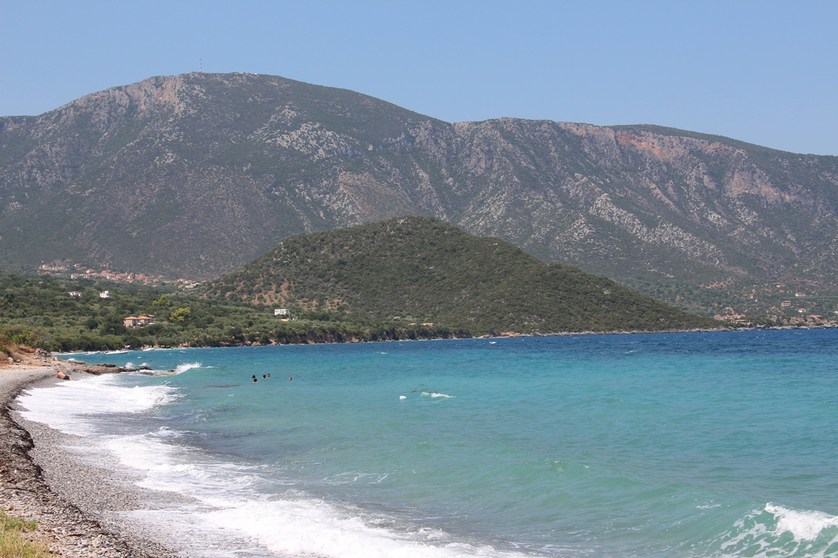 The Vígla hill at
Poúlithra from the south - Photo: Mieke Prent, summer 2017
On
a hill to the south of Poúlithra (pictured above) lie the remains of a
walled settlement dating from around 300 BC, identified as Políchne
(for the historian Polybius' mention of this place, see above). The
hill is called Vígla,
after the
medieval watchtower that once stood on its summit.
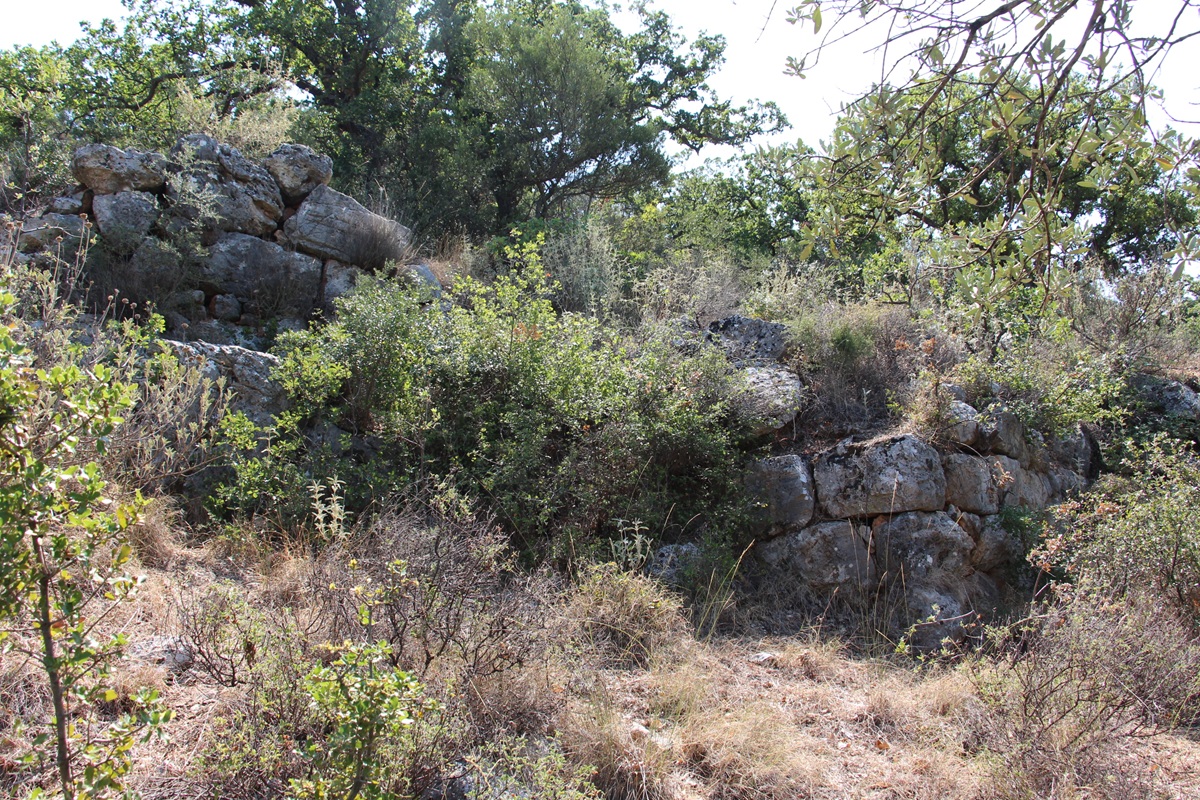 Remains of walls of
Políchne 1 - Photo: Mieke Prent, summer 2017
Mieke Prent and Stuart MacVeagh Thorne climbed to
the top of the hill
in the summer of 2017 and took photographs, including some of the
ancient
walls. With their permission, I'm showing four of these photos.
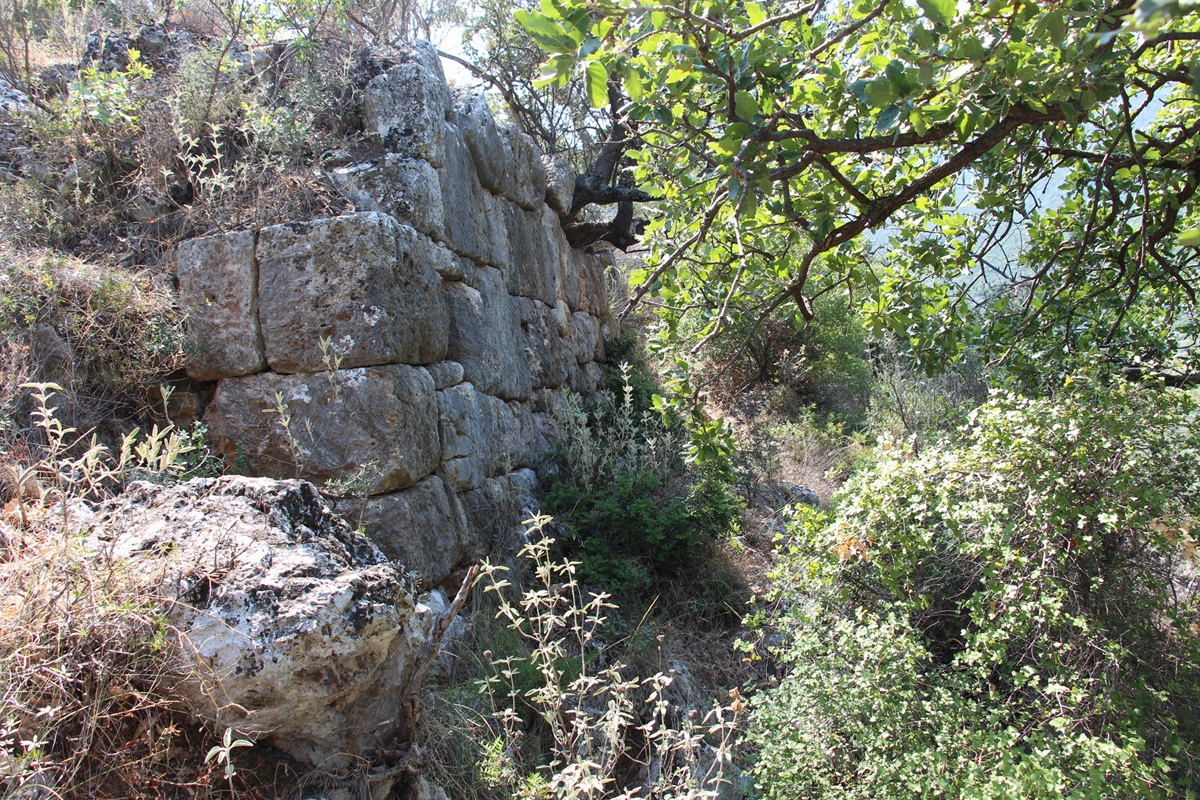 Remains of walls of
Políchne 2 - Photo: Mieke Prent, summer 2017
Looking south from Vígla (see photo below), it's easy to see why it was
chosen as the site of a watchtower.
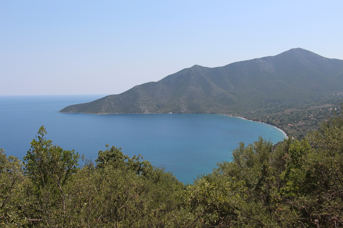 View to the south
from Vígla Hill - Photo: Mieke Prent, summer 2017
Photos of 'the citadel of ancient Políchne' can also be found on the
weblog of Dina Vitzileou, here.
Sights
around the central massif of the Párnonas
Around
the central massif of the Párnonas
(pictured below) are mountain
villages such as Áyios Ioánnis, Áyios Pétros, Plátanos, Kastánitsa and
Prastós. Nowadays, the demographic, economic and administrative centre
of the region is in the coastal towns of Ástros and Leonídio, but it
used to be different: during the Ottoman period, Prastós was the most
important settlement in the region, a bishop's seat and, as the centre
of an international trade network, one of the most prosperous towns in
the Peloponnese. This changed from the second half of the 18th century.
The emergence of Leonídio as a new regional centre came at the expense
of Prastós. Like many other settlements in the area, Prastós was
destroyed by the troops of Ibrahim Pasha in 1826. Its inhabitants moved
to Leonídio and Áyios Andréas, many of them permanently.
The secondary importance of the settlements near the coast
before
the later 19th and 20th centuries is often reflected in their original
name, which contained the element kalývia
(temporary winter quarters). For example, Ástros was known as
Ayiannítika Kalývia (the temporary winter quarters of the inhabitants
of the mountain village of Áyios Ioánnis), Áyios Andréas as Prastiótika
Kalývia (the winter quarters of the inhabitants of Prastós), etc.
(Faklaris 2023). Since then,
the roles have been reversed.
Nowadays, the mountain villages of the Párnonas are suffering from
depopulation, but in summer they are in demand because of their
relative coolness.
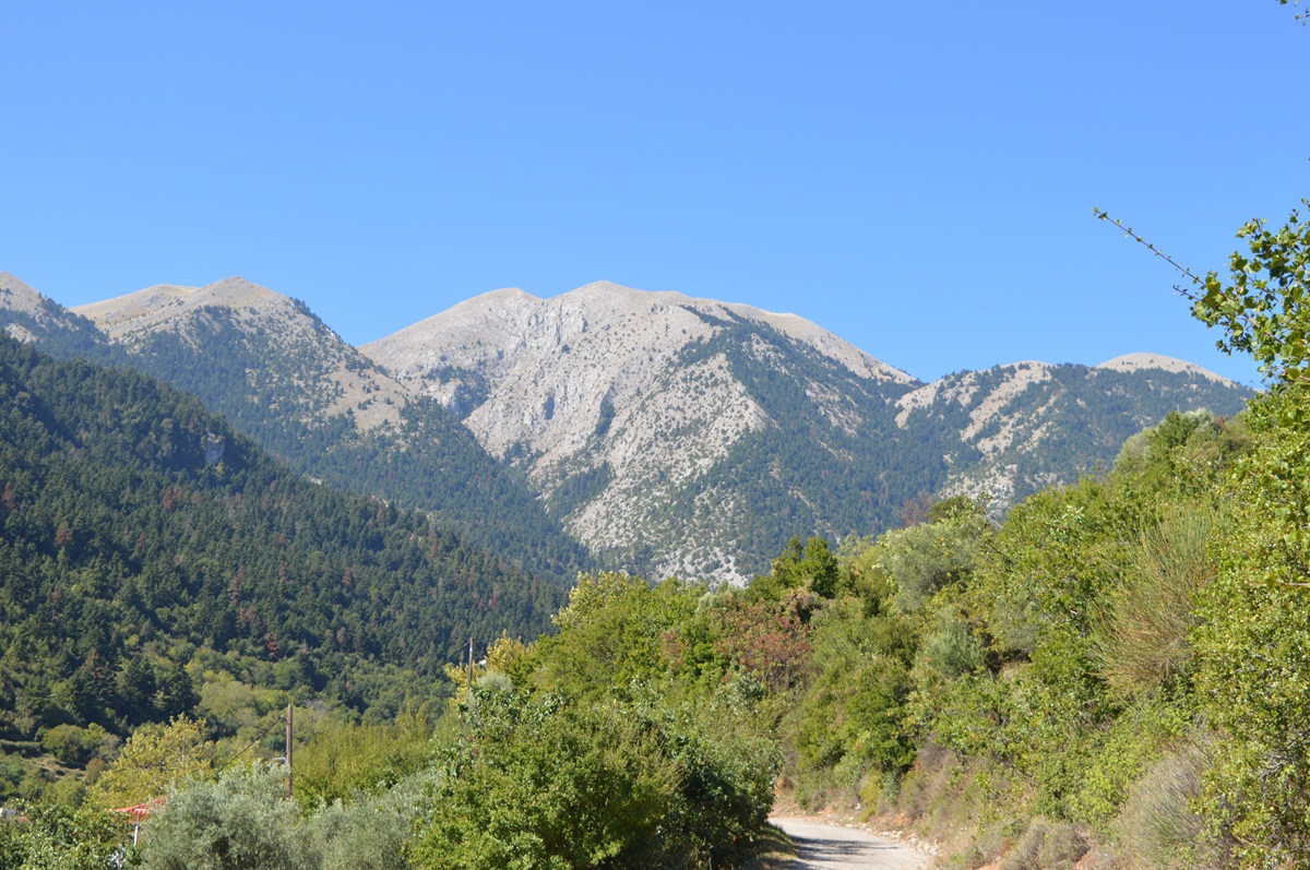 Mount Párnonas -
Photo: Jaap-Jan Flinterman, September 2023
Prastós
(pictured below) lies at an altitude of over 800 metres. It can be
reached by a road from Áyios Andréas, which offers spectacular views of
the Párnonas.
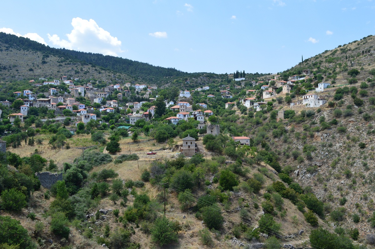 Prastós - Photo:
Jaap-Jan Flinterman, summer 2015
Prastós'
former prosperity can be seen in the rich decoration of the village's
old churches, such as the 17th-century Áyios Dimítrios with its
magnificent
Christós Pandokrátor (pictured below).
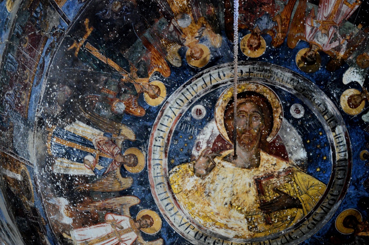 Prastós, Áyios
Dimítrios, Christós Pandokrátor - Photo: Jaap-Jan Flinterman, summer
2015
Plátanos
lies at an altitude of about 440 metres, in a valley to the north-east
of the central massif of the Párnonas, on one of the small rivers that
flow into the Vrasiátis. To reach the village, take the road from
Ástros to Áyios Pétros and after about 12 km, at a three-way junction,
choose the direction Plátanos-Sítaina-Kastánitsa. A 15 minute walk from
Plátanos will take you to a traditional bridge just north of the
village.
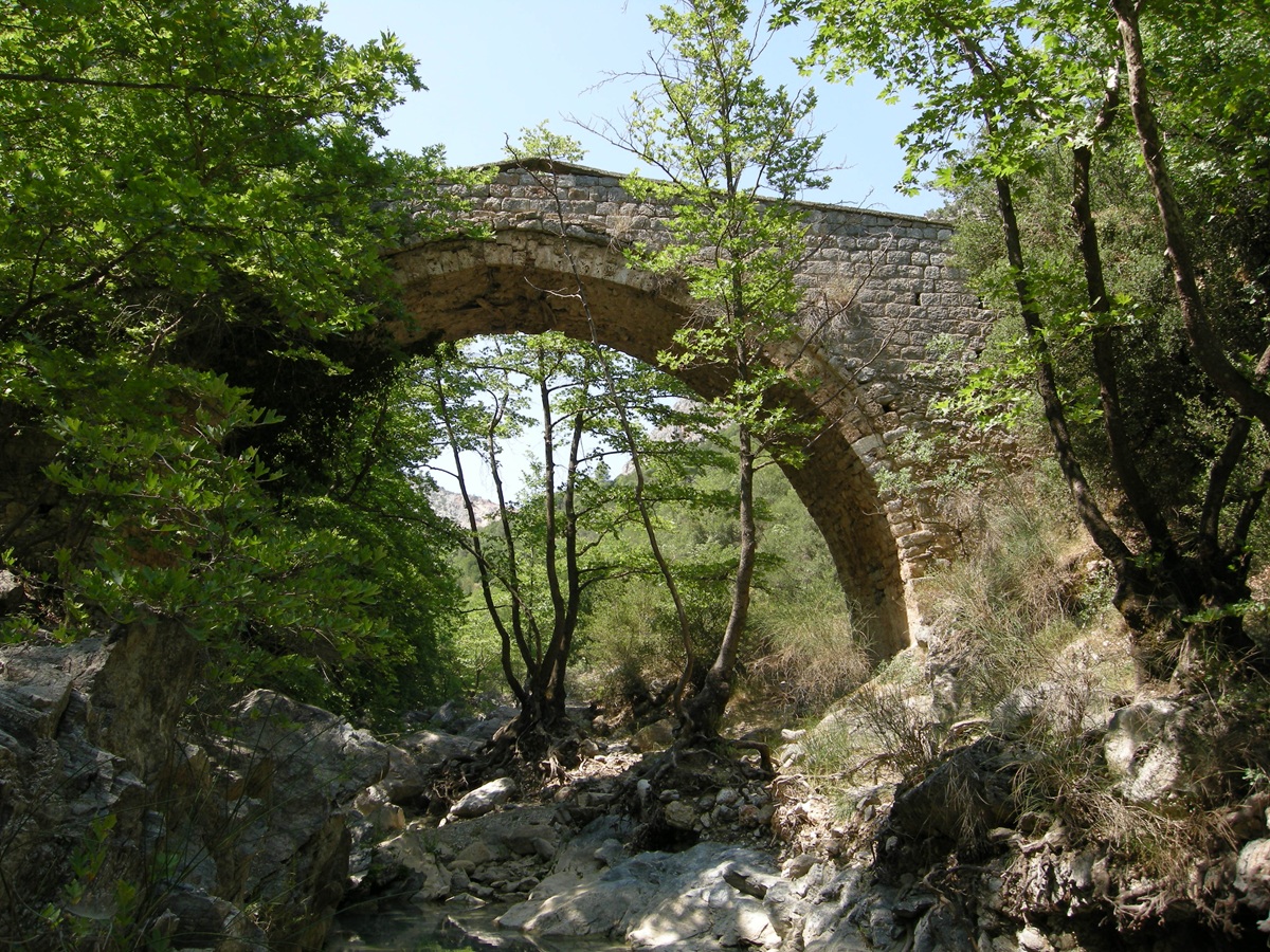 Traditional bridge
near Plátanos - Photo: Jaap-Jan Flinterman, summer 2013
Daniel
Koster describes Plátanos as 'a wonderfully beautiful oasis', and this
compliment is more than justified by the omnipresence of the water ...
 Plátanos: the
omnipresence of water - Photo: Jaap-Jan Flinterman, summer 2013
... and the densely forrested surroundings.
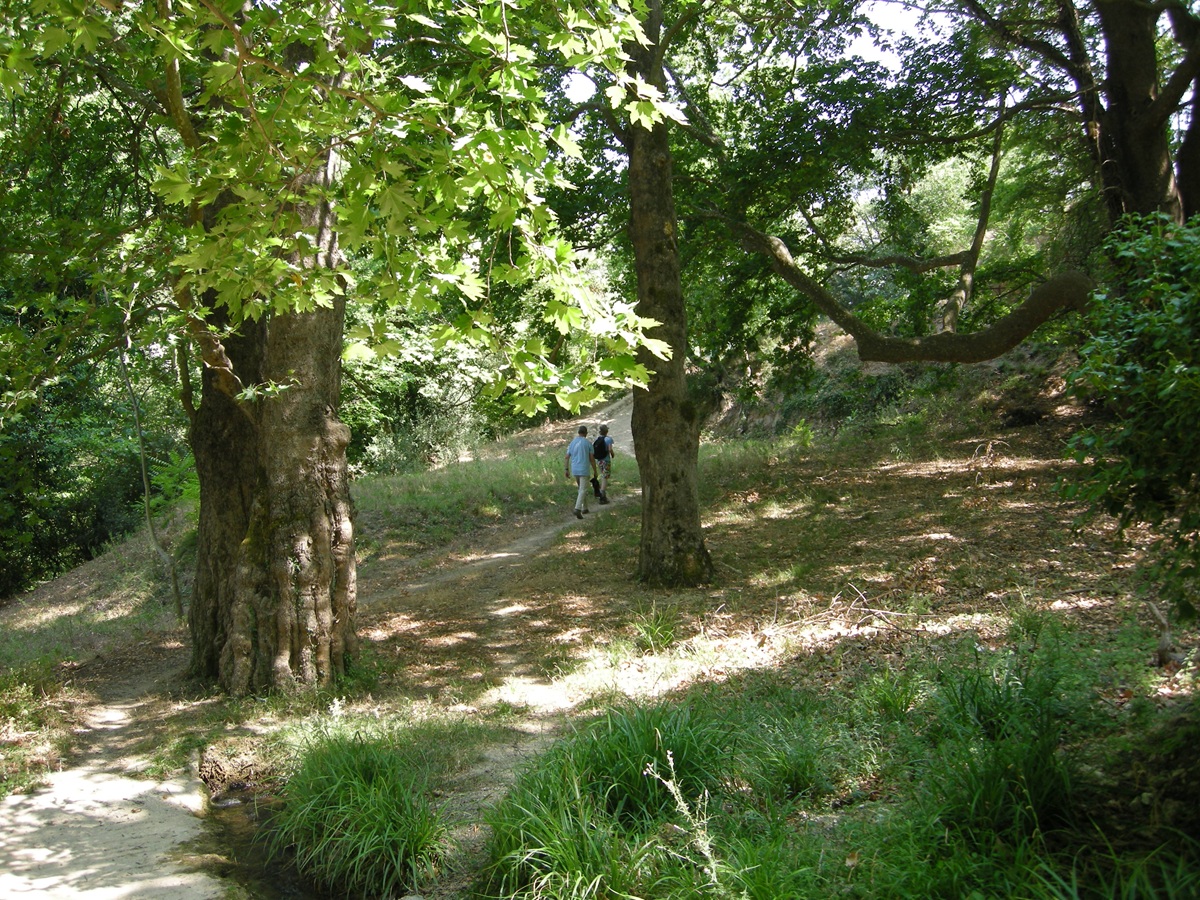 Plátanos - Photo:
Susanne Feiertag, summer 2013
From Áyios Andréas, a tricky but
good road leads to Kastánitsa
(photo below), which lies at an altitude of about 800 metres at the
foot of the central massif of the Párnonas; you can also take the road
via Plátanos from Ástros. Until a few generations ago, the inhabitants
of Kastánitsa earned their living by burning lime and harvesting wood.
The village is now largely depopulated, but in the summer months the
temporary return of (descendants of) former residents and some tourism
liven things up. According to Daniel Koster, Kastánitsa is 'the only
village in the Peloponnese whose roofs are almost entirely made of
slate'. The premonition that creeps up on the reader from these words
is somewhat realised on entering the central square, but the polished
appearance of the platía does not detract from the beauty of the
village...
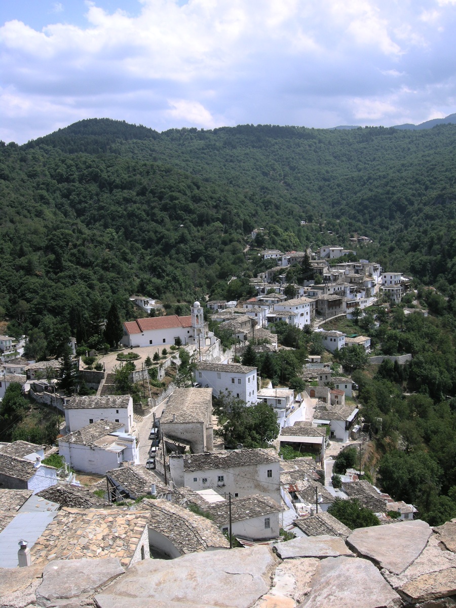 Kastánitsa, view from
the Tower of Kapsambélis - Photo: Jaap-Jan Flinterman, summer 2011
... and the overwhelming presence of the mountains all around.
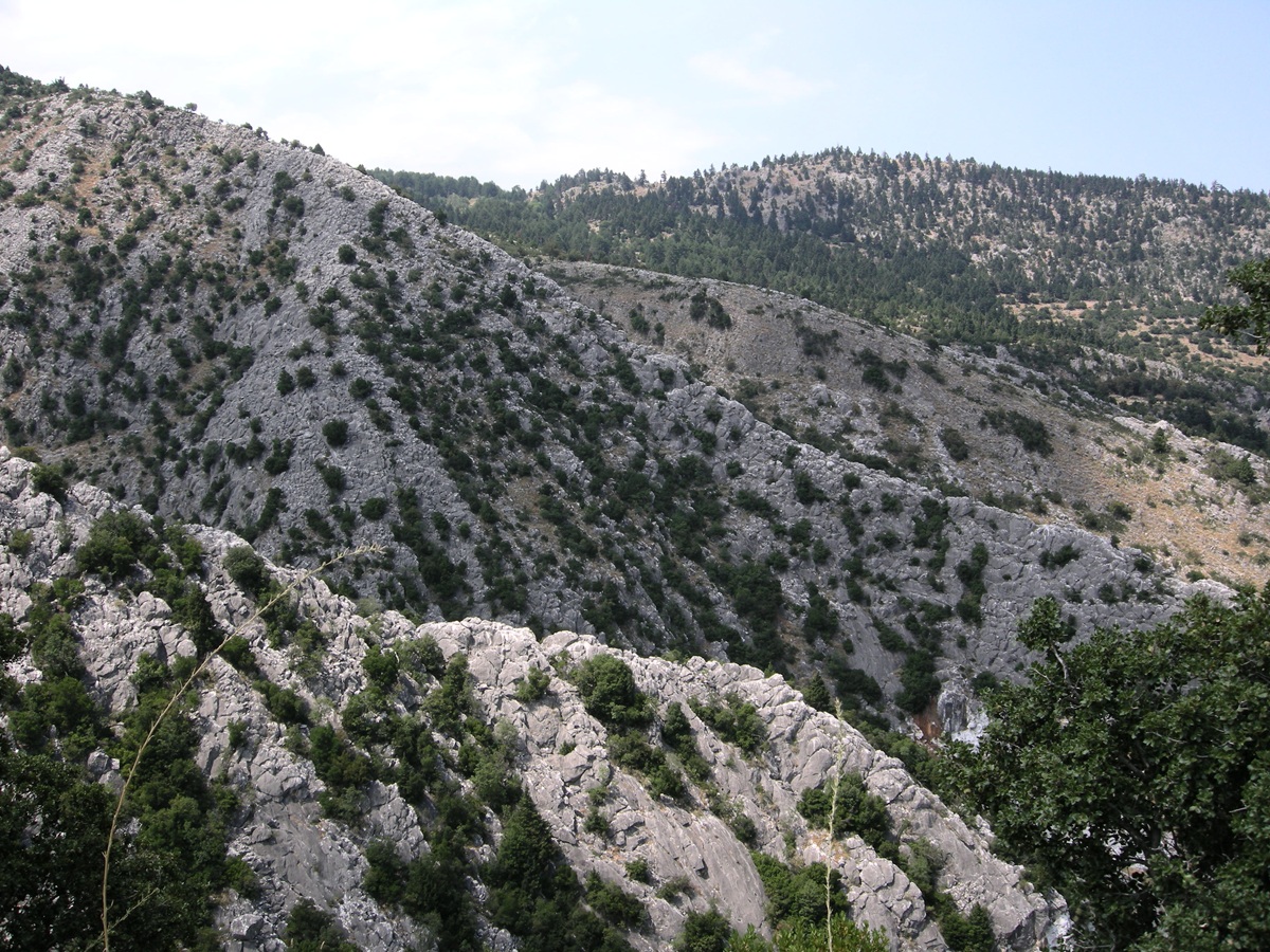 Kastánitsa, surroundings - Photo: Jaap-Jan Flinterman,
summer 2011
While it is commendable that such a beautiful village is well
maintained, decay has its own aesthetic.
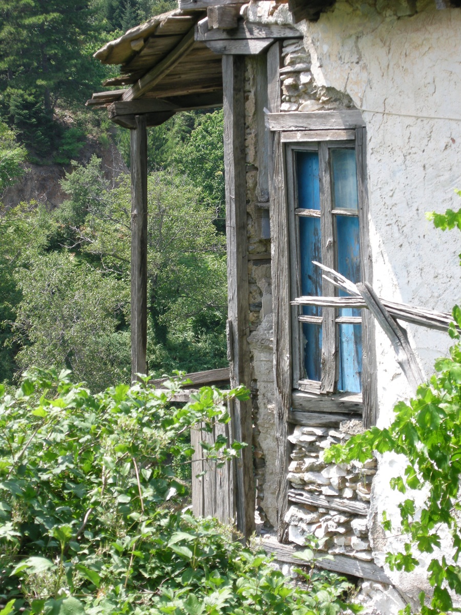 Kastánitsa - Photo:
Jaap-Jan Flinterman, summer 2011
The
village is dominated by the remains of a fortified tower, known locally
as the Pyrgos of Kapsambélis (a resident of Kastánitsa who had the
tower restored in 1810). The building, which dates from the late
Byzantine period (14th century), originally had three floors and was 8
m high. During the Greek Civil War, the tower served as a gendarmerie
post; in 1948 it was destroyed in an attack by communist partisans. The
Greek Castles website
has a page on the Pyrgos of Kapsambélis, here.
 Kastánitsa -
Kapsambélis' Tower - Photo: Jaap-Jan Flinterman, summer 2011
The
road from Ástros to Áyios Pétros takes you first to Ellinikó, then to
the plateau north of the Párnonas, to the villages of Oriní Meligoú,
Áyios Ioánnis, Áyios Pétros and finally (but by then you have already
crossed the border into Lakonia) to Karyés. The scenery on this trip is
very varied. South of Áyios Ioánnis is a plain (pictured below) that
looks desolate in summer: Xerokámbi.
According to Faklaris (1987),
it was here that the battle between Argos and
Sparta took place in the middle of the sixth century BC, giving the
Spartans possession of the Thyreatis.
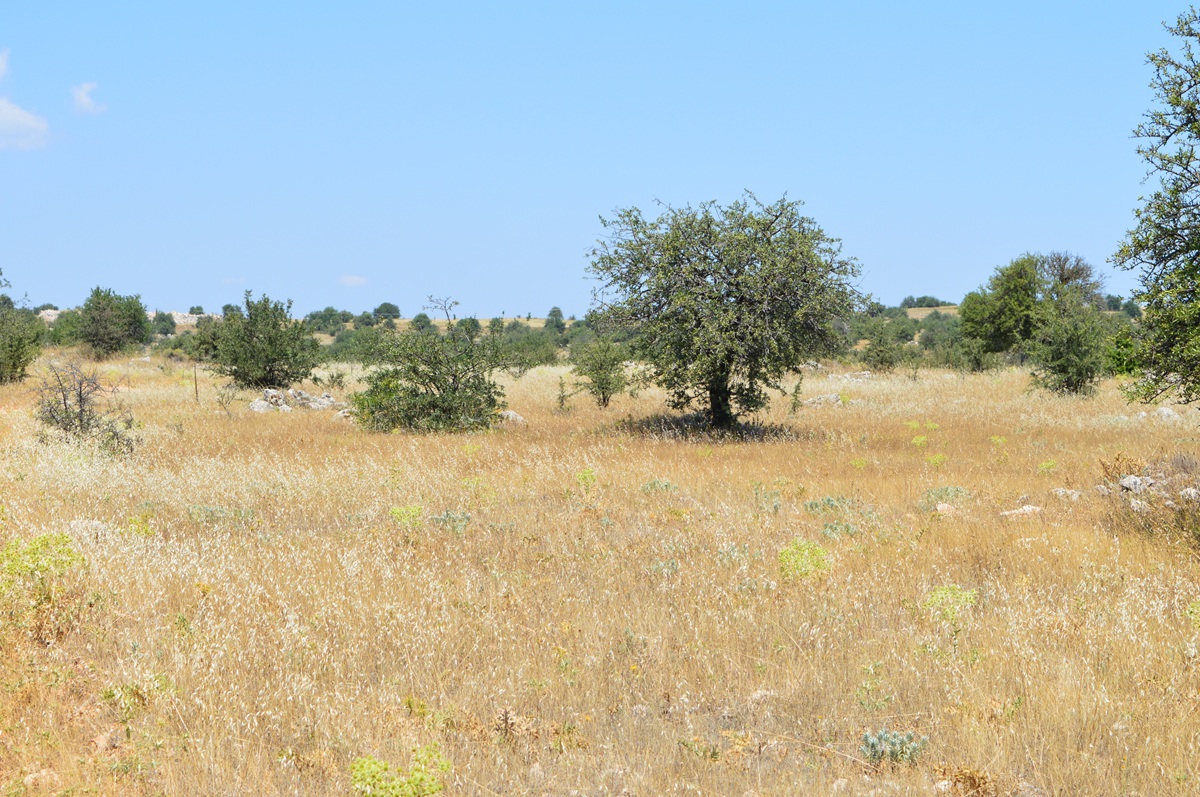 Xerokámbi - Photo:
Jaap-Jan Flinterman, summer 2015
On
a steep hill overlooking Xerokámbi (photo below) lie the remains of a
castle. It is probably the castle mentioned in the Aragonese
version of the Chronicle
of the Morea, which records the construction of a castle
by the
Frankish prince of Achaea, Guillaume de Villehardouin. The Chronicle of the Morea
is a 14th-century history of Frankish rule in the Peloponnese that has
been handed down in several versions. According to the Aragonese version,
De Villehardouin had a castle called 'Estella' built in 1256 in order
to bring the Tsakonian mountains under his control. The name of the
castle, which means 'star' (in Greek: astron),
has caused some confusion with the castle of Parálio Ástros,
but it is now generally accepted that the latter castle was
not a
Frankish creation and that the castle built to subjugate the Tsakonian
mountains must have been the castle overlooking Xerokámbi. See Arvaniti
2007; Faklaris 2023. It owes its
usual name (Kástro tis
Oriás, 'Castle of the Fair Maiden') to the story of a
popular ballad
about a castle belonging to a fair maiden that was taken by enemies
through treachery. The story was very popular and the castle built by
Guillaume de Villardouin shares the name with many other castles in the
Greek world.
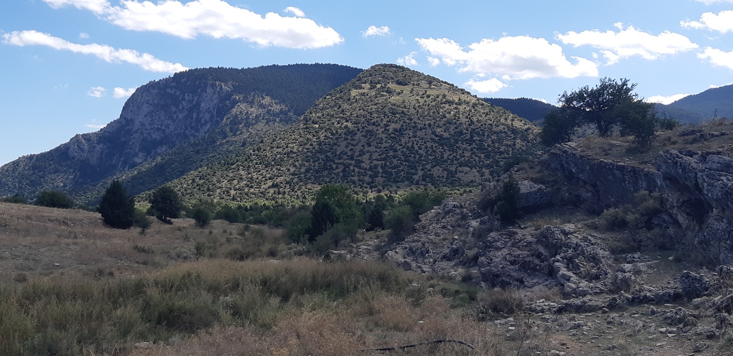 Kástro tis Oriás as seen from Xerokámbi - Photo: Jaap-Jan Flinterman, September 2022
The distinctive conical shape of the hill is better seen when
photographed from the west.
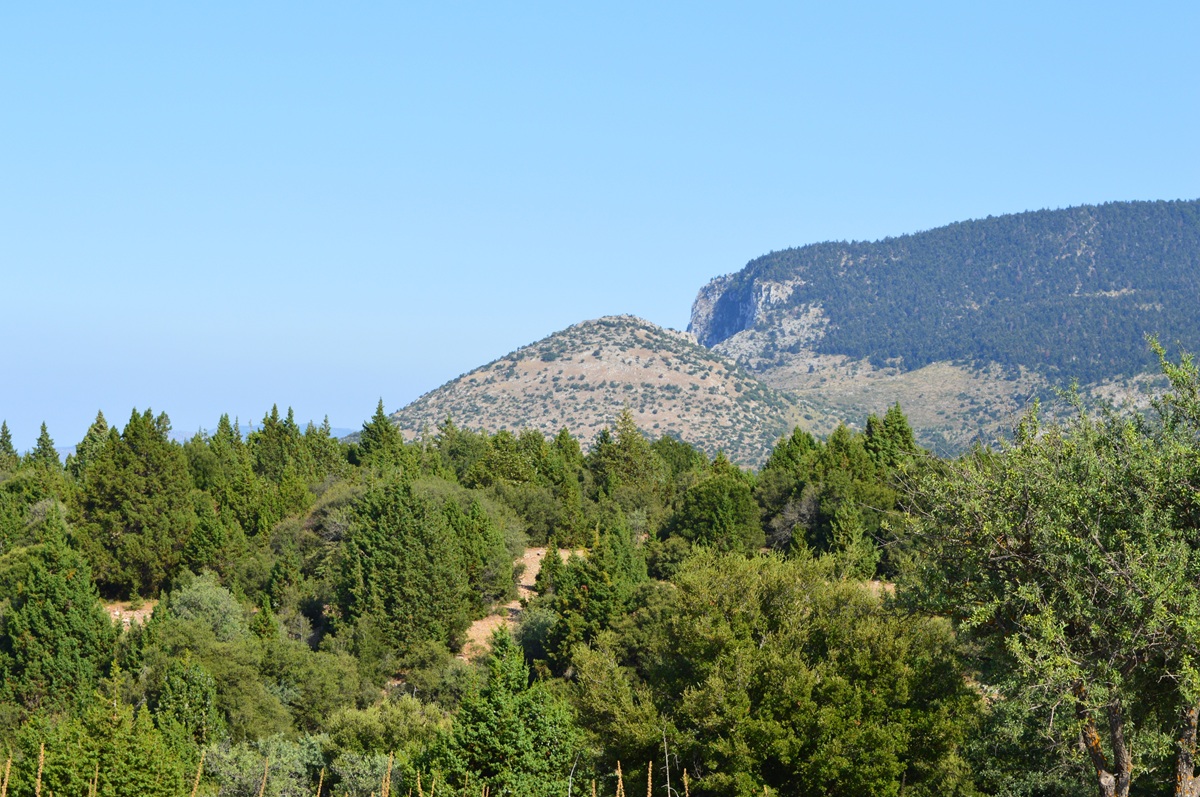 Kástro tis Oriás as seen
from the west - Photo: Jaap-Jan Flinterman, summer 2015
Even
if you don't bother climbing to the top, you can make out the remains
of the castle from a distance, but it helps to get a little closer (and
boost the contrast, see photo below).
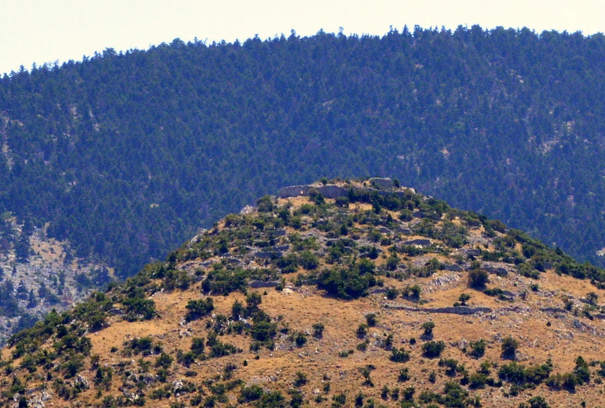 Kástro tis Oriás -
Photo: Jaap-Jan Flinterman, summer 2015
Of
course, there are those who have made the effort, as evidenced by the
page dedicated to the castle on
the Greek Castles website
and the photo
below.
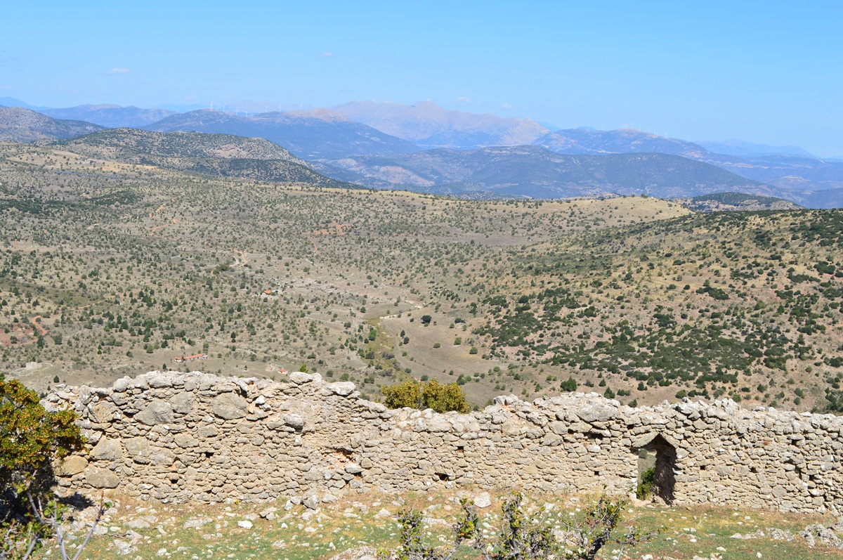 Inside the walls of
Kástro tis Oriás - Photo: Jaap-Jan Flinterman, September 2022
The view to
the north-east from around Áyios Pétros is suddenly much less barren.
The ridge in the distance to the left of the centre of the photo is
Mount Závitsa, which forms the northern boundary of Kynouría. Kalitsis
and Pritchett, unlike
Faklaris, believed that the mid-6th century BCE
battle between Argos and Sparta for possession of Thyreatis took place
on Závitsa.
 View from the
surroundings of Áyios Pétros - Photo: Jaap-Jan Flinterman, summer 2015
We leave
Kynouría. On the way from Áyios Pétros to Karyés, in Lakonía, we say
goodbye to the central massif of the Párnonas. In the second century
AD, Pausanias travelled from the Argolid to Sparta (Description of Greece
2.38.6-7). After listing the three villages he passed along the way,
the last of which was Éua (Ellinikó), he writes:
Beyond
the villages extends Mount Parnon, on which the Lacedaemonian border
meets the borders of the Argives and the Tegeatae. On the borders stand
stone figures of Hermes, from which the name of the place is derived.
[Translation: W.H.S. Jones, London/Cambridge Mass. 1918, slightly
adapted.]
This
tripoint ('Herms') has been plausibly identified with a
site more recently known as Phoneméni, between Áyios Pétros and Karyés
(Aráchova). [Pikoulas 2012]
By travelling from Áyios Pétros to Karyés,
we are by and large following in the footsteps of Pausanias.
Literature
and
websites
A
list of titles in Greek can be found in alphabetical order by the name
of the author or by the title, after the list of titles in other modern
languages. For technical reasons, this bibliography does not include
URLs or links to web publications or links to the full text of printed
publications. These can be found in the bibliography for the desktop
version of this web page. Click here.
Ameling,
W.
2011. 'Die Gefallenen der Phyle Erechtheis im Jahr 490 v.Chr.', Zeitschrift
für Papyrologie und Epigrahik 176, 10-23.
Andrews,
K.
19842. The flight of Ikaros. Travels
in Greece during a civil war,
Harmondsworth. [See for the dirty war in the southern Peloponnese
especially the chapters 9 and 10 (pp.
141-191). Reprint by Paul Dry Books, 2010.]
Arisoy,
I.A. 2018. 'From Morea to Marmara: Tsakonian trade
networks and migratory movements during the Ottoman period', Studies of the Ottamon Domain
8.14, 43-65. [A very informative article, about the economic
development of Kynouría under Ottoman rule and about the
17th-century Turkish traveller Evliya Tchelebi, who
first noted the Tsakonian language.]
Arvaniti,
S.I. 2021. 'The castle of Paralio Astros, Kynouria. A
stronghold of the Greek Revolution', Days of Art in Greece
12, 54-65.
Balandier,
C./Guintrand, M. 2019, 'L'apport de la teichologie à l’étude historique
d’une région. Le cas des fortifications de Thyréatide, zone
conflictuelle entre Sparte et Argos aux périodes classique et
hellénistique', Bulletin de Correspondance Hellénique 143, 425-445.
Balta,
E.
2009. 'Venetians
and Ottomans in the Southeast Peloponnese (15th-18th Century),
Halil
Inalcık Armağanı - I', Tarih Araştırmaları,
Ankara, Doğu Batı, 2009,
168-204. [Preliminary results of a Greek researcher's study based on
Ottoman and Venetian tax registers, which testify to the prosperity of
the area under Ottoman rule. See for Tsakonia
in the 18th and 19th century also the web article H
Τσακωνιά στη δεύτερη τουρκοκρατία (1715-1820), and the book
by Βαγενάς mentioned below.]
Baumer,
L.E. 2004. Kult im Kleinen, Ländliche Heiligtümer
spätarchaischer bis
Hellenistischer zeit: Attika – Arkadien – Argolis – Kynouria,
Rahden,
Westf. [About the sanctuary for Apollo Tyrítas, among other things.]
Blomley,
A.M. 2022. A Landscape of Conflict? Rural Fortifications in
the Argolid
(400-146 BC), Oxford. [Also discusses fortified
settlements and other military architecture in Kynouría.]
Böhm,
S.
1994. 'Griechische Sepulkralkunst im römischen Klassizismus', Jahrbuch
des
Deutschen Archäologischen Instituts 110, 405-429.
[About the relief NM
1450]
Bon, A.
1969. La Morée franque. Recherches historiques,
topographiques et
archéologiques sur la principauté d'Achaïe (1245-1430). Bibliothèques
de l'Ecole française d'Athènes et de Rome - Série
Athènes, 213, 1 and 2, Paris. [Available
online on
the Cefael website]
Browning, R.
1983. Medieval and Modern Greek.
Second edition,
Cambridge. [For the Tsakonian dialect, see pp. 124-125.]
Bursian,
C. 1868. Geographie von
Griechenland. II. Peloponnesos und Inseln,
Leipzig. [See p. 134 for identification as Prasiaí of the remains of an
ancient city ('die reste einer alten Stadt') near Pláka, the port of
Leonídio.]
Caraher,
W.R. 2003. Church, society, and the sacred in
early Christian Greece,
diss. Ohio State University. [See p. 363 for (slight) evidence for the
existence of a Late Antique basilica on the site of Moní Loukoús. Cf.
R. Sweetman, 2015. 'The
Christianization of the Peloponnese: the case for strategic change',
Annual of the British School at Athens 110, 285-319,
p. 301:
'Late Antique rural churches have been identified at (...) Kato Doliana
and Astros Moni Loukou', but both sites are unpublished.]
Charamis,
K. 2005. '"Nothing
and no one has been forgotten": commemorating those who did not give in
during the Greek civil war (1946-1949)', in: Cahiers
de la Méditerranée [online],
vol. 70, accessed 31 December 2024. [Discusses four monuments
erected by the PEAEA (Volos, Serres, Larissa, and Makronisos).]
Christien,
J., Spyropoulos, Th. 1985. 'Eua et la Thyréatide: topographie et
histoire',
Bulletin
de Correspondance Hellénique 109, 455-466.
Goester,
Y.C. 1979. 'Kynouria 1976-1978', Hermeneus 51.5,
347-351. [A preliminary publication
of the results of a survey of the plain of Ástros, in Dutch.]
Goester,
Y.C. 1993. 'The plain of Astros: a survey', Pharos
1,
39-112. [The final report on the results of the above mentioned survey.
Especially the archaeological site of Ellinikó/Teichió is thoroughly
discussed, but there is also a description of e.g. Nisí Ayíou Andréa.]
Goette, H.R. 2019. 'The portraits of Herodes Atticus and his circle', in: O Palagia (ed.), Handbook of Greek Sculpture, Berlin/Boston, 225-258.
Gorrini,
M.E. 2014. 'Il Polemokrateion di
Eua: alcune note', NumAntCl 43, 127-148.
Greek
Castles/Ελληνικά Κάστρα,
accessed 31 December 2024.
[As the Greek pages of this bilingual website are often more
informative than the English pages, I refer to the Greek pages above.
Returning to the homepage of the site will take you to the
corresponding English page.]
Grigorakakis,
G. 2009. 'New investigations by the 39th Ephorate at Eva in the
Thyreatis. A
Late Classical burial in the western roadside cemetery', in:
H. Cavanagh,
W. Cavanagh, J. Roy (eds), Honouring the dead in the
Peloponnese.
Proceedings
of the conference held at Sparta 23-25 April 2009. CSPS Online
Publication 2,
prepared by Sam Farnham, 183-199. [See p. 185 with n. 12 for the
discovery of a second roof tile with the text EYATAN.]
Grigorakakis,
G., Tsatsaris, A. 2018. 'Kynourians, Horeiatai, Prahioi. Evolution
and
transformations of a region from the Bronze to the Early Iron Age. The
new evidence', Χρονικά των Τσακώνων, τ. ΚΓ´ 2/2, 71–9.
Guintrand,
M. 2017, Sparte et la défense du Péloponnèse mériodinale du
milieu du VIe
siècle au milieu du IIe siècle av. J.C.. Volume I – Synthèse
historique; Volume
II – Catalogue des ouvrages fortifiés,
PhD Dissertation, Université
d’Avignon et des Pays de Vaucluse, Avignon. [A goldmine of information
on military architecture on the southern Peloponnese, Kynouría
included.]
Janko,
R.
2014. 'The new epitaph for the fallen of Marathon (SEG
56.430)',
Zeitschrift für Papyrologie und Epigraphik 190,
11-12.
Jansen,
K.
2006. Herodes Atticus und
seine τρόφιμοι,
Diss.
Westfälischen Wilhelmsuniversität Münster. [See for the relief NM
1450 as representation of Achilles now also Goette 2019, 248-251 (above).]
Karusu,
S.
1969. 'Die antiken vom Kloster Luku in der Thyreatis', Römische
Mitteilungen
76, 253-265.
Keesling,
C. 2012. 'The Marathon casualty list from Eua-Loukou
and the Plinthedon style
in Attic inscriptions', Zeitschrift für Papyrologie
und Epigraphik 180,
139-148.
Koster,
D.
2004. Athene en de Peloponnesus. Reisgids,
Amsterdam/Antwerpen. [The best Dutch-language guide to the Peloponnese,
including Kynouría, to date. All guides take you to Epidauros, Mycenae,
and Olympia. But how many guides bring you to the sanctuary of Apollo
Tyrítas between Péra Mélana en Sapounakaíika? Or to the ancient
Glympeís
or
Glyppía?]
Kralli,
I.
2017. The Hellenistic Peloponnese:
Interstate Relations. A narrative and
analytic history, from the fourth century to 146 BC,
Swansea. [This heroic attempt to create order in the confusing history
of the Peloponnese between 371 and 146 BC is obligatory reading for
those interested in the history of Kynouría during these
years.]
Kritzas,
Ch. 2006. 'Nouvelles inscriptions d'Argos: les archives des comptes du
Trésor
sacré (IVe siècle av. J.-C.)', CRAI 2006,
397-434.
Lanérès,
N.,
Grigorakakis,
G. 2015. '1.
Une découverte récente: un haltére pour les "Maleateia" ou Sparte à la
conquête de sa côte orientale. 2. 'l'Haltère de Tirôn et l'expansion de
Sparte sur le territoire de
Prasiai (Cynourie du Sud)', Revue des Études
Grecques 128,
647-658. [Grigorakakis concludes from archaeological data that the
Spartan
annexation of southern Kynouria 'était déjà accomplie vers 700 a.C.',
which seems on the early side. Certainty is out of the question, but
the material presented in various publications (apart from this title,
see also Lanérès & Grigorakakis 2017; Pavlidis 2018) seems best
reconciled with the assumption that the Spartan occupation of southern
Kynouría was the result of a gradual process of infiltration and
subjugation in the decades around 600 BC.]
Lanérès,
N.,
Grigorakakis, G. 2017. 'Le cavalier de Tyros, une figurine de bronze
laconien', Revue
des Études Grecques
130, 327-346. [Here the authors state that '[a]u début du VIe a.C., en
même temps que toute la Cynourie, Prasiai fut conquise par Sparte qui
s’empressa d’assurer sa mainmise sur les sanctuaires de Maleatas et
d’Apollon Tyritas.']
Leake,
W.M. 1830. Travels in
the Morea in three
volumes.
Volume II, London.
Liosis,
N. 2013. 'Tsakonian', in: Encyclopedia
of Ancient Greek
Language and Linguistics Online,
<doi.org/10.1163/2214-448X_eagll_COM_000037>.
MacLeod,
W. 1972. 'Castles
of the Morea in 1467', Byzantinische Zeitschrift
65, 353-363.
Meyer,
H.F.
2002. Von Wien nach Kalavryta. Die blutige Spur der 117.
Jäger-Division
durch Serbien und Griechenland,
Mannheim/Möhnesee. [On the history of the German division stationed in
the Peloponnese in 1943-1944. Describes the German attack on the
Párnonas area and Kynouría in June/July 1944 as the largest military
operation on the Peloponnese of the war years (p. 402), 'das grösste
Unternehmen, welches je auf der Peloponnes durchgeführt wurde.']
Nicholas,
N. Tsakonian
Bibliography, 2003-2015, accessed: 31 December 2024,
<www.opoudjis.net/Work/tsakbib.html> ["An
annotated bibliography of references on Tsakonian. The
emphasis is on the
Tsakonian language, but I am happy to insert references on Tsakonia in
general
..." ]
Nielsen,
Th. H. 2002. Arkadia and its poleis in the
Archaic and Classical periods,
Göttingen. [See index s.n. Eua and especially pp. 106-107 for
the
fragment of Theopompus in which Eua is called a πόλις Ἀρκαδίας and for
the mythical genealogy supporting Arcadian claims to the Thyreátis.]
Pavlidis,
N. 2018. 'The sanctuaries of Apollo Maleatas and
Apollo Tyritas in Laconia: religion in Spartan perioikic relations',
Annual of the British
School at Athens 113, 279-305.
Piérart,
M.
2014. 'Les relations d’ Argos avec ses voisines.
Repentirs et mises au point', Dialogues
d’histoire ancienne supplément 11, 219-236.
Pritchett,
W.K. 1980. Studies in Ancient Greek Topography, Part
III (Roads),
Berkeley-Los Angeles-London, 102-142; Studies in
Ancient Greek
Topography, Part IV (Passes),
Berkeley/Los Angeles/London 1982, 64-79. Studies
in ancient Greek topography, Part VI, Berkeley-Los
Angeles-London
1989,
79-106; Studies in ancient Greek topography VII,
Amsterdam 1991,
137-168 and 205-226; Thucydides' Pentekontaetia
and other
Essays,
Amsterdam 1995, 228-262. [A series of important contributions on the
ancient topography of Kynouría, especially North Kynouría. Cf. the review by Graham
Shipley, Classical Review 43, 1993, 131-134.]
Rife,
J.L.
2008. 'The burial of Herodes Atticus: élite
identity, urban society,
and public memory in Roman Greece', Journal of
Hellenic Studies 128,
92-127.
Roy, J.
2009. 'Finding the limits of Laconia: defining and re-defining
communities on
the Spartan-Arkadian frontier', in: W.G. Cavanagh, C. Gallou, M.
Georgiadis
(eds), Sparta and Laconia. From pre-history to pre-modern,
London,
205-211. [See pp. 206-207 for the fragment of Theopompus in which Eua
is called a πόλις Ἀρκαδίας.]
Scranton, R.L. 1941, Greek Walls, Cambridge, MA. [See p. 153 for 'indented trace'.]
Shipley,
G.
2000. 'The extent of Spartan territory in the late
Classical and Hellenistic
periods', Annual of the British School in Athens
95, 367-390. [About the conquest and loss of Kynouría by the Spartans
and the ancient topography of the region.]
Shipley,
G.
2004. 'Lakedaimon', in: M.H. Hansen, Th. H. Nielsen (eds), An
inventory of Archaic and
Classical poleis,
Oxford, 569-598. [See the entrances for relevant toponyms (Anthana,
Prasiae, Tyros etc.) for brief discussions of the ancient topography of
Kynouría.]
Shipley,
G.
2019. Pseudo-Scylax's Periplous. The Circumnavigation of the
Inhabited World.
Text, Translation and Commentary by Graham Shipley, Liverpool 2019.
Spyropoulos,
G. 2001. Drei Meisterwerke der griechischen
Plastik aus der Villa des
Herodes Atticus zu Eva/Loukou, Frankfurt am Main
etc.
Spyropoulos,
Th. Spyropoulos, G. 2003. 'Prächtige Villa, Refugium und Musenstätte.
Die Villa des
Herodes Atticus im arkadischen Eva', Antike Welt
34, 463-470.
Steinhauer,
G. 2009. Marathon and the Archaeological museum,
available for consultation in the e-library of the John S. Latsis
Public
Benefit Foundation. [For a brief discussion of the list of
war dead from the phyle Erechtheis see p. 122.]
Strazdins, E. 2023. Fashioning the Future in Roman Greece. Memory, monuments, texts, Cambridge.
Tobin,
J.
1997. Herodes Attikos and the city of Athens. Patronage and
conflict under
the Antonines, Amsterdam.[ See pp. 333-354 for
Herodes' villa near
Ástros.]
Tritsaroli, P., Grigorakakis, G.,
& Richards, M. 2024.
'Bioarchaeological
insights into the Late Helladic communities of South Kynouria,
Peloponnese: The case of the LH IIIA2-IIIB2 burial cluster of Socha', International Journal of
Osteoarchaeology 34(1), e3268.
Walker,
I.
1936. Kynouria. Its history in the light of existing remains, Ph.D.
University of Columbia, Williamsport, Pennsylvania. [The
characterization as 'the first study of the region illustrated with
many photographs and
drawings' is Yvonne Goester's. Descriptions of several sites
(Týros, Nisí Ayíou Andréa, Ellinikó) and of Moní Loukoús. Outdated, of
course, but interesting for that very reason, and still useful from
time to time.]
Woodhouse,
C.M. 1976. The struggle for Greece 1941-1949,
London. [See p. 261 for the battle of Áyios Vasíleios on 22 January
1949. Reprinted, with a very
informatieve introduction by Richard Clogg, in
2002.]
Αρβανίτη,
Σμαράγδη. Άγιος Ιωάννης Κυνουρίας, n.d., accessed
31 December 2024.
Αρβανίτη, Σμαράγδη
Ι.
2001-2002, 'Οἱ σχολές του
Δημητρίου Καρυτσιώτη στoν Άγιο Ιωάννη
καὶ τό Άστρος
Θυρέας - Κυνουρίας κατά τα
προεπαναστατικά χρόνια ως την απελευθέρωση', Πρακτικά
τού Στ΄ Διεθνούς Συνεδρίου Πελοποννησιακών
Σπουδών (Τρίπολις, 24-29 Σεπτεμβρίου 2000), Τόμος
Γ', Αθήνα, 369-394.
Αρβανίτη, Σμαράγδη
Ι. 2007. 'Το
κάστρο του Παραλίου Άστρους Κυνουρίας. Πρώτες παρατηρήσεις',
in: Πράκτικα του Ζ’ Διεθνόυς Συνεδρίου Πελοποννησιακών Σπουδών
(Πύργος - Γαστόυνη - Αμαλίαδα 11-17 Σεπτεμβρίου 2005). Τομος Δ', Αθήνα,
385-410.
Βαγενάς, Θάνος
1971. Ιστορικά Τσακωνιάς και Λεωνιδίου, Αθήνα. [The
magnum opus
of a dedicated local historian, who has made a good case for the
hypothesis that Kynouría was not fully occupied by the Ottomans until
1540.]
Βιτζηλαίου,Ντίνα.
Λεωνίδιο
- Πούλιθρα. Φωτογραφικά οδοιπορικά στη Νότια Κυνουρία,
accessed 31 December 2024.
Γαλανιάδη,
Εύα. Ο Δημήτριος Καρυτσιώτης και η Ορθόδοξη
Κοινότητα της Τεργέστης, accessed 31 December 2024.
[On the merchant from Áyios Ioánnis who founded schools for secondary
education in his native village and in Ástros.]
Γρηγορακάκης,
Γ. 2016. 'Θέση Άρνακας - Σκάλωμα Σοχάς, Δ.Ε. Λεωνιδίου', Αρχαιολογικόν
Δελτίον - Χρονικά 66 (2011), 247–248.
Καλίτσης,
Κ. 1967. 'Τὰ ᾿Ανιγραῖα τοῦ Παυσανίου καὶ ἡ θέσις τῶν Θυραιατικῶν
κωμῶν', Ἀρχαιολογικὴ
Ἐφημερίς 1965, Χρονικά, 10-18. [An important
article on the ancient
topography of the Thyreatis.]
Kόκκινος
φάκελος. Ιστορικό, πολιτικό Blog για την ιστορία της διεθνούς και
ελληνικής
αριστεράς. Τρίτη, 9 Νοεμβρίου 2010· H 3η
Μεραρχία των νεκρών του ΔΣΕ.
Kόκκινος
φάκελος. Ιστορικό, πολιτικό Blog για την ιστορία της διεθνούς και
ελληνικής
αριστεράς. Πέμπτη, 2 Ιανουαρίου 2014· Oι
εκκαθαριστικές επιχειρήσεις στην Πελοπόννησο - σύντομο χρονικό.
Kόκκινος
φάκελος. Ιστορικό, πολιτικό
Blog για την
ιστορία της διεθνούς και ελληνικής αριστεράς. Τετάρτη, 30 Σεπτεμβρίου
2015· Νίκος Λάτσης - Μια σεμνή μορφή του αγώνα.
Kόκκινος
φάκελος. Ιστορικό, πολιτικό Blog για την ιστορία της διεθνούς και
ελληνικής
αριστεράς. Δευτέρα, 4 Φεβρουαρίου 2019· Δύο μάχες του ΔΣΕ Πελοποννήσου
- Η μάχη του
Λεωνιδίου.
Κουνιάς,
Στρατής. Η δημιουργία, η ανατίναξη και το τέλος της
'Ηλεκτρικής'
Λεωνιδίου, accessed 31 December 2024.
Κουνιάς,
Στρατής. Η τελευταία επιδρομή των Γερμανών και η
εκτέλεση των 11 στο
Λεωνίδιο (6 Ιουλίου 1944), accessed 31 December
2024.
Κουνιάς,
Στρατής. Η
μάχη του Κοσμά (27 Ιουλίου 1943), accessed 31 December 2024.
Κουνιάς,
Στρατής. Πολιτικό μνημόσυνο στη μνήμη της οικογένειας
Αθηνάς Λάτση, accessed 31 December 2024.
[Stratís
Kouniás, who has written several historical articles on the 1940s for
the
website www.leonidion.gr, is an interesting personality: statistician
of international repute, professor emeritus of the Faculty of
Mathematics of the University of Athens, active member of the KKE (the
Greek Communist Party) since 1979, member of the Leonídio municipal
council from 1994 to 2002. On his activities as a local historian, he
himself says: 'After 1990 I showed an intense interest for the local
history of the 1940-1950 period, taking personal interviews and
studying the local press; I have also written related articles. It was
of course a little late because the main leaders had passed away.' I
borrow this information from Statistical
Periscope. GSI
News No 32 (February 2009), a special issue 'In
honour of Professor Efstratios (Stratis) Kounias'.]
Κριτζάς,
Χ.Β. 2013. 'Οι νέοι χαλκοί ενεπίγραφοι πίνακες απὸ
το Άργος. II. Πρόδρομη ανακοίνωση', in: D. Muliez (ed.), Στα
βήματα του
Wilhelm Vollgraff. Εκατό χρόνια αρχαιολογικής δραστεριότητας στό Άργος.
Πράκτικα
του διεθνούς συνεδρίου που διοργανώθηκε απὸ την Δ’ ΕΠΚΑ και
απὸ την Γαλλική
Σχολή Αθηνών, 25-28 Σεπτεμβρίου 2003, Ελληνογαλλικές Έρευνες IV,
Athens,
275-301.
'Μνημόσυνο
στη μνήμη του Γιάννη Σαρρηγιάννη – 50 χρόνια από το θάνατό του',
Ριζοσπάστης
6 Αυγούστου 1999, σελίδα 16.
Ντατσόυλη-Σταυρίδη,
Α. 1999. Αρχαιολογικό
Μουσείο Άστρους. Κατάλογος γλυπτών, Αθήνα.
Παπαδογιάννης,
Κώστας Ι. Η μάχη του Λεωνιδίου στις 20 Ιανουαρίου 1949,
accessed 31 December 2024.
Παπαδογιάννης,
Κώστας I. Η πολύνεκρη μάχη του Αγίου
Βασιλείου Κυνουρίας στις 22
Ιανουαρίου 1949, accessed 31 December 2024.
Πίκουλας,
Γ.Α. 2012. Το οδικό
δίκτυο της
Λακωνικής, Αθήνα.
[See pp. 140-143 for 'Herms', the tripoint between Áyios Pétros and
Karyés, with full references to evidence and previous scholarship.]
Σάλτα,
M. 2011. Το νεοκλασικό νεκροταφείο των Αγίων Πάντων
και τα μνημεία του, accessed 31 December 2024.
Σπυρόπουλος,
Γ. 2006. Η έπαυλη του Ηρώδη Αττικού
στην Εύα/Λουκού Κυνουρίας, Αθήνα.
Σπυρόπουλος,
Γ. 2009. Οι στήλες των πεσόντων στη μάχη του
Μαραθώνα από
την έπαυλη του Ηρώδη Αττικού στην Εύα Κυνουρίας, Αθήνα.
[On p.
34f. note 1, the author refers to a future publication (Η αρχιτεκτονική
της έπαυλης του Ηρώδη
Αττικού στην Εύα Κυνουρίας) for a more detailed argument for his
hypothesis that the burial mound at Marathon was raised in the
2nd century AD.]
Φακλάρης,
Π.Β. 1990. Αρχαία Κυνουρία. Ανθρωπινή
δραστηριότητα και περίβαλλον,
Αθήνα.
Φακλάρης,
Π.Β. 1987. 'Η μάχη της Θυρέας (546 π.Χ.). Το πρόβλημα
του προσδιορισμού του
πεδίου της μάχης', ΗΟΡΟΣ
5, 101-119. [Argues that the legendary 6th-century battle for
the Thyreatis between Argos and Sparta must have happened 'in the
Xerokámbi, and in particular at the spot known as
Lepidha'.]
Φακλάρης,
Π.Β. 2023. Παράλιον Άστρος. Αρχαιότητες,
Ιστορία, Νεότεροι χρόνοι,
Θεσσαλονίκη.
Maps
Map of Peloponnese 1:200.000 (2022 edition), Anavasi.
Map of Mt Parnon, 1:50.000 (ed. 2022), Anavasi.


